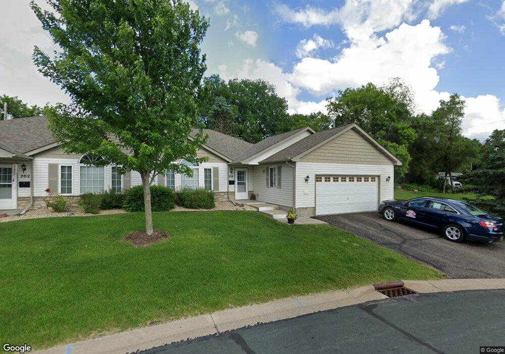
200 Bluff Dr Somerset, WI 54025
Estimated Value: $270,115 - $320,000
2
Beds
2
Baths
1,300
Sq Ft
$224/Sq Ft
Est. Value
About This Home
This home is located at 200 Bluff Dr, Somerset, WI 54025 and is currently estimated at $291,029, approximately $223 per square foot. 200 Bluff Dr is a home located in St. Croix County with nearby schools including Somerset Elementary School, Somerset Middle School, and Somerset High School.
Ownership History
Date
Name
Owned For
Owner Type
Purchase Details
Closed on
Jan 22, 2024
Sold by
Norling Andrew
Bought by
Major Jonathan and Major Susan
Current Estimated Value
Purchase Details
Closed on
Nov 4, 2022
Sold by
Mcgurran Sean M
Bought by
Major Jonathan and Major Susan
Purchase Details
Closed on
Aug 23, 2021
Sold by
Higgins Homas P
Bought by
Higgins Thomas P and Thomas P Higgins Living Trust
Purchase Details
Closed on
Feb 18, 2021
Sold by
Higgins Shirley
Bought by
Higgins Thomas P
Purchase Details
Closed on
Jan 27, 2021
Sold by
Higgins Thomas P
Bought by
Higgins Thomas P and Higgins James A
Purchase Details
Closed on
Jun 30, 2014
Sold by
Haviland David and Haviland Carol
Bought by
Higgins Thomas P and Higgins Shirley
Purchase Details
Closed on
Jan 6, 2006
Sold by
Arkell Cory and Arkell Jennifer
Bought by
Haviland David and Haviland Carol
Create a Home Valuation Report for This Property
The Home Valuation Report is an in-depth analysis detailing your home's value as well as a comparison with similar homes in the area
Home Values in the Area
Average Home Value in this Area
Purchase History
We collect this data history from publicly available records. To have your information removed, we recommend requesting removal directly through your county’s website.
| Date | Buyer | Sale Price | Title Company |
|---|---|---|---|
| Major Jonathan | $335,000 | None Listed On Document | |
| Norling Andrew | $250,000 | None Listed On Document | |
| Major Jonathan | $249,000 | Guardian Title | |
| Major Jonathan | $249,000 | Guardian Title | |
| Higgins Thomas P | -- | None Available | |
| Higgins Thomas P | -- | -- | |
| Higgins Thomas P | -- | Guardian Title | |
| Higgins Thomas P | $125,000 | None Available | |
| Haviland David | $144,000 | Burnet Title |
Source: Public Records
Tax History
| Year | Tax Paid | Tax Assessment Tax Assessment Total Assessment is a certain percentage of the fair market value that is determined by local assessors to be the total taxable value of land and additions on the property. | Land | Improvement |
|---|---|---|---|---|
| 2025 | $2,840 | $164,000 | $15,000 | $149,000 |
| 2024 | $30 | $164,000 | $15,000 | $149,000 |
| 2023 | $2,626 | $164,000 | $15,000 | $149,000 |
| 2022 | $2,561 | $164,000 | $15,000 | $149,000 |
| 2021 | $2,606 | $164,000 | $15,000 | $149,000 |
| 2020 | $2,055 | $164,000 | $15,000 | $149,000 |
| 2019 | $2,184 | $91,200 | $9,000 | $82,200 |
| 2018 | $2,061 | $91,200 | $9,000 | $82,200 |
| 2017 | $2,014 | $91,200 | $9,000 | $82,200 |
| 2016 | $2,014 | $91,200 | $9,000 | $82,200 |
| 2015 | $2,000 | $91,200 | $9,000 | $82,200 |
| 2014 | $1,950 | $91,200 | $9,000 | $82,200 |
| 2013 | $1,956 | $91,200 | $9,000 | $82,200 |
Source: Public Records
Map
Nearby Homes
- 229 Bluff Dr
- 108 Main St
- 00 County Highway I
- TBD County Road C
- 239 Plum Tree Ln
- 314 Aspen Dr
- 318 Aspen Dr
- 309 Walnut Ln
- 308 Walnut Ln
- 334 Cypress St
- 440 Timberlane Dr
- 873 Sutherland St
- 869 Sutherland St
- 335 Martell St
- 861 Sutherland St
- 837 Sutherland St
- 857 Sutherland St
- 316 Evergreen Dr
- 611 Meadow Ln
- 1992 80th St
Your Personal Tour Guide
Ask me questions while you tour the home.