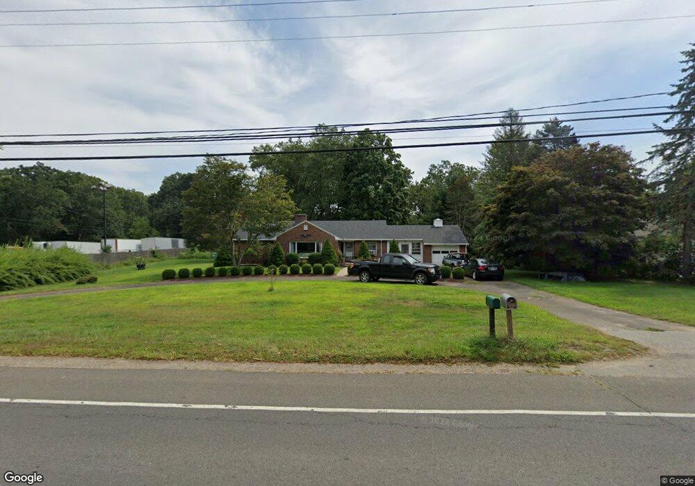
200 Boston Post Rd Old Saybrook, CT 06475
Estimated Value: $493,819 - $552,000
3
Beds
2
Baths
1,580
Sq Ft
$335/Sq Ft
Est. Value
About This Home
This home is located at 200 Boston Post Rd, Old Saybrook, CT 06475 and is currently estimated at $528,955, approximately $334 per square foot. 200 Boston Post Rd is a home located in Middlesex County with nearby schools including Kathleen E. Goodwin School, Old Saybrook Middle School, and Old Saybrook Senior High School.
Ownership History
Date
Name
Owned For
Owner Type
Purchase Details
Closed on
Aug 23, 2002
Sold by
Miner Reba E and Massini Joseph E
Bought by
Loguidice Nicholas and Loguidice Christine
Current Estimated Value
Home Financials for this Owner
Home Financials are based on the most recent Mortgage that was taken out on this home.
Original Mortgage
$23,000
Interest Rate
6.24%
Create a Home Valuation Report for This Property
The Home Valuation Report is an in-depth analysis detailing your home's value as well as a comparison with similar homes in the area
Home Values in the Area
Average Home Value in this Area
Purchase History
| Date | Buyer | Sale Price | Title Company |
|---|---|---|---|
| Loguidice Nicholas | $230,000 | -- |
Source: Public Records
Mortgage History
| Date | Status | Borrower | Loan Amount |
|---|---|---|---|
| Closed | Loguidice Nicholas | $119,039 | |
| Closed | Loguidice Nicholas | $176,457 | |
| Closed | Loguidice Nicholas | $181,672 | |
| Closed | Loguidice Nicholas | $23,000 |
Source: Public Records
Tax History
| Year | Tax Paid | Tax Assessment Tax Assessment Total Assessment is a certain percentage of the fair market value that is determined by local assessors to be the total taxable value of land and additions on the property. | Land | Improvement |
|---|---|---|---|---|
| 2025 | $4,307 | $277,900 | $61,300 | $216,600 |
| 2024 | $4,224 | $277,900 | $61,300 | $216,600 |
| 2023 | $3,951 | $193,200 | $51,700 | $141,500 |
| 2022 | $3,879 | $193,200 | $51,700 | $141,500 |
| 2021 | $3,874 | $193,200 | $51,700 | $141,500 |
| 2020 | $3,874 | $193,200 | $51,700 | $141,500 |
| 2019 | $3,816 | $193,200 | $51,700 | $141,500 |
| 2018 | $3,838 | $195,800 | $48,800 | $147,000 |
| 2017 | $3,849 | $195,800 | $48,800 | $147,000 |
| 2016 | $3,771 | $195,800 | $48,800 | $147,000 |
| 2015 | $3,683 | $195,800 | $48,800 | $147,000 |
| 2014 | $3,622 | $195,800 | $48,800 | $147,000 |
Source: Public Records
Map
Nearby Homes
- 5 Sunrise Ave
- 0 Middlesex Turnpike
- 9 2nd Ave
- 62-14,15,16 Middlesex Turnpike
- 6 Parkman Place
- 11 Coulter St Unit 28
- 96 Ayers Point Rd
- 25 Pond Rd
- 125 Main St
- 12 Hill Rd
- 1333A Boston Post Rd
- 1 & 3 Neck Rd
- 0 Merritt Ln
- 8 Lieutenant River Ln
- 3 Ferry Rd
- 24 Church St
- 1 Huntley Rd
- 18 Quarry St
- 367 Main St Unit 7
- 167 Ingham Hill Rd
- 165 Boston Post Rd
- 141 Boston Post Rd
- 240 Boston Post Rd
- 131 Boston Post Rd
- 131 Boston Post Rd
- 134 Boston Post Rd
- 134 Boston Post Rd Unit 2
- 131 Boston Post Rd
- 124 Boston Post Rd
- 3 Patterson Place
- 1 Briarcliffe Trail
- 7 Patterson Place
- 112 Boston Post Rd
- 5 Patterson Place
- 256 Boston Post Rd
- 233 Boston Post Rd
- 2 Briarcliffe Trail
- 98 Boston Post Rd
- 3 Briarcliffe Trail
- 4 Briarcliffe Trail
Your Personal Tour Guide
Ask me questions while you tour the home.