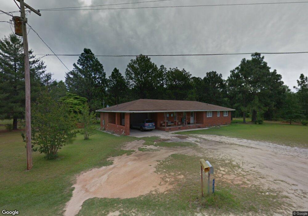
200 Bridges Rd Raeford, NC 28376
Estimated Value: $233,000 - $296,490
--
Bed
2
Baths
2,146
Sq Ft
$119/Sq Ft
Est. Value
About This Home
This home is located at 200 Bridges Rd, Raeford, NC 28376 and is currently estimated at $254,873, approximately $118 per square foot. 200 Bridges Rd is a home located in Hoke County with nearby schools including Upchurch Elementary School, West Hoke Middle, and Hoke County High.
Ownership History
Date
Name
Owned For
Owner Type
Purchase Details
Closed on
Aug 15, 2006
Sold by
Tudor Patrice A
Bought by
Wells Fargo Bank
Current Estimated Value
Purchase Details
Closed on
Oct 17, 2005
Sold by
Wells Fargo Bank N A
Bought by
Bronson Pete and Bronson Ella
Home Financials for this Owner
Home Financials are based on the most recent Mortgage that was taken out on this home.
Original Mortgage
$84,900
Interest Rate
6.27%
Mortgage Type
New Conventional
Purchase Details
Closed on
Mar 31, 2005
Sold by
Mitchell Robert and Mitchell Teresa C
Bought by
Tudor Patrice A
Home Financials for this Owner
Home Financials are based on the most recent Mortgage that was taken out on this home.
Original Mortgage
$99,000
Interest Rate
9.65%
Mortgage Type
Adjustable Rate Mortgage/ARM
Create a Home Valuation Report for This Property
The Home Valuation Report is an in-depth analysis detailing your home's value as well as a comparison with similar homes in the area
Home Values in the Area
Average Home Value in this Area
Purchase History
| Date | Buyer | Sale Price | Title Company |
|---|---|---|---|
| Wells Fargo Bank | $111,500 | None Available | |
| Bronson Pete | $85,000 | None Available | |
| Tudor Patrice A | $110,000 | None Available |
Source: Public Records
Mortgage History
| Date | Status | Borrower | Loan Amount |
|---|---|---|---|
| Previous Owner | Bronson Pete | $84,900 | |
| Previous Owner | Tudor Patrice A | $99,000 |
Source: Public Records
Tax History Compared to Growth
Tax History
| Year | Tax Paid | Tax Assessment Tax Assessment Total Assessment is a certain percentage of the fair market value that is determined by local assessors to be the total taxable value of land and additions on the property. | Land | Improvement |
|---|---|---|---|---|
| 2025 | $1,364 | $128,420 | $19,990 | $108,430 |
| 2024 | $1,209 | $125,420 | $19,990 | $105,430 |
| 2023 | $1,123 | $115,430 | $10,000 | $105,430 |
| 2022 | $1,103 | $115,430 | $10,000 | $105,430 |
| 2021 | $1,133 | $120,350 | $10,000 | $110,350 |
| 2020 | $1,151 | $120,350 | $10,000 | $110,350 |
| 2019 | $1,151 | $120,350 | $10,000 | $110,350 |
| 2018 | $1,151 | $120,350 | $10,000 | $110,350 |
| 2017 | $1,151 | $120,350 | $10,000 | $110,350 |
| 2016 | $1,131 | $120,350 | $10,000 | $110,350 |
| 2015 | $1,131 | $120,350 | $10,000 | $110,350 |
| 2014 | $1,109 | $120,350 | $10,000 | $110,350 |
| 2013 | -- | $111,080 | $7,640 | $103,440 |
Source: Public Records
Map
Nearby Homes
- Engage Plan at Kirwin Village
- Wayfare Plan at Kirwin Village
- Embark Plan at Kirwin Village
- Freelance Plan at Kirwin Village
- Prelude Plan at Kirwin Village
- 618 Melbourne Dr
- 649 Melbourne Dr
- 527 Melbourne Dr
- 553 Melbourne Dr
- 264 Arlington Dr
- 274 Arlington Dr
- 254 Arlington Dr
- 625 Melbourne Dr
- 520 Melbourne Dr
- 613 Melbourne Dr
- 666 Melbourne Dr
- 253 Arlington Dr
- 673 Melbourne Dr
- 236 Bridges Rd
- 235 Bridges Rd
- 219 Bridges Rd
- 282 Bridges Rd
- 151 Bridges Rd
- 263 Bridges Rd
- 310 Bridges Rd
- 180 Bridges Rd
- 267 Bridges Rd
- 285 Bridges Rd
- 154 Bridges Rd
- 132 Bridgeport (L52bp)
- 316 Bridges Rd
- 321 Bridges Rd
- 2220 Doc Brown Rd
- 2216 Doc Brown Rd
- 2300 Doc Brown Rd
- 327 Bridges Rd
- 0 Doc Brown Road June Johnson Unit 657287
- 2330 Doc Brown Rd