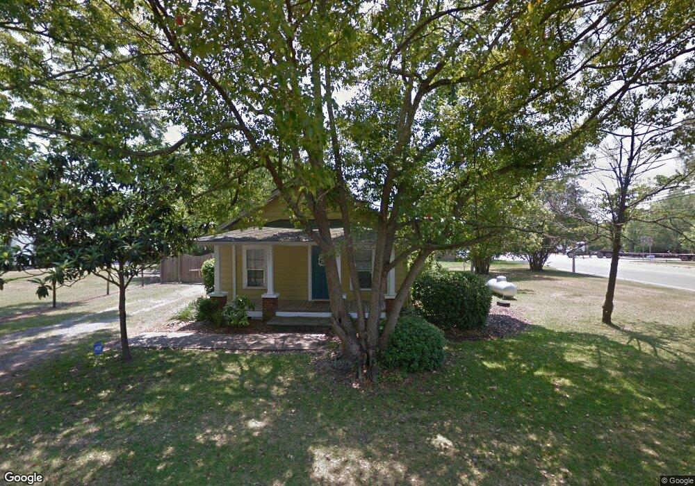
200 Byrd St E Broxton, GA 31519
Estimated Value: $66,000 - $132,000
3
Beds
1
Bath
762
Sq Ft
$139/Sq Ft
Est. Value
About This Home
This home is located at 200 Byrd St E, Broxton, GA 31519 and is currently estimated at $105,832, approximately $138 per square foot. 200 Byrd St E is a home with nearby schools including Broxton-Mary Hayes Elementary School, Coffee Middle School, and Coffee County High School.
Ownership History
Date
Name
Owned For
Owner Type
Purchase Details
Closed on
Mar 24, 2021
Sold by
Smith Wayne A
Bought by
Abercrombie Matilda F
Current Estimated Value
Home Financials for this Owner
Home Financials are based on the most recent Mortgage that was taken out on this home.
Original Mortgage
$85,858
Outstanding Balance
$76,710
Interest Rate
2.9%
Mortgage Type
New Conventional
Estimated Equity
$29,122
Purchase Details
Closed on
Sep 29, 2014
Sold by
Deal Dela
Bought by
Smith Wayne A and Smith Sherry G
Purchase Details
Closed on
Sep 28, 2012
Sold by
Coarsey Austin L
Bought by
Deal Dela
Purchase Details
Closed on
May 16, 2007
Sold by
Skinner Scott E
Bought by
Coarsey Austin L
Create a Home Valuation Report for This Property
The Home Valuation Report is an in-depth analysis detailing your home's value as well as a comparison with similar homes in the area
Purchase History
| Date | Buyer | Sale Price | Title Company |
|---|---|---|---|
| Abercrombie Matilda F | $85,000 | -- | |
| Smith Wayne A | $45,000 | -- | |
| Deal Dela | -- | -- | |
| Coarsey Austin L | $36,000 | -- |
Source: Public Records
Mortgage History
| Date | Status | Borrower | Loan Amount |
|---|---|---|---|
| Open | Abercrombie Matilda F | $85,858 |
Source: Public Records
Tax History
| Year | Tax Paid | Tax Assessment Tax Assessment Total Assessment is a certain percentage of the fair market value that is determined by local assessors to be the total taxable value of land and additions on the property. | Land | Improvement |
|---|---|---|---|---|
| 2025 | $436 | $14,105 | $693 | $13,412 |
| 2024 | $432 | $13,125 | $693 | $12,432 |
| 2023 | $380 | $13,125 | $693 | $12,432 |
| 2022 | $415 | $13,125 | $693 | $12,432 |
| 2021 | $408 | $12,885 | $693 | $12,192 |
| 2020 | $408 | $12,885 | $693 | $12,192 |
| 2019 | $408 | $12,885 | $693 | $12,192 |
| 2018 | $408 | $12,885 | $693 | $12,192 |
| 2017 | $409 | $12,885 | $693 | $12,192 |
| 2016 | $409 | $12,885 | $693 | $12,192 |
| 2015 | $411 | $12,885 | $693 | $12,192 |
| 2014 | $413 | $12,885 | $693 | $12,192 |
Source: Public Records
Map
Nearby Homes
- 906 Alabama St N
- 2048 Somerset
- 744 Lotts Crossing
- 4653 Douglas Braxton Hwy
- 570 Knollwood Rd
- 740 Knollwood Rd
- 310 Leyland Dr
- 123 Leyland Dr
- 2002 Apache Trail
- 7789 Bowens Mill Rd
- 73 Bay Dr
- 161 Green Tree Dr
- 699 Twin Lakes Dr
- 5495 Cross Rd
- 1671 Warren Carter Rd
- 7468 George Deen Rd
- 271 Brigmond Estates Rd
- 00 Rocky Pond Rd
- 0 Hwy 301 Hwy Unit 1635753
- 6415 George Deen Rd
- 00 Alabama St Unit n/a
- 802 Alabama St N
- 709 Railroad St
- 900 Alabama St N
- 901 Alabama St N
- 707 Railroad St N
- 903 Alabama St N
- 803 Alabama St N
- 708 Railroad St N
- 817 Alabama St N
- 3790 Ga Highway 268 W
- 203 Smith St
- 102 Byrd St
- 904 Alabama St N
- 103 Byrd St E
- 3768 Ga Highway 268 W
- 104 Byrd St E
- 213 Smith St
- 828 Railroad St
- 907 Alabama St N
Your Personal Tour Guide
Ask me questions while you tour the home.