Estimated Value: $124,918 - $269,000
--
Bed
1
Bath
1,344
Sq Ft
$147/Sq Ft
Est. Value
About This Home
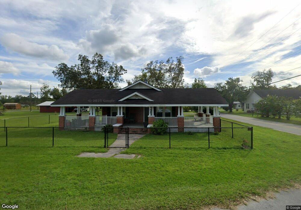
This home is located at 200 Carter St, Odum, GA 31555 and is currently estimated at $198,230, approximately $147 per square foot. 200 Carter St is a home located in Wayne County with nearby schools including Odum Elementary School, Martha Puckett Middle School, and Wayne County High School.
Ownership History
Date
Name
Owned For
Owner Type
Purchase Details
Closed on
Mar 1, 2001
Sold by
Driggers Melba C
Bought by
Driggers Jack L and Driggers Melba C
Current Estimated Value
Purchase Details
Closed on
Apr 1, 1995
Bought by
Driggers Melba C
Purchase Details
Closed on
Aug 1, 1993
Purchase Details
Closed on
Mar 1, 1992
Purchase Details
Closed on
Nov 1, 1986
Create a Home Valuation Report for This Property
The Home Valuation Report is an in-depth analysis detailing your home's value as well as a comparison with similar homes in the area
Home Values in the Area
Average Home Value in this Area
Purchase History
| Date | Buyer | Sale Price | Title Company |
|---|---|---|---|
| Driggers Jack L | $37,000 | -- | |
| Driggers Melba C | $35,000 | -- | |
| -- | -- | -- | |
| -- | -- | -- | |
| -- | -- | -- |
Source: Public Records
Tax History Compared to Growth
Tax History
| Year | Tax Paid | Tax Assessment Tax Assessment Total Assessment is a certain percentage of the fair market value that is determined by local assessors to be the total taxable value of land and additions on the property. | Land | Improvement |
|---|---|---|---|---|
| 2024 | -- | $37,214 | $3,199 | $34,015 |
| 2023 | $748 | $21,310 | $3,199 | $18,111 |
| 2022 | $748 | $21,310 | $3,199 | $18,111 |
| 2021 | $748 | $21,310 | $3,199 | $18,111 |
| 2020 | $748 | $21,310 | $3,199 | $18,111 |
| 2019 | $748 | $21,310 | $3,199 | $18,111 |
| 2018 | $0 | $21,310 | $3,199 | $18,111 |
| 2017 | $748 | $21,310 | $3,199 | $18,111 |
| 2016 | -- | $21,310 | $3,199 | $18,111 |
| 2014 | -- | $21,310 | $3,199 | $18,111 |
| 2013 | -- | $21,309 | $3,198 | $18,111 |
Source: Public Records
Map
Nearby Homes
- 21 AC Hwy 341
- 0 N Church St
- 10.00 AC Hwy 341 Odum Hwy
- 0 Beards Bluff Rd
- 000 Beards Bluff Rd
- 10 Beards Bluff Rd
- 468 Lake Lanell Rd
- 468 Lake Lannell Rd
- Lot 00 Moss Landing
- Lots 26+ Moss Landing
- Lot 21 Moss Landing
- 0 Tract 3 Hwy 341 & Bennett Mill Pond Rd Unit 1656129
- 0 Tract 6 Hwy 341 & Bennett Mill Rd Unit 1656128
- 0 Bennett Mill Pond Rd
- 796 Lud Oquinn Rd
- 858 Hoke Ogden Rd
- TRACT 2 Bennett Mill Pond Rd
- Tract 4 Bennett Mill Pond Rd
- Tract 3 Bennett Mill Pond Rd
- 221 Carter St
- 240 Carter Ave
- 213 Carter St
- 300 Carter St
- 120 Shon St
- 401 Roberson Rd
- 116 Shon St
- 400 Roberson Rd
- 301 Roberson Rd
- 308 S Church St
- 309 Carter St
- 402 Roberson Rd
- 305 S Church St
- 212 Carter St
- 332 Carter St
- .16 AC S Church St
- 14-6-5 Carter St
- 120 Carter Ave
- .28 AC S Church St
- 120 Carter Ave