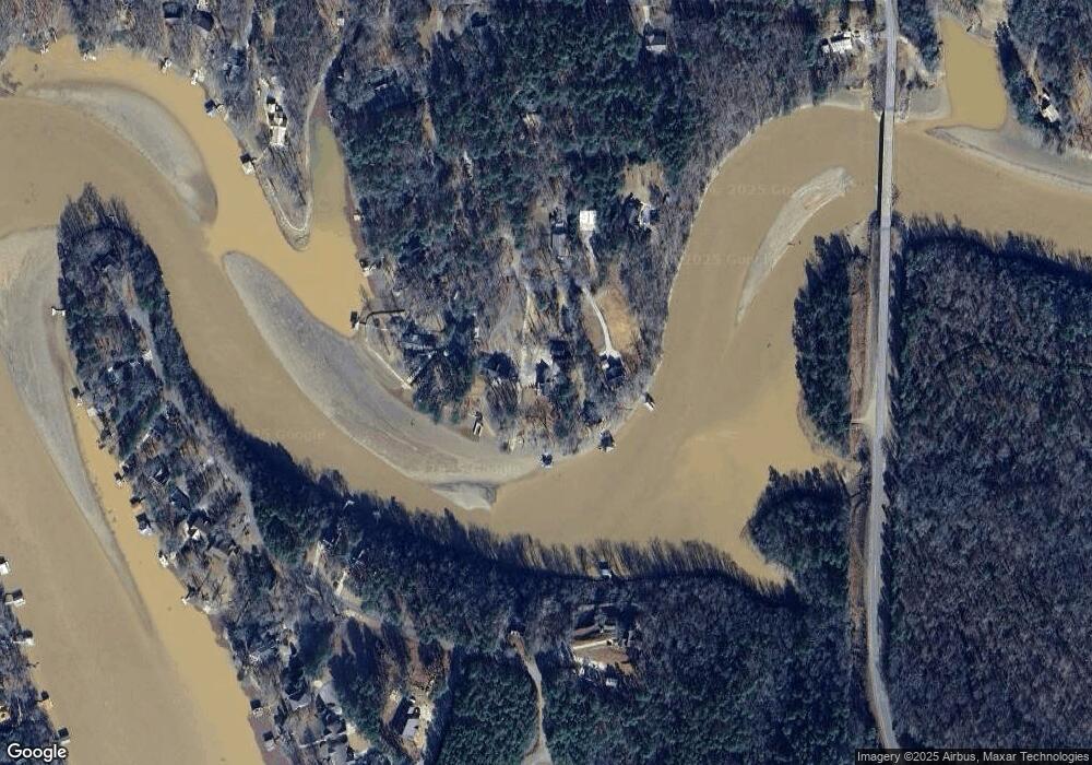
200 Cedar Cove Dr Unit South portion of Lot Wedowee, AL 36278
Estimated Value: $511,000 - $636,000
--
Bed
--
Bath
1,680
Sq Ft
$339/Sq Ft
Est. Value
About This Home
This home is located at 200 Cedar Cove Dr Unit South portion of Lot, Wedowee, AL 36278 and is currently estimated at $569,540, approximately $339 per square foot. 200 Cedar Cove Dr Unit South portion of Lot is a home located in Randolph County.
Ownership History
Date
Name
Owned For
Owner Type
Purchase Details
Closed on
Jul 13, 2022
Sold by
Warden Jack R and Warden Ruth E
Bought by
Berry Tracy Renee
Current Estimated Value
Home Financials for this Owner
Home Financials are based on the most recent Mortgage that was taken out on this home.
Original Mortgage
$58,650
Outstanding Balance
$56,118
Interest Rate
5.78%
Mortgage Type
New Conventional
Estimated Equity
$513,422
Purchase Details
Closed on
Mar 4, 2021
Sold by
Pam Scruggs
Bought by
Whitehall Angela
Home Financials for this Owner
Home Financials are based on the most recent Mortgage that was taken out on this home.
Original Mortgage
$276,250
Interest Rate
2.7%
Mortgage Type
New Conventional
Purchase Details
Closed on
Jul 26, 2012
Sold by
Chad Chad
Bought by
Scruggs Pam
Purchase Details
Closed on
Jun 18, 2008
Sold by
Casey Ken
Bought by
Casey Chad and Scruggs Pam
Create a Home Valuation Report for This Property
The Home Valuation Report is an in-depth analysis detailing your home's value as well as a comparison with similar homes in the area
Home Values in the Area
Average Home Value in this Area
Purchase History
| Date | Buyer | Sale Price | Title Company |
|---|---|---|---|
| Berry Tracy Renee | $69,000 | Tinney John A | |
| Berry Tracy Renee | $69,000 | Tinney John A | |
| Whitehall Angela | $325,000 | Kesa M Johnston Llc | |
| Scruggs Pam | -- | -- | |
| Casey Chad | -- | -- |
Source: Public Records
Mortgage History
| Date | Status | Borrower | Loan Amount |
|---|---|---|---|
| Open | Berry Tracy Renee | $58,650 | |
| Closed | Berry Tracy Renee | $58,650 | |
| Previous Owner | Whitehall Angela | $276,250 |
Source: Public Records
Tax History Compared to Growth
Tax History
| Year | Tax Paid | Tax Assessment Tax Assessment Total Assessment is a certain percentage of the fair market value that is determined by local assessors to be the total taxable value of land and additions on the property. | Land | Improvement |
|---|---|---|---|---|
| 2024 | $1,384 | $43,240 | $17,500 | $25,740 |
| 2023 | $1,384 | $35,880 | $19,260 | $16,620 |
| 2022 | $1,229 | $35,880 | $19,260 | $16,620 |
| 2021 | $1,069 | $35,880 | $19,260 | $16,620 |
| 2020 | $1,148 | $35,880 | $19,260 | $16,620 |
| 2018 | $1,071 | $33,480 | $17,500 | $15,980 |
| 2017 | $1,071 | $33,480 | $17,500 | $15,980 |
| 2016 | $1,006 | $31,300 | $17,500 | $13,800 |
| 2015 | $1,006 | $314,388 | $0 | $0 |
| 2014 | $1,032 | $322,290 | $0 | $0 |
| 2013 | -- | $322,290 | $0 | $0 |
Source: Public Records
Map
Nearby Homes
- Lot 9 Peninsula Dr Unit 9
- Lot 5 Old Highway 431 Unit 1
- Lot 6 Old Highway 431 Unit 1
- Lot 4/5 Old Highway 431 Unit 1
- Lot 4 Old Highway 431 Unit 1
- Lot 3 Coopers C Old Highway 431 Unit 1
- 0 Poplar Place Unit 3 21408863
- 0 Poplar Place Unit 147951
- 0 Poplar Place Unit 10559236
- Lot 42B Hicks Bend Ct
- 847 Wright Way Dr
- 551 Poplar Place
- 358 Muffet Dr
- LOTS 90 & 91B Wright Way Dr
- 82 Muffet Dr Unit 40
- 82 Muffet Dr
- 268 Cedar Valley Dr
- 111 Warren Dr
- 293 Misty Ln
- 321 Pleasure Point Rd
- 200 Cedar Cove Dr
- 230 Cedar Cove Dr
- 240 Cedar Cove Dr Unit 2
- 227 Cedar Cove Dr
- 180 Cedar Cove Dr
- 180 Cedar Cove Dr
- 196 Cedar Cove Dr
- 196 Cedar Cove Dr
- 104 Hickory Hollow
- 480 Peninsula Dr
- 24 Peninsula Ct
- 74 Hill Crest Way
- 0 Peninsula Dr Unit 9 527124
- 0 Peninsula Dr Unit 44 538027
- 0 Peninsula Dr Unit 45 538000
- 0 Peninsula Dr Unit LOT 45 569082
- 0 Peninsula Dr Unit 44 568315
- 0 Peninsula Dr Unit 13 568357
- 0 Peninsula Dr Unit 44,45 581250
- 0 Peninsula Dr Unit 9 584608
