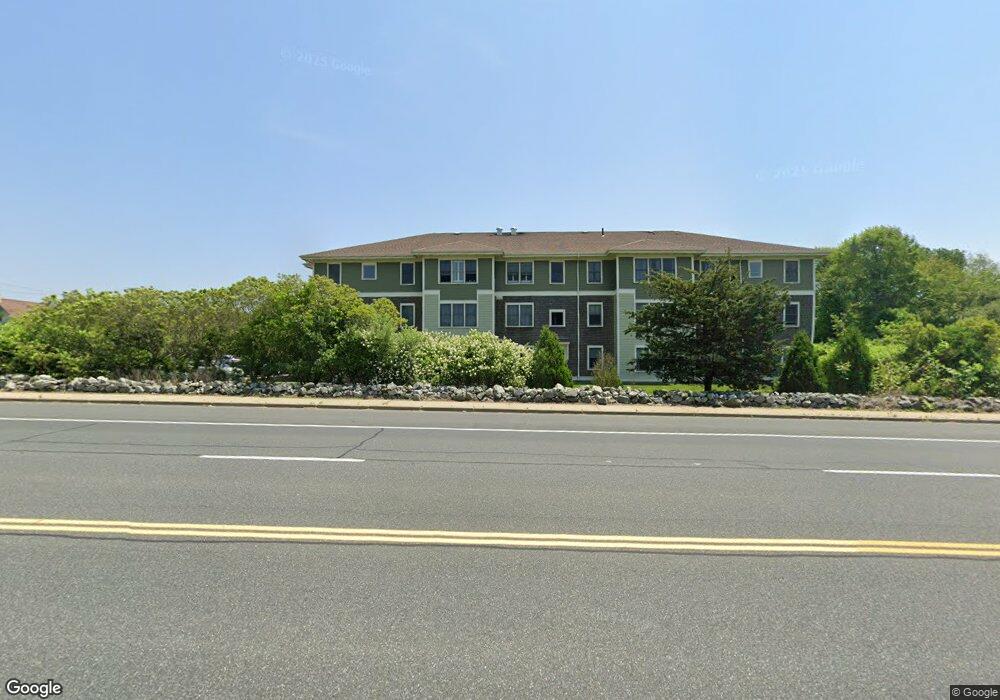
200 Clarke Rd Unit A207 Narragansett, RI 02882
Estimated Value: $357,788 - $636,000
2
Beds
1
Bath
1,195
Sq Ft
$388/Sq Ft
Est. Value
About This Home
This home is located at 200 Clarke Rd Unit A207, Narragansett, RI 02882 and is currently estimated at $463,447, approximately $387 per square foot. 200 Clarke Rd Unit A207 is a home located in Washington County with nearby schools including Narragansett Elementary School, Narragansett Pier Middle School, and Narragansett High School.
Ownership History
Date
Name
Owned For
Owner Type
Purchase Details
Closed on
May 18, 2010
Sold by
Narr Affordable Hsng C
Bought by
Mccarty Mary C
Current Estimated Value
Home Financials for this Owner
Home Financials are based on the most recent Mortgage that was taken out on this home.
Original Mortgage
$70,000
Outstanding Balance
$47,056
Interest Rate
5.11%
Mortgage Type
Purchase Money Mortgage
Estimated Equity
$416,391
Create a Home Valuation Report for This Property
The Home Valuation Report is an in-depth analysis detailing your home's value as well as a comparison with similar homes in the area
Home Values in the Area
Average Home Value in this Area
Purchase History
| Date | Buyer | Sale Price | Title Company |
|---|---|---|---|
| Mccarty Mary C | $210,000 | -- |
Source: Public Records
Mortgage History
| Date | Status | Borrower | Loan Amount |
|---|---|---|---|
| Open | Mccarty Mary C | $70,000 |
Source: Public Records
Tax History Compared to Growth
Tax History
| Year | Tax Paid | Tax Assessment Tax Assessment Total Assessment is a certain percentage of the fair market value that is determined by local assessors to be the total taxable value of land and additions on the property. | Land | Improvement |
|---|---|---|---|---|
| 2025 | $1,749 | $257,656 | $0 | $257,656 |
| 2024 | $1,688 | $257,656 | $0 | $257,656 |
| 2023 | $2,581 | $277,265 | $0 | $277,265 |
| 2022 | $2,495 | $277,265 | $0 | $277,265 |
| 2021 | $2,457 | $277,265 | $0 | $277,265 |
| 2020 | $2,166 | $206,700 | $0 | $206,700 |
| 2019 | $2,115 | $206,700 | $0 | $206,700 |
| 2018 | $2,057 | $206,700 | $0 | $206,700 |
| 2017 | $2,114 | $200,200 | $0 | $200,200 |
| 2016 | $2,018 | $200,200 | $0 | $200,200 |
| 2015 | $1,990 | $200,200 | $0 | $200,200 |
| 2014 | $2,108 | $210,000 | $0 | $210,000 |
Source: Public Records
Map
Nearby Homes
- 660 Point Judith Rd Unit D2
- 580 Point Judith Rd
- 576 Point Judith Rd
- 2 Bristol Rd
- 60 Daytona Ave
- 62 Daytona Ave
- 64 Burnside Ave
- 813 Ocean Rd
- 815 Ocean Rd
- 45 Durkin Dr
- 18 Greenbrier Rd
- 6 Pendleton Place
- 17 Goose Island Rd
- 103 Cedar Island Rd
- 8 Pocono Rd
- 25 Scallop Shell Rd
- 0 Point Judith Rd
- 0 Hazard Ave
- 0 Houston Ave
- 0 Hemlock Ave
- 200 Clarke Rd Unit A310
- 200 Clarke Rd Unit A309
- 200 Clarke Rd Unit A308
- 200 Clarke Rd Unit A307
- 200 Clarke Rd Unit A306
- 200 Clarke Rd Unit A305
- 200 Clarke Rd Unit A304
- 200 Clarke Rd Unit A303
- 200 Clarke Rd Unit A302
- 200 Clarke Rd Unit A301
- 200 Clarke Rd Unit A210
- 200 Clarke Rd Unit A209
- 200 Clarke Rd Unit A208
- 200 Clarke Rd Unit A206
- 200 Clarke Rd Unit A205
- 200 Clarke Rd Unit A204
- 200 Clarke Rd Unit A203
- 200 Clarke Rd Unit A202
- 200 Clarke Rd Unit A201
- 200 Clarke Rd Unit A110