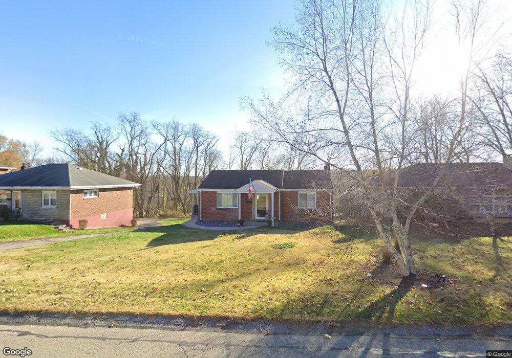
200 Duncan Station Rd McKeesport, PA 15135
Mount Vernon NeighborhoodEstimated Value: $135,000 - $169,000
2
Beds
1
Bath
960
Sq Ft
$160/Sq Ft
Est. Value
About This Home
This home is located at 200 Duncan Station Rd, McKeesport, PA 15135 and is currently estimated at $153,139, approximately $159 per square foot. 200 Duncan Station Rd is a home located in Allegheny County with nearby schools including Elizabeth Forward Senior High School and Young Scholars of Greater Allegheny Charter School.
Ownership History
Date
Name
Owned For
Owner Type
Purchase Details
Closed on
Mar 2, 2004
Sold by
Hammar James
Bought by
Smrdel Mark
Current Estimated Value
Home Financials for this Owner
Home Financials are based on the most recent Mortgage that was taken out on this home.
Original Mortgage
$45,000
Outstanding Balance
$21,002
Interest Rate
5.65%
Mortgage Type
New Conventional
Estimated Equity
$132,137
Create a Home Valuation Report for This Property
The Home Valuation Report is an in-depth analysis detailing your home's value as well as a comparison with similar homes in the area
Home Values in the Area
Average Home Value in this Area
Purchase History
| Date | Buyer | Sale Price | Title Company |
|---|---|---|---|
| Smrdel Mark | $56,000 | -- |
Source: Public Records
Mortgage History
| Date | Status | Borrower | Loan Amount |
|---|---|---|---|
| Open | Smrdel Mark | $45,000 |
Source: Public Records
Tax History Compared to Growth
Tax History
| Year | Tax Paid | Tax Assessment Tax Assessment Total Assessment is a certain percentage of the fair market value that is determined by local assessors to be the total taxable value of land and additions on the property. | Land | Improvement |
|---|---|---|---|---|
| 2025 | $1,790 | $50,400 | $23,800 | $26,600 |
| 2024 | $1,790 | $50,400 | $23,800 | $26,600 |
| 2023 | $1,763 | $50,400 | $23,800 | $26,600 |
| 2022 | $1,763 | $50,400 | $23,800 | $26,600 |
| 2021 | $238 | $50,400 | $23,800 | $26,600 |
| 2020 | $1,686 | $50,400 | $23,800 | $26,600 |
| 2019 | $1,647 | $50,400 | $23,800 | $26,600 |
| 2018 | $238 | $50,400 | $23,800 | $26,600 |
| 2017 | $1,475 | $50,400 | $23,800 | $26,600 |
| 2016 | $238 | $50,400 | $23,800 | $26,600 |
| 2015 | $238 | $50,400 | $23,800 | $26,600 |
| 2014 | $1,475 | $50,400 | $23,800 | $26,600 |
Source: Public Records
Map
Nearby Homes
- 102 Narragansett Dr
- 161 Mount Vernon Dr
- 2012 Country Club Dr
- 255 Broadlawn Dr
- 217 Coulter Rd
- 1309 Penhurst Dr
- 523 Friendship Dr
- 105 Parkwyn Dr
- 1033 Old Hills Rd
- 811 Pinecrest Dr
- 506 Princess Dr
- 806 Golfview Dr
- 924 Old Hills Rd
- 0 Mcgowan Unit 1717163
- 119 Oberdick Dr
- 401 Industry Rd
- 5824 Holsing St
- 5812 Meade St
- 2040 Constitution Blvd
- 2164 Constitution Blvd
- 196 Duncan Station Rd
- 206 Duncan Station Rd
- 206 Duncan Station Rd
- 208 Duncan Station Rd
- 201 Duncan Station Rd
- 205 Duncan Station Rd
- 197 Duncan Station Rd
- 212 Duncan Station Rd
- 209 Duncan Station Rd
- 215 Duncan Station Rd
- 219 Duncan Station Rd
- 296 Duncan Station Rd
- 314 Saratoga Dr
- 134 Duncan Station Rd
- 223 Duncan Station Rd
- 310 Duncan Station Rd
- 136 Duncan Station Rd
- 136 Duncan Station Rd
- 131 Duncan Station Rd
- 300 Duncan Station Rd