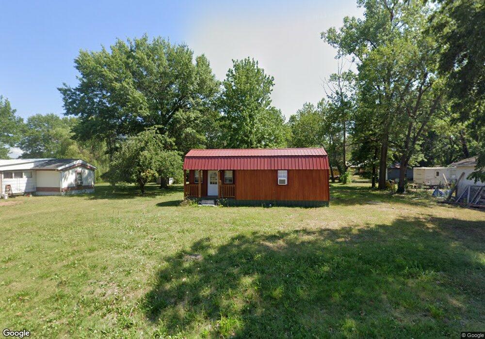
200 E Arbor St Appleton City, MO 64724
Estimated Value: $65,347 - $300,000
Studio
--
Bath
560
Sq Ft
$257/Sq Ft
Est. Value
About This Home
This home is located at 200 E Arbor St, Appleton City, MO 64724 and is currently estimated at $144,116, approximately $257 per square foot. 200 E Arbor St is a home located in St. Clair County with nearby schools including Appleton City Elementary School and Appleton City High School.
Ownership History
Date
Name
Owned For
Owner Type
Purchase Details
Closed on
Oct 12, 2023
Sold by
Smith Matthew
Bought by
Bakebe Llc
Current Estimated Value
Purchase Details
Closed on
Nov 9, 2022
Sold by
Vanbuskirk Jeremy and Vanbuskirk Christina
Bought by
Smith Matthew
Purchase Details
Closed on
Mar 11, 2022
Sold by
Gardner Christina K
Bought by
Vanbuskirk Jeremy
Purchase Details
Closed on
Jan 17, 2019
Sold by
Fetters Brad and Fetters Valerie
Bought by
Fetters Jacob
Purchase Details
Closed on
Apr 29, 2011
Sold by
Foster Bobbie
Bought by
Aversman Galyn and Aversman Tamara
Create a Home Valuation Report for This Property
The Home Valuation Report is an in-depth analysis detailing your home's value as well as a comparison with similar homes in the area
Purchase History
| Date | Buyer | Sale Price | Title Company |
|---|---|---|---|
| Bakebe Llc | -- | None Listed On Document | |
| Bakebe Llc | -- | None Listed On Document | |
| Smith Matthew | -- | -- | |
| Vanbuskirk Jeremy | -- | None Listed On Document | |
| Fetters Jacob | -- | None Available | |
| Aversman Galyn | -- | None Available |
Source: Public Records
Tax History
| Year | Tax Paid | Tax Assessment Tax Assessment Total Assessment is a certain percentage of the fair market value that is determined by local assessors to be the total taxable value of land and additions on the property. | Land | Improvement |
|---|---|---|---|---|
| 2025 | $411 | $5,300 | $0 | $0 |
| 2024 | $375 | $5,300 | $0 | $0 |
| 2023 | $372 | $6,700 | $0 | $0 |
| 2022 | $472 | $6,700 | $0 | $0 |
| 2021 | $28 | $400 | $0 | $0 |
| 2020 | $26 | $400 | $0 | $0 |
| 2019 | $26 | $400 | $0 | $0 |
| 2018 | $26 | $400 | $0 | $0 |
| 2017 | $26 | $400 | $0 | $0 |
| 2016 | $26 | $400 | $0 | $0 |
| 2015 | $21 | $400 | $0 | $0 |
| 2014 | -- | $400 | $0 | $0 |
| 2013 | -- | $400 | $0 | $0 |
Source: Public Records
Map
Nearby Homes
- 201 E 1st St
- 311 E Dover St
- 400 Sunset Dr
- 407 W Miller St
- 409 W Miller St
- 5574 SE State Route P
- 0 NW 630 Rd
- NW 400 Rd
- 0000 NW 630 Rd
- 10010 NW 400 Rd Unit 10010 NW 400th Road
- 10010 NW 400 Rd
- Hh Hwy
- 208 N Jefferson St
- 000 SW 600 Rd
- 0 SW 600 Rd
- 0 F Hwy Unit HMS2435368
- 000 Old River Rd
- TBD NE County Road 10003
- Off Old River Rd
- 18 acres NW 576
- 203 S Chestnut St
- 205 E Arbor St
- 201 S Chestnut St
- 207 E B St
- 211 E Burbank St
- 201 E Burbank St
- 300 S Chestnut St
- 214 S Beech St
- 215 E Arbor St
- 214 E 1st St
- 214 S Locust St
- 204 S Locust St
- 109 W 1st St
- 210 E Burbank St
- 204 E Burbank St
- 313 S Chestnut St
- 108 E 1st St
- 101 S Chestnut St
- 110 E Arbor St
- 201 E A St
Your Personal Tour Guide
Ask me questions while you tour the home.