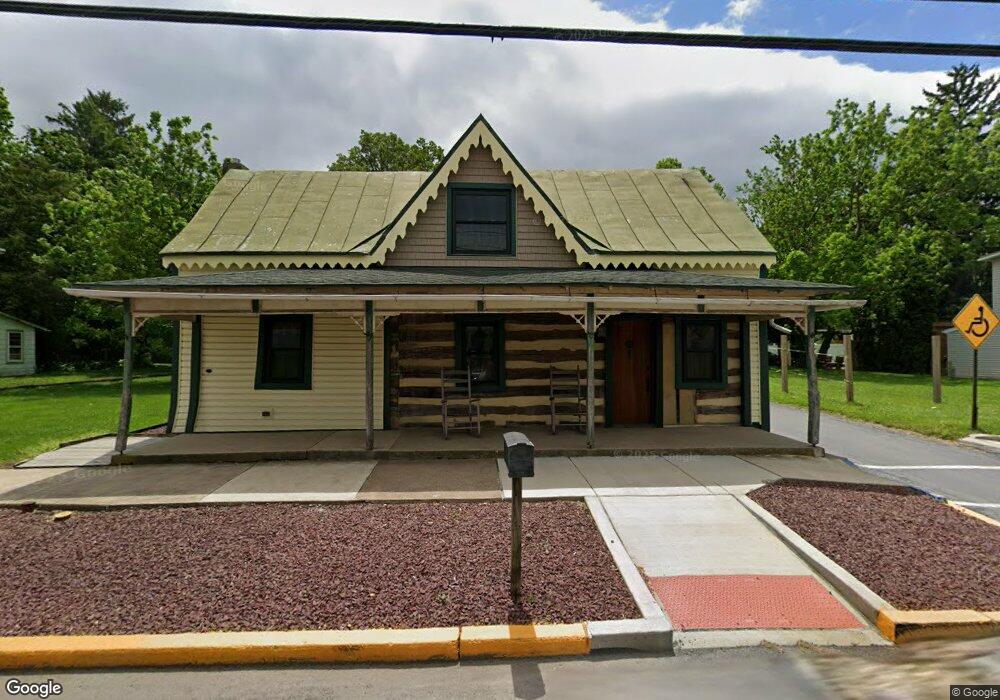
200 E Main St Newmanstown, PA 17073
Estimated Value: $205,000 - $362,000
--
Bed
3
Baths
1,728
Sq Ft
$155/Sq Ft
Est. Value
About This Home
This home is located at 200 E Main St, Newmanstown, PA 17073 and is currently estimated at $267,460, approximately $154 per square foot. 200 E Main St is a home located in Lebanon County with nearby schools including Eastern Lebanon County Senior High School, Millcreek Parochial School, and Millbach Mennonite School.
Ownership History
Date
Name
Owned For
Owner Type
Purchase Details
Closed on
Sep 12, 2022
Sold by
Smucker Holdings Llc
Bought by
Patches Eric and Wonders Marissa
Current Estimated Value
Home Financials for this Owner
Home Financials are based on the most recent Mortgage that was taken out on this home.
Original Mortgage
$136,875
Outstanding Balance
$130,491
Interest Rate
4.99%
Mortgage Type
New Conventional
Estimated Equity
$136,969
Purchase Details
Closed on
Feb 27, 2018
Sold by
Oberholtzer Mele L and Oberholtzer Sierra N
Bought by
Smucker Holdings Llc
Home Financials for this Owner
Home Financials are based on the most recent Mortgage that was taken out on this home.
Original Mortgage
$120,000
Interest Rate
4.04%
Mortgage Type
Commercial
Create a Home Valuation Report for This Property
The Home Valuation Report is an in-depth analysis detailing your home's value as well as a comparison with similar homes in the area
Home Values in the Area
Average Home Value in this Area
Purchase History
| Date | Buyer | Sale Price | Title Company |
|---|---|---|---|
| Patches Eric | $182,500 | -- | |
| Smucker Holdings Llc | $150,000 | None Available |
Source: Public Records
Mortgage History
| Date | Status | Borrower | Loan Amount |
|---|---|---|---|
| Open | Patches Eric | $136,875 | |
| Previous Owner | Smucker Holdings Llc | $120,000 |
Source: Public Records
Tax History
| Year | Tax Paid | Tax Assessment Tax Assessment Total Assessment is a certain percentage of the fair market value that is determined by local assessors to be the total taxable value of land and additions on the property. | Land | Improvement |
|---|---|---|---|---|
| 2025 | $2,716 | $117,200 | $18,500 | $98,700 |
| 2024 | $2,508 | $117,200 | $18,500 | $98,700 |
| 2023 | $2,508 | $117,200 | $18,500 | $98,700 |
| 2022 | $2,451 | $117,200 | $18,500 | $98,700 |
| 2021 | $2,338 | $117,200 | $18,500 | $98,700 |
| 2020 | $2,306 | $117,200 | $18,500 | $98,700 |
| 2019 | $2,262 | $117,200 | $18,500 | $98,700 |
| 2018 | $2,222 | $117,200 | $18,500 | $98,700 |
| 2017 | $563 | $117,200 | $18,500 | $98,700 |
| 2016 | $2,127 | $117,200 | $18,500 | $98,700 |
| 2015 | -- | $117,200 | $18,500 | $98,700 |
| 2014 | -- | $117,200 | $18,500 | $98,700 |
Source: Public Records
Map
Nearby Homes
- 32 Village Dr
- 0 Sportsman Rd
- 143 Rosebush Ct
- 150 Sweetwater Ln
- 195 Sweet Birch Ln
- 45 Thea Ct
- LOT #10 Conveyor Dr Unit SILVERBROOKE A
- LOT #10 Conveyor Dr
- LOT #9 Conveyor Dr Unit CALLAHAN A
- LOT #9 Conveyor Dr
- Anvil Model LOT #4 Conveyor Dr
- Anvil Model LOT #9 Conveyor Dr
- LOT #4 Conveyor Dr
- 2 Locust Ln
- 631 W Franklin St
- 161 W High St
- 218 W Franklin St
- 23 N Front St
- 204 E High St
- 137 E High St
Your Personal Tour Guide
Ask me questions while you tour the home.