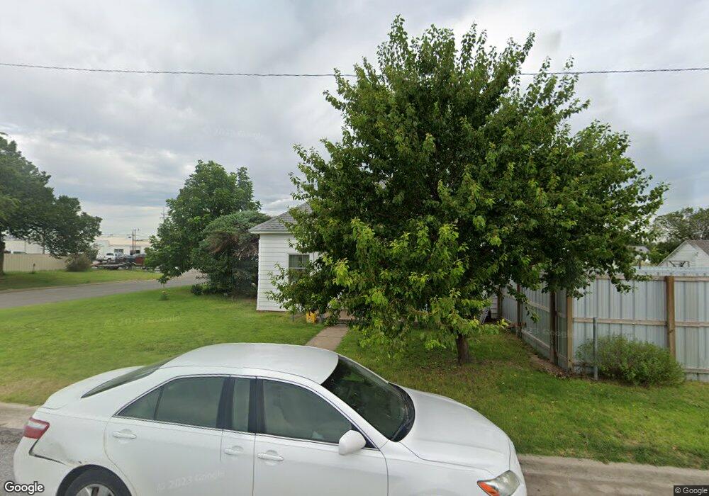
200 E Third St Shattuck, OK 73858
Estimated Value: $50,000 - $61,000
2
Beds
1
Bath
780
Sq Ft
$70/Sq Ft
Est. Value
About This Home
This home is located at 200 E Third St, Shattuck, OK 73858 and is currently estimated at $54,446, approximately $69 per square foot. 200 E Third St is a home with nearby schools including Shattuck Elementary School and Shattuck High School.
Ownership History
Date
Name
Owned For
Owner Type
Purchase Details
Closed on
Oct 6, 2025
Sold by
Starbuck Edward and Starbuck Eunice
Bought by
Anderson James P
Current Estimated Value
Purchase Details
Closed on
Dec 6, 2010
Sold by
Trenfield Brady
Bought by
Starbuck Edward and Starbuck Eunice
Purchase Details
Closed on
Oct 31, 2002
Sold by
Hanshu Carl and Hanshu Gertrude
Bought by
Trenfield Brady
Purchase Details
Closed on
Jul 17, 1998
Sold by
Trenfield Brady
Bought by
Hanshu Carl and Hanshu Gertrude
Purchase Details
Closed on
Dec 24, 1997
Sold by
Schultz and Kirk
Bought by
Trenfield Brady
Purchase Details
Closed on
Mar 30, 1995
Sold by
Kelln Lenora
Bought by
Schultz Donovan and Schultz Joaquina
Create a Home Valuation Report for This Property
The Home Valuation Report is an in-depth analysis detailing your home's value as well as a comparison with similar homes in the area
Purchase History
| Date | Buyer | Sale Price | Title Company |
|---|---|---|---|
| Anderson James P | $30,000 | -- | |
| Starbuck Edward | $25,000 | -- | |
| Trenfield Brady | $12,000 | -- | |
| Hanshu Carl | $12,000 | -- | |
| Trenfield Brady | $12,000 | -- | |
| Schultz Donovan | $8,000 | -- |
Source: Public Records
Tax History
| Year | Tax Paid | Tax Assessment Tax Assessment Total Assessment is a certain percentage of the fair market value that is determined by local assessors to be the total taxable value of land and additions on the property. | Land | Improvement |
|---|---|---|---|---|
| 2025 | $116 | $3,178 | $173 | $3,005 |
| 2024 | $1 | $3,177 | $168 | $3,009 |
| 2023 | $108 | $3,177 | $183 | $2,994 |
| 2022 | $202 | $3,177 | $174 | $3,003 |
| 2021 | $207 | $3,177 | $174 | $3,003 |
| 2020 | $114 | $3,177 | $174 | $3,003 |
| 2019 | $195 | $3,178 | $174 | $3,004 |
| 2018 | $184 | $3,085 | $168 | $2,917 |
| 2017 | $182 | $2,995 | $157 | $2,838 |
| 2016 | $174 | $2,908 | $161 | $2,747 |
| 2015 | $166 | $2,824 | $161 | $2,663 |
| 2014 | $122 | $2,417 | $151 | $2,266 |
Source: Public Records
Map
Nearby Homes
- 219 S Locust St Unit 114 E 3rd
- 124 N Main St
- 619 S Locust St
- 307 S Walnut Unit 311 S Walnut St
- 402 S Ellis St
- 514 S Ellis St Unit 506 S Ellis St.
- 506 E 6th St
- 221 W Eighth St
- 519 E Eighth
- 302 10th St
- 318 Sylvania St
- 180 Maple Dr
- 0 Cottonwood Dr
- 175839 E County Road 48
- E 460 Rd
- TBD E 460 Rd
- 111 S Francis
- 204 Beaver
- 171748 E County Road 43
- 116 E Second
- 219 S Locust St
- 219 S Locust St Unit 111 E 3rd
- 304 S Locust St
- 208 S Locust St
- 219 S Olive St
- 204 S Locust St
- 211 S Olive St
- 301 S Olive St
- 311 S Locust St
- 209 S Olive St
- 173797 E County Road 56
- 60252 S County Road 177
- 171251 E County Road 58
- 171814 E County Road 59
- 170165 E County Road 58
- 169573 E County Road 58
- 56664 S County Road 172
- 58036 S County Road 177
- 57172 S County Road 173
- 57328 S County Road 177
Your Personal Tour Guide
Ask me questions while you tour the home.