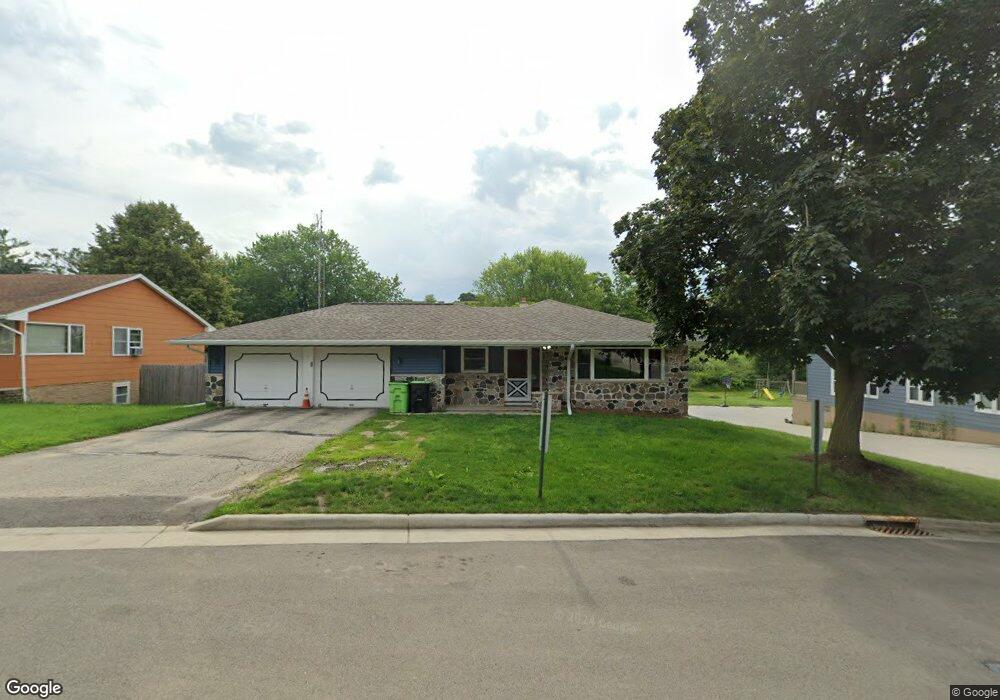
200 East Ave Iron Ridge, WI 53035
Estimated Value: $297,000 - $329,675
--
Bed
--
Bath
--
Sq Ft
0.36
Acres
About This Home
This home is located at 200 East Ave, Iron Ridge, WI 53035 and is currently estimated at $314,419. 200 East Ave is a home located in Dodge County with nearby schools including Hartford High School and St. Matthew Lutheran School.
Ownership History
Date
Name
Owned For
Owner Type
Purchase Details
Closed on
Sep 2, 2025
Sold by
Mayer Naomi and Spring Naomi
Bought by
Mayer Naomi R and Mayer Jeremy R
Current Estimated Value
Purchase Details
Closed on
Oct 15, 2019
Sold by
Schmidt Dean J and Dean Schmidt Living Trust
Bought by
Spring Naomi Ruth
Home Financials for this Owner
Home Financials are based on the most recent Mortgage that was taken out on this home.
Original Mortgage
$156,750
Interest Rate
3.4%
Mortgage Type
New Conventional
Purchase Details
Closed on
Jan 15, 2016
Sold by
Schmidt Dean J
Bought by
Dean Schmidt Living Trust
Create a Home Valuation Report for This Property
The Home Valuation Report is an in-depth analysis detailing your home's value as well as a comparison with similar homes in the area
Home Values in the Area
Average Home Value in this Area
Purchase History
| Date | Buyer | Sale Price | Title Company |
|---|---|---|---|
| Mayer Naomi R | -- | None Listed On Document | |
| Spring Naomi Ruth | $165,000 | None Available | |
| Dean Schmidt Living Trust | -- | Knight Barry Title Inc |
Source: Public Records
Mortgage History
| Date | Status | Borrower | Loan Amount |
|---|---|---|---|
| Previous Owner | Spring Naomi Ruth | $156,750 |
Source: Public Records
Tax History Compared to Growth
Tax History
| Year | Tax Paid | Tax Assessment Tax Assessment Total Assessment is a certain percentage of the fair market value that is determined by local assessors to be the total taxable value of land and additions on the property. | Land | Improvement |
|---|---|---|---|---|
| 2024 | $3,286 | $174,500 | $30,300 | $144,200 |
| 2023 | $3,219 | $174,500 | $30,300 | $144,200 |
| 2022 | $3,185 | $174,500 | $30,300 | $144,200 |
| 2021 | $3,077 | $174,500 | $30,300 | $144,200 |
| 2020 | $3,345 | $174,500 | $30,300 | $144,200 |
| 2019 | $3,347 | $174,500 | $30,300 | $144,200 |
| 2018 | $3,374 | $174,500 | $30,300 | $144,200 |
| 2017 | $3,136 | $174,500 | $30,300 | $144,200 |
| 2016 | $3,095 | $174,500 | $30,300 | $144,200 |
| 2015 | $3,053 | $174,500 | $30,300 | $144,200 |
| 2014 | $3,303 | $174,500 | $30,300 | $144,200 |
Source: Public Records
Map
Nearby Homes
- 202 East Ave
- 234 Watertower Cir
- 0 Burkwald Ave
- Lt0 E Neda Rd
- N5413 County Rd S
- N6436 County Road Tw
- N4973 Lake Dr
- N4569 Hazelwood Rd
- N4510 Anthony Island -
- N4510 & N4504 Anthony Island
- Lt1 Lilly Rd
- Lt0 Lilly Rd
- Lt2 Lilly Rd
- W4069 Raasch Hill Rd
- Lt38 Sinissippi Point Rd
- .68 Acre Parcel Anthony Island
- 244 S Ridge St
- 727 E Lakeview Rd Unit 8
- W4436 E Lakeview Rd
- 252 S Hustis St