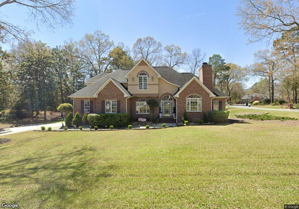
200 Falcon Crest Unit 12 Warner Robins, GA 31088
Estimated Value: $384,000 - $442,000
4
Beds
3
Baths
2,800
Sq Ft
$148/Sq Ft
Est. Value
About This Home
This home is located at 200 Falcon Crest Unit 12, Warner Robins, GA 31088 and is currently estimated at $414,089, approximately $147 per square foot. 200 Falcon Crest Unit 12 is a home located in Houston County with nearby schools including Bonaire Elementary School, Huntington Middle School, and Warner Robins High School.
Ownership History
Date
Name
Owned For
Owner Type
Purchase Details
Closed on
Oct 28, 2021
Sold by
Franco Maria Norietta
Bought by
Simms Bryan E and Clifton Sharon V
Current Estimated Value
Home Financials for this Owner
Home Financials are based on the most recent Mortgage that was taken out on this home.
Original Mortgage
$337,590
Outstanding Balance
$308,867
Interest Rate
2.88%
Mortgage Type
VA
Estimated Equity
$105,222
Create a Home Valuation Report for This Property
The Home Valuation Report is an in-depth analysis detailing your home's value as well as a comparison with similar homes in the area
Home Values in the Area
Average Home Value in this Area
Purchase History
| Date | Buyer | Sale Price | Title Company |
|---|---|---|---|
| Simms Bryan E | $355,000 | None Available |
Source: Public Records
Mortgage History
| Date | Status | Borrower | Loan Amount |
|---|---|---|---|
| Open | Simms Bryan E | $337,590 |
Source: Public Records
Tax History Compared to Growth
Tax History
| Year | Tax Paid | Tax Assessment Tax Assessment Total Assessment is a certain percentage of the fair market value that is determined by local assessors to be the total taxable value of land and additions on the property. | Land | Improvement |
|---|---|---|---|---|
| 2024 | $3,634 | $151,920 | $16,000 | $135,920 |
| 2023 | $3,647 | $150,880 | $16,000 | $134,880 |
| 2022 | $3,292 | $136,200 | $16,000 | $120,200 |
| 2021 | $2,359 | $99,080 | $16,000 | $83,080 |
| 2020 | $2,283 | $93,280 | $16,000 | $77,280 |
| 2019 | $2,228 | $93,280 | $16,000 | $77,280 |
| 2018 | $2,228 | $93,280 | $16,000 | $77,280 |
| 2017 | $2,230 | $93,280 | $16,000 | $77,280 |
| 2016 | $2,234 | $93,280 | $16,000 | $77,280 |
| 2015 | $2,238 | $93,280 | $16,000 | $77,280 |
| 2014 | -- | $99,320 | $16,000 | $83,320 |
| 2013 | -- | $99,320 | $16,000 | $83,320 |
Source: Public Records
Map
Nearby Homes
- 216 Stathams Way
- 215 Falcon Crest
- 256 Falcon Crest Unit STATHAMS LANDING
- 215 Falcon Crest Unit Stathams Landing
- 256 Falcon Crest
- 104 Bunkers Trail
- 107 Shadowood Dr
- 100 Deerwood Dr
- 308 Piedmont Ln
- 100 Huxley Terrace
- 204 Thornton Dr
- 307 Apalachee Way
- 310 Davids Place Dr
- 312 Davids Place Dr
- 203 Virginia Dare Dr
- 2001 Pin Oak Terrace
- 206,208,210&212 Virginia Dare Dr
- 115 Virginia Dare Dr Unit MH
- 104 Old Perry Rd
- 106 Mulligan Ct
- 200 Falcon Crest
- 202 Falcon Crest
- 103 Bentwood Cove
- 203 Falcon Crest
- 201 Falcon Crest
- 100 Bentwood Cove
- 105 Bentwood Cove
- 204 Falcon Crest
- 153 Falcon Crest
- 102 Bentwood Cove
- 148 Falcon Crest
- 151 Falcon Crest
- 207 Falcon Crescent
- 206 Falcon Crest
- 107 Bentwood Cove
- 104 Bentwood Cove
- 149 Falcon Crest
- 106 Bentwood Cove
- 146 Falcon Crest
- 147 Falcon Crest