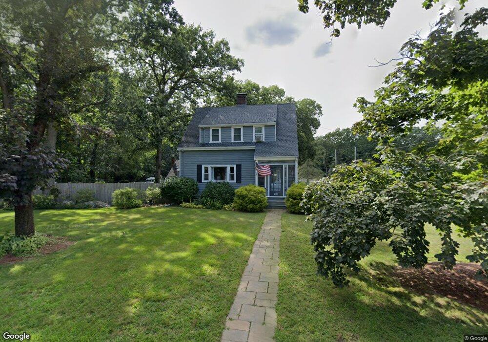
200 Forest St South Weymouth, MA 02190
South Weymouth NeighborhoodEstimated Value: $649,000 - $746,000
3
Beds
2
Baths
1,680
Sq Ft
$414/Sq Ft
Est. Value
About This Home
This home is located at 200 Forest St, South Weymouth, MA 02190 and is currently estimated at $695,637, approximately $414 per square foot. 200 Forest St is a home located in Norfolk County with nearby schools including Thomas V Nash, Abigail Adams Middle School, and Weymouth Middle School Chapman.
Ownership History
Date
Name
Owned For
Owner Type
Purchase Details
Closed on
Jan 30, 1987
Sold by
Mcdonald Richard W
Bought by
Mallon Edward T
Current Estimated Value
Home Financials for this Owner
Home Financials are based on the most recent Mortgage that was taken out on this home.
Original Mortgage
$714,000
Interest Rate
9.26%
Mortgage Type
Purchase Money Mortgage
Create a Home Valuation Report for This Property
The Home Valuation Report is an in-depth analysis detailing your home's value as well as a comparison with similar homes in the area
Home Values in the Area
Average Home Value in this Area
Purchase History
| Date | Buyer | Sale Price | Title Company |
|---|---|---|---|
| Mallon Edward T | $144,000 | -- |
Source: Public Records
Mortgage History
| Date | Status | Borrower | Loan Amount |
|---|---|---|---|
| Open | Mallon Edward T | $120,000 | |
| Closed | Mallon Edward T | $714,000 |
Source: Public Records
Tax History Compared to Growth
Tax History
| Year | Tax Paid | Tax Assessment Tax Assessment Total Assessment is a certain percentage of the fair market value that is determined by local assessors to be the total taxable value of land and additions on the property. | Land | Improvement |
|---|---|---|---|---|
| 2025 | $5,204 | $515,200 | $221,200 | $294,000 |
| 2024 | $5,168 | $503,200 | $210,700 | $292,500 |
| 2023 | $4,987 | $477,200 | $195,100 | $282,100 |
| 2022 | $4,876 | $425,500 | $180,700 | $244,800 |
| 2021 | $4,559 | $388,300 | $180,700 | $207,600 |
| 2020 | $4,371 | $366,700 | $180,700 | $186,000 |
| 2019 | $4,269 | $352,200 | $173,700 | $178,500 |
| 2018 | $4,146 | $331,700 | $165,400 | $166,300 |
| 2017 | $3,979 | $310,600 | $157,600 | $153,000 |
| 2016 | $3,823 | $298,700 | $151,500 | $147,200 |
| 2015 | $3,504 | $271,600 | $136,400 | $135,200 |
| 2014 | $3,555 | $267,300 | $141,000 | $126,300 |
Source: Public Records
Map
Nearby Homes
- 68 Massapoag St Unit 7
- 24 Fisher Rd
- 16 Jay Rd
- 308 Forest St
- 354 Tilden Commons Ln
- 211 Randolph St
- 92 Mercury St
- 193 Randolph St
- 134 Tyson Commons Ln
- 175 Tyson Commons Ln
- 120 Randolph St
- 30 Bradford Commons Ln
- 262 West St
- 255 West St
- 50 Hollis St
- 655 Summer St
- 2 Mitchell Ln Unit B
- 27 Park Ave
- 441 Grove St
- 432 Grove St
- 0 Massapoag St Unit 72051974
- 0 Massapoag St
- 192 Forest St
- 18 Massapoag St
- 203 Forest St
- 186 Forest St
- 212 Forest St
- 17 Massapoag St
- 185 Forest St
- 13 King Philip St
- 26 Massapoag St
- 213 Forest St
- 74 Massapoag St Unit 6
- 220 Forest St
- 15 King Philip St
- 11 Harvest Ln
- 34 Massapoag St
- 18 King Philip St
- 221 Forest St
- 175 Forest St