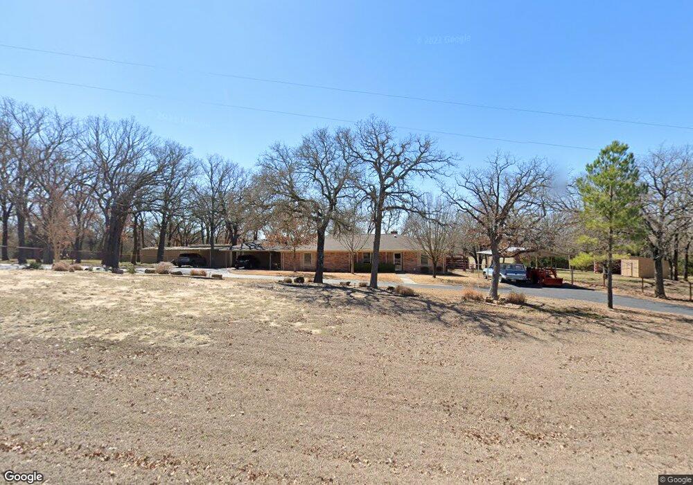
200 Hearndale Dr Weatherford, TX 76085
Estimated Value: $446,637 - $526,000
--
Bed
--
Bath
1,923
Sq Ft
$250/Sq Ft
Est. Value
About This Home
This home is located at 200 Hearndale Dr, Weatherford, TX 76085 and is currently estimated at $480,659, approximately $249 per square foot. 200 Hearndale Dr is a home located in Parker County with nearby schools including Martin Elementary School, Tison Middle School, and Weatherford High School.
Ownership History
Date
Name
Owned For
Owner Type
Purchase Details
Closed on
Sep 28, 2006
Sold by
Neely Douglas Leo and Neely Priscilla
Bought by
Hogg Beverly J
Current Estimated Value
Home Financials for this Owner
Home Financials are based on the most recent Mortgage that was taken out on this home.
Original Mortgage
$390,000
Outstanding Balance
$233,363
Interest Rate
6.51%
Mortgage Type
Purchase Money Mortgage
Estimated Equity
$247,296
Purchase Details
Closed on
Feb 28, 1980
Bought by
Bynum Laura and Bynum Hogg B
Create a Home Valuation Report for This Property
The Home Valuation Report is an in-depth analysis detailing your home's value as well as a comparison with similar homes in the area
Home Values in the Area
Average Home Value in this Area
Purchase History
| Date | Buyer | Sale Price | Title Company |
|---|---|---|---|
| Hogg Beverly J | -- | Stnt | |
| Bynum Laura | -- | -- |
Source: Public Records
Mortgage History
| Date | Status | Borrower | Loan Amount |
|---|---|---|---|
| Open | Hogg Beverly J | $390,000 |
Source: Public Records
Tax History Compared to Growth
Tax History
| Year | Tax Paid | Tax Assessment Tax Assessment Total Assessment is a certain percentage of the fair market value that is determined by local assessors to be the total taxable value of land and additions on the property. | Land | Improvement |
|---|---|---|---|---|
| 2025 | $1,457 | $375,439 | -- | -- |
| 2024 | $1,457 | $341,308 | -- | -- |
| 2023 | $1,457 | $310,280 | $0 | $0 |
| 2022 | $5,252 | $294,440 | $103,760 | $190,680 |
| 2021 | $5,176 | $294,440 | $103,760 | $190,680 |
| 2020 | $4,728 | $261,150 | $91,100 | $170,050 |
| 2019 | $4,586 | $261,150 | $91,100 | $170,050 |
| 2018 | $4,191 | $192,660 | $55,680 | $136,980 |
| 2017 | $3,951 | $192,660 | $55,680 | $136,980 |
| 2016 | $3,592 | $161,810 | $55,680 | $106,130 |
| 2015 | $2,691 | $161,810 | $55,680 | $106,130 |
| 2014 | $2,833 | $157,020 | $55,680 | $101,340 |
Source: Public Records
Map
Nearby Homes
- TBD Lot 7 N Lake Dr
- 109 Perdue Ln
- 748 Rocky Ridge Ln
- 0 R000118724 Unit 20846338
- 5885-F Upper Denton Rd
- 5885-H Upper Denton Rd
- E 67 Acres TBD Upper Denton Rd
- 5885-G Upper Denton Rd
- 4674 Azle Hwy
- 2431 E Lake Dr
- 2425 E Lake Dr
- 2421 E Lake Dr
- 1128 W Lake Dr
- 2065 Preserve Trail
- 1154 W Lake Dr
- 1357 Friendship Rd
- 4895 Upper Denton Rd
- 470 Wildwood Trail
- 1001 Emery Ct
- Chapman Plan at Parker Ridge
- 215 Hearndale Dr
- 201 Hearndale Dr
- 902 N Lake Dr
- 906 N Lake Dr
- 205 Rocky Ridge Ln
- 302 Hearndale Dr
- TBD Lot 6 N Lake Dr
- TBD1 N Lake Dr
- tbd N Lake Dr
- 1001 N Lake Dr
- 909 N Lake Dr
- 955 N Lake Dr
- 801 N Lake Dr
- 1401 N Lake Dr
- 1355 N Lake Dr
- 00 Embers Ln
- 715 N Lake Dr
- 104 Embers Ln
- 1283 N Lake Dr
- 705 N Lake Dr