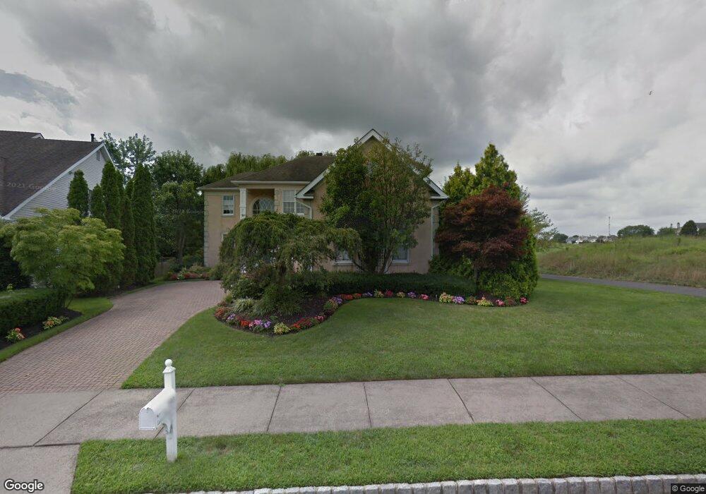
200 Laurel Creek Blvd Moorestown, NJ 08057
Estimated Value: $976,624 - $1,092,000
--
Bed
--
Bath
3,060
Sq Ft
$344/Sq Ft
Est. Value
About This Home
This home is located at 200 Laurel Creek Blvd, Moorestown, NJ 08057 and is currently estimated at $1,053,208, approximately $344 per square foot. 200 Laurel Creek Blvd is a home located in Burlington County with nearby schools including South Valley Elementary School, Moorestown Upper Elementary School, and William Allen Middle School.
Ownership History
Date
Name
Owned For
Owner Type
Purchase Details
Closed on
Jun 22, 2019
Sold by
Gaskill Kathleen
Bought by
Gaskill Kathleen and Gaskill Kenneth
Current Estimated Value
Purchase Details
Closed on
Jun 20, 2014
Sold by
Gaskill Kenneth and Gaskill Kathleen
Bought by
Gaskill Kathleen
Purchase Details
Closed on
Sep 27, 1996
Sold by
Laurel Creek Lp
Bought by
Gaskill Kenneth and Gaskill Kathleen
Create a Home Valuation Report for This Property
The Home Valuation Report is an in-depth analysis detailing your home's value as well as a comparison with similar homes in the area
Home Values in the Area
Average Home Value in this Area
Purchase History
| Date | Buyer | Sale Price | Title Company |
|---|---|---|---|
| Gaskill Kathleen | -- | None Available | |
| Gaskill Kathleen | -- | None Available | |
| Gaskill Kenneth | $371,545 | -- |
Source: Public Records
Tax History Compared to Growth
Tax History
| Year | Tax Paid | Tax Assessment Tax Assessment Total Assessment is a certain percentage of the fair market value that is determined by local assessors to be the total taxable value of land and additions on the property. | Land | Improvement |
|---|---|---|---|---|
| 2025 | $14,857 | $523,700 | $191,600 | $332,100 |
| 2024 | $14,407 | $523,700 | $191,600 | $332,100 |
| 2023 | $14,407 | $523,700 | $191,600 | $332,100 |
| 2022 | $14,260 | $523,700 | $191,600 | $332,100 |
| 2021 | $14,072 | $523,700 | $191,600 | $332,100 |
| 2020 | $13,983 | $523,700 | $191,600 | $332,100 |
| 2019 | $13,737 | $523,700 | $191,600 | $332,100 |
| 2018 | $13,365 | $523,700 | $191,600 | $332,100 |
| 2017 | $13,480 | $523,700 | $191,600 | $332,100 |
| 2016 | $13,433 | $523,700 | $191,600 | $332,100 |
| 2015 | $13,271 | $523,700 | $191,600 | $332,100 |
| 2014 | $12,600 | $523,700 | $191,600 | $332,100 |
Source: Public Records
Map
Nearby Homes
- 14 Baltusrol Terrace
- 158 Sarazen Dr
- 40 Palmer Dr Unit 110
- 950 Bortons Landing Rd
- 901 Mcelwee Rd
- 12 Cove Rd
- 20 Starboard Way
- 42 Landing Ct
- 6 Buoy Dr
- 218 Starboard Way
- 482 Monte Farm Rd
- 861 Centerton Rd
- 5 Birch Dr
- 69 Sister's Farmstead Rd
- 39 Bramley Rd
- 22 Cardinal Way
- 97 Brooks Rd
- 10 Crows Nest Ct
- 163 Memorial Ln
- 5 Murray Rd
- 202 Laurel Creek Blvd
- 204 Laurel Creek Blvd
- 201 Laurel Creek Blvd
- 206 Laurel Creek Blvd Unit 27
- 203 Laurel Creek Blvd
- 208 Laurel Creek Blvd
- 205 Laurel Creek Blvd
- 210 Laurel Creek Blvd
- 100 Muirfield Ct
- 207 Laurel Creek Blvd
- 212 Laurel Creek Blvd
- 209 Laurel Creek Blvd
- 214 Laurel Creek Blvd
- 211 Laurel Creek Blvd
- 102 Muirfield Ct
- 3 Turnberry Ct
- 216 Laurel Creek Blvd
- 213 Laurel Creek Blvd
- 101 Augusta Dr
- 1 Turnberry Ct