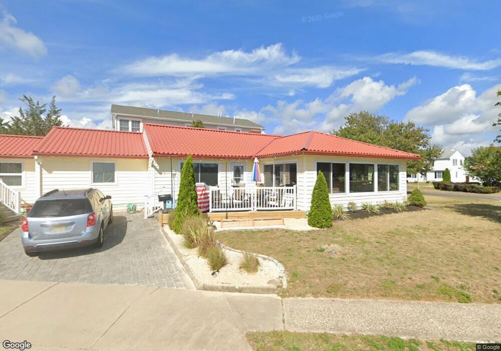
200 Laurel Ct Point Pleasant Beach, NJ 08742
Point Pleasant Beach NeighborhoodEstimated Value: $985,000 - $1,733,000
3
Beds
3
Baths
2,568
Sq Ft
$556/Sq Ft
Est. Value
About This Home
This home is located at 200 Laurel Ct, Point Pleasant Beach, NJ 08742 and is currently estimated at $1,426,931, approximately $555 per square foot. 200 Laurel Ct is a home located in Ocean County with nearby schools including G Harold Antrim Elementary School, Point Pleasant Beach High School, and St. Peter School.
Ownership History
Date
Name
Owned For
Owner Type
Purchase Details
Closed on
Feb 25, 1999
Sold by
Jones George William and Jones Anne Marie
Bought by
Mccartney Sharon
Current Estimated Value
Home Financials for this Owner
Home Financials are based on the most recent Mortgage that was taken out on this home.
Original Mortgage
$199,920
Outstanding Balance
$48,302
Interest Rate
6.73%
Estimated Equity
$1,378,629
Create a Home Valuation Report for This Property
The Home Valuation Report is an in-depth analysis detailing your home's value as well as a comparison with similar homes in the area
Home Values in the Area
Average Home Value in this Area
Purchase History
| Date | Buyer | Sale Price | Title Company |
|---|---|---|---|
| Mccartney Sharon | $249,900 | -- |
Source: Public Records
Mortgage History
| Date | Status | Borrower | Loan Amount |
|---|---|---|---|
| Open | Mccartney Sharon | $199,920 |
Source: Public Records
Tax History Compared to Growth
Tax History
| Year | Tax Paid | Tax Assessment Tax Assessment Total Assessment is a certain percentage of the fair market value that is determined by local assessors to be the total taxable value of land and additions on the property. | Land | Improvement |
|---|---|---|---|---|
| 2025 | $13,318 | $775,200 | $616,100 | $159,100 |
| 2024 | $12,915 | $775,200 | $616,100 | $159,100 |
| 2023 | $12,550 | $775,200 | $616,100 | $159,100 |
| 2022 | $12,550 | $775,200 | $616,100 | $159,100 |
| 2021 | $12,271 | $775,200 | $616,100 | $159,100 |
| 2020 | $12,256 | $775,200 | $616,100 | $159,100 |
| 2019 | $12,085 | $775,200 | $616,100 | $159,100 |
| 2018 | $11,836 | $771,100 | $616,100 | $155,000 |
| 2017 | $11,651 | $771,100 | $616,100 | $155,000 |
| 2016 | $11,705 | $771,100 | $616,100 | $155,000 |
| 2015 | $12,391 | $822,800 | $616,100 | $206,700 |
| 2014 | $12,334 | $822,800 | $616,100 | $206,700 |
Source: Public Records
Map
Nearby Homes
- 201 Forman Ave
- 118 New York Ave
- 1008 Ocean Ave N
- 503 Atlantic Ave
- 303 Cooks Ln
- 607 Richmond Ave Unit 4
- 325 Hawthorne Ave Unit 327
- 606 Bay Ave Unit 2
- 606 Bay Ave Unit 3
- 202 Yale Ave
- 10 Brunswick Place
- 7 Brunswick Place
- 1322 Ocean Ave
- 704 Forman Ave
- 5 Water St
- 728 Arnold Ave
- 140 Ocean Ave
- 143 Boardwalk
- 6 Beachcomber Ln Unit 6
- 2 Beachcomber Ln Unit 7-2