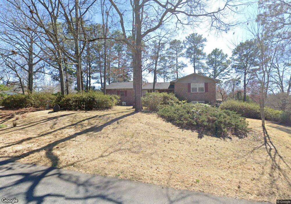
200 Lumpkin Dr Warner Robins, GA 31093
Estimated Value: $183,000 - $214,000
3
Beds
2
Baths
1,781
Sq Ft
$110/Sq Ft
Est. Value
About This Home
This home is located at 200 Lumpkin Dr, Warner Robins, GA 31093 and is currently estimated at $196,150, approximately $110 per square foot. 200 Lumpkin Dr is a home located in Houston County with nearby schools including Westside Elementary School, Northside Middle School, and Northside High School.
Ownership History
Date
Name
Owned For
Owner Type
Purchase Details
Closed on
Apr 26, 2018
Sold by
Varnadoe Linda Kay and Varnado Gary Keith
Bought by
Varnadoe Betty Jo
Current Estimated Value
Purchase Details
Closed on
Nov 24, 2017
Sold by
Varnadoe Linda Kay and Varnadoe Keith
Bought by
Varnadoe Betty Jo
Purchase Details
Closed on
Aug 20, 2013
Sold by
Varnadoe James H
Bought by
Varnadoe Betty J
Purchase Details
Closed on
Dec 20, 1977
Sold by
Varnadoe James H
Bought by
Varnadoe James H and Varnadoe Betty J
Purchase Details
Closed on
Dec 6, 1977
Sold by
Veterans Administration
Bought by
Varnadoe James H
Purchase Details
Closed on
Mar 1, 1977
Sold by
Phipps-Harrington Corp
Bought by
Veterans Administration
Purchase Details
Closed on
Oct 22, 1975
Sold by
Horne Russell M
Bought by
Bauer William C
Purchase Details
Closed on
Apr 20, 1972
Sold by
Bowman Hubert A
Bought by
Horne Russell M
Purchase Details
Closed on
Jan 6, 1972
Sold by
Legg John F and Ann Genevieve
Bought by
Bowman Hubert A
Purchase Details
Closed on
Aug 7, 1969
Sold by
Barlow Joseph N
Bought by
Legg John F and Ann Genevieve
Purchase Details
Closed on
Jun 20, 1968
Sold by
Pike David F
Bought by
Barlow Joseph N
Create a Home Valuation Report for This Property
The Home Valuation Report is an in-depth analysis detailing your home's value as well as a comparison with similar homes in the area
Home Values in the Area
Average Home Value in this Area
Purchase History
| Date | Buyer | Sale Price | Title Company |
|---|---|---|---|
| Varnadoe Betty Jo | -- | None Available | |
| Varnadoe Betty Jo | -- | None Available | |
| Varnadoe Betty J | -- | -- | |
| Varnadoe James H | -- | -- | |
| Varnadoe James H | -- | -- | |
| Veterans Administration | -- | -- | |
| Phipps-Harrington Corp | -- | -- | |
| Bauer William C | -- | -- | |
| Horne Russell M | -- | -- | |
| Bowman Hubert A | -- | -- | |
| Legg John F | -- | -- | |
| Barlow Joseph N | -- | -- |
Source: Public Records
Tax History
| Year | Tax Paid | Tax Assessment Tax Assessment Total Assessment is a certain percentage of the fair market value that is determined by local assessors to be the total taxable value of land and additions on the property. | Land | Improvement |
|---|---|---|---|---|
| 2025 | $1,174 | $58,200 | $7,120 | $51,080 |
| 2024 | $1,217 | $52,880 | $7,120 | $45,760 |
| 2023 | $1,090 | $47,080 | $7,120 | $39,960 |
| 2022 | $983 | $42,680 | $5,720 | $36,960 |
| 2021 | $862 | $37,480 | $5,720 | $31,760 |
| 2020 | $846 | $36,640 | $5,720 | $30,920 |
| 2019 | $846 | $36,640 | $5,720 | $30,920 |
| 2018 | $846 | $36,640 | $5,720 | $30,920 |
| 2017 | $846 | $36,640 | $5,720 | $30,920 |
| 2016 | $848 | $36,640 | $5,720 | $30,920 |
| 2015 | $849 | $36,640 | $5,720 | $30,920 |
| 2014 | -- | $36,640 | $5,720 | $30,920 |
| 2013 | -- | $36,200 | $5,720 | $30,480 |
Source: Public Records
Map
Nearby Homes
- 416 Knodishall Dr
- 221 Gilchrist Dr
- 111 Laurel Oak Ln
- 111 Hawthorne Rd
- 209 Knodishall Dr
- 108 Laurel Oak Ln
- 102 Hemlock St
- 110 Foxfire Dr
- 123 Tanglewood Dr
- 104 Heather St
- 103 Westcliff Cir Unit A
- 103 Westcliff Cir Unit A
- 108 Madison Ave
- 102 Westcliff Center St Unit D
- 102 Williams St
- 112 Emory Dr
- 110 Merlin St
- 136 Red Birch Ln
- 127 Red Birch Ln
- 118 Red Birch Ln
- 303 Taylor St
- 202 Lumpkin Dr
- 201 Lumpkin Dr
- 306 Taylor St
- 308 Taylor St
- 304 Taylor St
- 203 Lumpkin Dr
- 400 Taylor St
- 200 Debbie Dr
- 205 Lumpkin Dr
- 201 Meadow Glen Ct
- 302 Taylor St
- 101 Meadow Glen Ct
- 203 Meadow Glen Ct
- 201 Stanford St
- 103 Meadow Glen Ct
- 110 Flournoy Dr
- 402 Taylor St
- 203 Stanford St
- 118 Taylor St
Your Personal Tour Guide
Ask me questions while you tour the home.