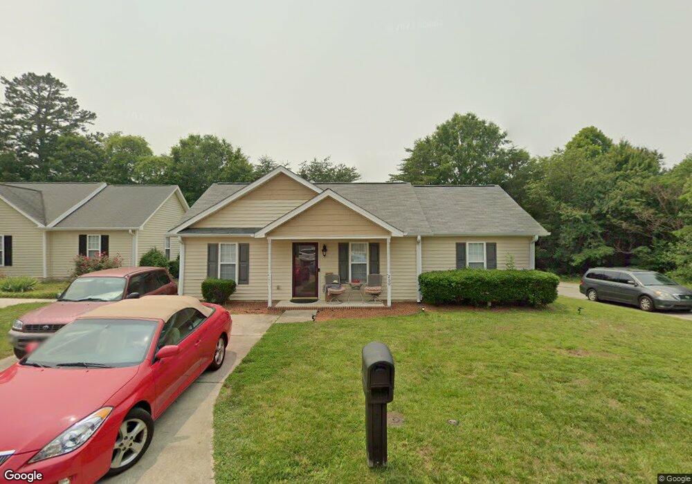
200 Madi Ct Winston Salem, NC 27107
Estimated Value: $198,000 - $236,000
3
Beds
4
Baths
2,240
Sq Ft
$97/Sq Ft
Est. Value
About This Home
This home is located at 200 Madi Ct, Winston Salem, NC 27107 and is currently estimated at $218,053, approximately $97 per square foot. 200 Madi Ct is a home located in Forsyth County with nearby schools including Hall-Woodward Elementary School, Philo-Hill Magnet Academy, and R.B. Glenn High School.
Ownership History
Date
Name
Owned For
Owner Type
Purchase Details
Closed on
Sep 3, 2021
Sold by
Jackson Gisele and Cloud Gisele J
Bought by
Jackson Gisele
Current Estimated Value
Home Financials for this Owner
Home Financials are based on the most recent Mortgage that was taken out on this home.
Original Mortgage
$92,000
Interest Rate
2.8%
Mortgage Type
New Conventional
Purchase Details
Closed on
Apr 16, 2013
Sold by
Cloud Percy H
Bought by
Cloud Gisele J
Create a Home Valuation Report for This Property
The Home Valuation Report is an in-depth analysis detailing your home's value as well as a comparison with similar homes in the area
Home Values in the Area
Average Home Value in this Area
Purchase History
| Date | Buyer | Sale Price | Title Company |
|---|---|---|---|
| Jackson Gisele | -- | Vylla Title Llc | |
| Cloud Gisele J | -- | None Available |
Source: Public Records
Mortgage History
| Date | Status | Borrower | Loan Amount |
|---|---|---|---|
| Closed | Jackson Gisele | $92,000 |
Source: Public Records
Tax History Compared to Growth
Tax History
| Year | Tax Paid | Tax Assessment Tax Assessment Total Assessment is a certain percentage of the fair market value that is determined by local assessors to be the total taxable value of land and additions on the property. | Land | Improvement |
|---|---|---|---|---|
| 2025 | $793 | $219,600 | $26,000 | $193,600 |
| 2024 | $1,506 | $112,500 | $23,000 | $89,500 |
| 2023 | $1,506 | $112,500 | $23,000 | $89,500 |
| 2022 | $1,478 | $112,500 | $23,000 | $89,500 |
| 2021 | $1,451 | $112,500 | $23,000 | $89,500 |
| 2020 | $1,196 | $86,600 | $22,000 | $64,600 |
| 2019 | $1,205 | $86,600 | $22,000 | $64,600 |
| 2018 | $1,144 | $86,600 | $22,000 | $64,600 |
| 2016 | $895 | $68,012 | $15,400 | $52,612 |
| 2015 | $881 | $68,012 | $15,400 | $52,612 |
| 2014 | $855 | $68,012 | $15,400 | $52,612 |
Source: Public Records
Map
Nearby Homes
- 0 Green Point Rd
- 137 Vogler Dr
- 3514 Landis St SE
- 3520 Landis St SE
- 3532 Landis St SE
- 3538 Landis St SE
- 3544 Landis St SE
- 301 Bedford Park Dr
- 3422 Robindale Dr
- 2830 Frank St
- 3441 Robindale Dr
- 2922 Poinsetta Dr
- 3453 Robindale Dr
- 3471 Robindale Dr
- 3598 Robindale Dr
- 113 Dillon St
- 2329 Cole Rd
- Ashe Plan at Robindale
- Erie Plan at Robindale
- Camden Plan at Robindale