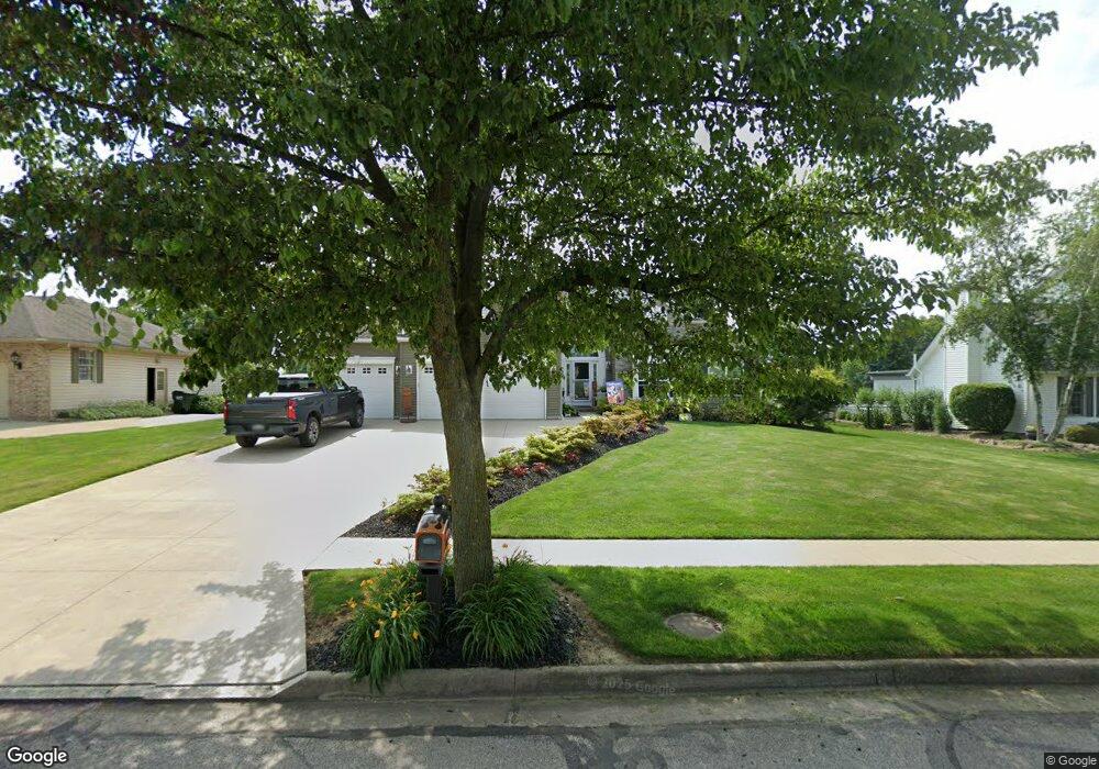
200 Meadow Ridge Trail Doylestown, OH 44230
Estimated Value: $373,456 - $421,000
3
Beds
2
Baths
2,060
Sq Ft
$192/Sq Ft
Est. Value
About This Home
This home is located at 200 Meadow Ridge Trail, Doylestown, OH 44230 and is currently estimated at $396,364, approximately $192 per square foot. 200 Meadow Ridge Trail is a home located in Wayne County with nearby schools including Hazel Harvey Elementary School, Chippewa Intermediate School, and Chippewa Jr./Sr. High School.
Ownership History
Date
Name
Owned For
Owner Type
Purchase Details
Closed on
Dec 29, 2011
Sold by
Easterling Darrell L and Easterling Bonnie
Bought by
Easterling Bonnie and The Bonnie & Darrell Easterling Revocabl
Current Estimated Value
Purchase Details
Closed on
Aug 5, 2008
Sold by
Funk Karen
Bought by
Easterling Darrell L and Easterling Bonnie
Home Financials for this Owner
Home Financials are based on the most recent Mortgage that was taken out on this home.
Original Mortgage
$185,197
Outstanding Balance
$121,907
Interest Rate
6.39%
Mortgage Type
Construction
Estimated Equity
$274,457
Purchase Details
Closed on
Aug 23, 2005
Sold by
Hohenshil Barbara A
Bought by
Funk Karen
Purchase Details
Closed on
Jul 24, 1998
Sold by
Galeheights Dev Co Inc
Bought by
Hohenshil Robert N and Hohenshil Barbara A
Create a Home Valuation Report for This Property
The Home Valuation Report is an in-depth analysis detailing your home's value as well as a comparison with similar homes in the area
Home Values in the Area
Average Home Value in this Area
Purchase History
| Date | Buyer | Sale Price | Title Company |
|---|---|---|---|
| Easterling Bonnie | -- | Attorney | |
| Easterling Darrell L | $47,000 | Bond & Associates Title Agen | |
| Funk Karen | $58,000 | Bond & Associates | |
| Funk Karen | $58,000 | Bond & Associates | |
| Hohenshil Robert N | $41,400 | -- |
Source: Public Records
Mortgage History
| Date | Status | Borrower | Loan Amount |
|---|---|---|---|
| Open | Easterling Darrell L | $185,197 |
Source: Public Records
Tax History Compared to Growth
Tax History
| Year | Tax Paid | Tax Assessment Tax Assessment Total Assessment is a certain percentage of the fair market value that is determined by local assessors to be the total taxable value of land and additions on the property. | Land | Improvement |
|---|---|---|---|---|
| 2024 | $3,977 | $118,470 | $27,350 | $91,120 |
| 2023 | $3,977 | $118,470 | $27,350 | $91,120 |
| 2022 | $3,366 | $92,550 | $21,370 | $71,180 |
| 2021 | $3,376 | $92,550 | $21,370 | $71,180 |
| 2020 | $3,751 | $92,550 | $21,370 | $71,180 |
| 2019 | $3,583 | $85,100 | $16,970 | $68,130 |
| 2018 | $3,616 | $85,100 | $16,970 | $68,130 |
| 2017 | $3,587 | $85,100 | $16,970 | $68,130 |
| 2016 | $3,501 | $81,830 | $16,320 | $65,510 |
| 2015 | $3,486 | $81,830 | $16,320 | $65,510 |
| 2014 | $3,084 | $81,830 | $16,320 | $65,510 |
| 2013 | $2,924 | $75,300 | $16,070 | $59,230 |
Source: Public Records
Map
Nearby Homes
- 46 Hidden Pond Dr
- 270 Maple St
- 0 S Portage St
- 325 Catawba Path
- 100 Merlot Ct
- 154 Circle Dr
- 605 Vineyard Way
- 680 Thorn Way
- 620 Thorn Way
- 580 Thorn Way
- 436 N Portage St
- 0 Akron Rd Unit 5123781
- 517 N Portage St
- 11626 Black Diamond Rd
- 340 Gates St
- 500 W Clinton St
- 77 Koehler Ave
- 14328 Calaboone Rd
- 12214 Vince Dr
- 104 Homan Dr
- 220 Meadow Ridge Trail
- 180 Meadow Ridge Trail
- 160 Meadow Ridge Trail
- 12935 Coal Bank Rd
- 12979 Coal Bank Rd
- 240 Meadow Ridge Trail
- 205 Meadow Ridge Trail
- 185 Meadow Ridge Trail
- 225 Meadow Ridge Trail
- 140 Meadow Ridge Trail
- 165 Meadow Ridge Trail
- 260 Meadow Ridge Trail
- 245 Meadow Ridge Trail
- 12891 Coal Bank Rd
- 13023 Coal Bank Rd
- 313 Willow Way
- 284 Willow Way
- 145 Meadow Ridge Trail
- 120 Meadow Ridge Trail
- 280 Meadow Ridge Trail