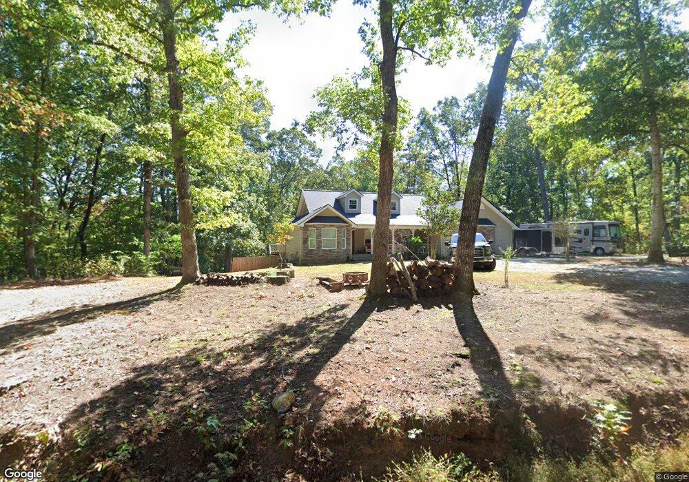
200 Miner Point Unit 46 Clarkesville, GA 30523
Estimated Value: $497,000 - $556,000
4
Beds
3
Baths
3,800
Sq Ft
$138/Sq Ft
Est. Value
About This Home
This home is located at 200 Miner Point Unit 46, Clarkesville, GA 30523 and is currently estimated at $523,540, approximately $137 per square foot. 200 Miner Point Unit 46 is a home located in Habersham County with nearby schools including Clarkesville Elementary School, North Habersham Middle School, and Habersham Success Academy.
Ownership History
Date
Name
Owned For
Owner Type
Purchase Details
Closed on
Oct 22, 2013
Sold by
Regions Bank
Bought by
Maxwell Melanie Elizabeth
Current Estimated Value
Purchase Details
Closed on
Nov 1, 2011
Sold by
Scoggins Hugh O
Bought by
Regions Bank
Purchase Details
Closed on
Apr 1, 2006
Sold by
Not Provided
Bought by
Scoggins Hugh O
Create a Home Valuation Report for This Property
The Home Valuation Report is an in-depth analysis detailing your home's value as well as a comparison with similar homes in the area
Home Values in the Area
Average Home Value in this Area
Purchase History
| Date | Buyer | Sale Price | Title Company |
|---|---|---|---|
| Maxwell Melanie Elizabeth | $147,000 | -- | |
| Regions Bank | $205,000 | -- | |
| Scoggins Hugh O | $240,000 | -- | |
| Scoggins Hugh O | -- | -- |
Source: Public Records
Tax History
| Year | Tax Paid | Tax Assessment Tax Assessment Total Assessment is a certain percentage of the fair market value that is determined by local assessors to be the total taxable value of land and additions on the property. | Land | Improvement |
|---|---|---|---|---|
| 2025 | $2,714 | $179,391 | $24,102 | $155,289 |
| 2024 | -- | $165,344 | $17,156 | $148,188 |
| 2023 | $1,913 | $139,664 | $17,156 | $122,508 |
| 2022 | $2,208 | $116,504 | $11,436 | $105,068 |
| 2021 | $2,130 | $106,892 | $11,436 | $95,456 |
| 2020 | $2,034 | $93,440 | $11,436 | $82,004 |
| 2019 | $2,036 | $93,440 | $11,436 | $82,004 |
| 2018 | $2,009 | $92,012 | $10,008 | $82,004 |
| 2017 | $1,923 | $84,680 | $10,008 | $74,672 |
| 2016 | $1,834 | $208,120 | $8,576 | $74,672 |
| 2015 | $1,819 | $208,120 | $8,576 | $74,672 |
| 2014 | $1,544 | $147,000 | $6,468 | $52,332 |
| 2013 | -- | $84,128 | $10,008 | $74,120 |
Source: Public Records
Map
Nearby Homes
- 775 Riverwilde Rd
- 1295 Wall Bridge Loop
- 182 Hardman Rd
- 274 Hardman Rd
- 220 Hardman Rd
- 2063 Highway 197 N
- 182 Farm Hill Dr
- 281 Grindstone Creek Dr
- 221 Grindstone Creek Dr
- 0 Old Clarkesville Mill Rd Unit (LOT 13)
- 0 Old Clarkesville Mill Rd Unit (LOT 11)
- 0 Old Clarkesville Mill Rd Unit (LOT 12)
- 382 Sherwood Dr
- LOT 27 Spring Field Dr
- 2171 Hollywood Hwy
- 164 Robinhood Dr
- 683 Grant St Unit I
- 4230 Hollywood Hwy
- 555 Highway 197 N
- 1398 Annandale Dr
- 200 Miner Point
- 242 Miner Point
- 124 Miner Point
- 288 Miner Point
- 314 One Hill of Hab
- 1225 Riverwilde Rd
- 1170 Riverwilde Rd
- 1745 Wall Bridge Rd
- 1330 Riverwilde Rd
- 315 Miner Point
- 318 Miner Point
- 1339 Riverwilde Rd
- 0 Miner Point Unit 40 8234485
- 318 Phillips St
- 315 Fenwick Wood Unit A
- 315 Fenwick Wood
- 313 One Hill of Hab
- 315A Fenwick Wood Unit WOOD
- 1741 Wall Bridge Rd
- 500 McCartan Trail
Your Personal Tour Guide
Ask me questions while you tour the home.