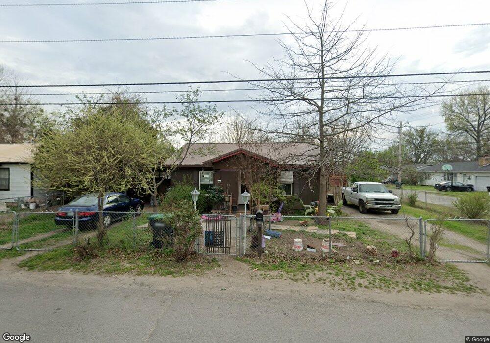
200 N East Ave Tahlequah, OK 74464
Estimated Value: $77,499 - $132,000
2
Beds
1
Bath
780
Sq Ft
$136/Sq Ft
Est. Value
About This Home
This home is located at 200 N East Ave, Tahlequah, OK 74464 and is currently estimated at $106,375, approximately $136 per square foot. 200 N East Ave is a home located in Cherokee County with nearby schools including Cherokee Elementary School, Greenwood Elementary School, and Tahlequah Middle School.
Ownership History
Date
Name
Owned For
Owner Type
Purchase Details
Closed on
Oct 17, 2023
Sold by
Conner Donald Wayne and Conner Audra Lynn
Bought by
Department Of Transportation Of The State Of
Current Estimated Value
Purchase Details
Closed on
Sep 25, 2023
Sold by
Neff Lisa and Neff Gene
Bought by
Ten and Ten Ovc
Purchase Details
Closed on
Jul 20, 2023
Sold by
Rogers Jimmie D and Rogers Cindy L
Bought by
State Of Oklahoma
Purchase Details
Closed on
Jan 6, 2014
Sold by
Hendrix Ronald and Hendrix Bessie
Bought by
Saddler Jeffrey Dale
Purchase Details
Closed on
Oct 6, 2003
Sold by
Thelma Hendrix
Bought by
Ronald and Bessie Hendrix
Create a Home Valuation Report for This Property
The Home Valuation Report is an in-depth analysis detailing your home's value as well as a comparison with similar homes in the area
Home Values in the Area
Average Home Value in this Area
Purchase History
| Date | Buyer | Sale Price | Title Company |
|---|---|---|---|
| Department Of Transportation Of The State Of | -- | None Listed On Document | |
| Ten | -- | None Listed On Document | |
| State Of Oklahoma | -- | None Listed On Document | |
| State Of Oklahoma | -- | None Listed On Document | |
| State Of Oklahoma | -- | None Listed On Document | |
| Saddler Jeffrey Dale | $50,000 | None Available | |
| Ronald | -- | -- |
Source: Public Records
Tax History Compared to Growth
Tax History
| Year | Tax Paid | Tax Assessment Tax Assessment Total Assessment is a certain percentage of the fair market value that is determined by local assessors to be the total taxable value of land and additions on the property. | Land | Improvement |
|---|---|---|---|---|
| 2025 | $202 | $3,006 | $550 | $2,456 |
| 2024 | $202 | $3,130 | $550 | $2,580 |
| 2023 | $202 | $5,084 | $550 | $4,534 |
| 2022 | $379 | $5,084 | $550 | $4,534 |
| 2021 | $379 | $5,067 | $550 | $4,517 |
| 2020 | $372 | $4,920 | $550 | $4,370 |
| 2019 | $355 | $4,777 | $550 | $4,227 |
| 2018 | $346 | $4,638 | $550 | $4,088 |
| 2017 | $427 | $5,500 | $550 | $4,950 |
| 2016 | $430 | $5,500 | $550 | $4,950 |
| 2015 | $422 | $5,500 | $550 | $4,950 |
| 2014 | $30 | $2,318 | $437 | $1,881 |
Source: Public Records
Map
Nearby Homes
- 619 E Cherrie St
- 609 E Ward St
- 605 E Ward St
- 111 N Logan Dr
- 640 N Oklahoma Ave
- 101 S Harrison Ave
- 103 S Harrison Ave
- 104 Tommye Ln
- 200 Remington Place
- 717 N Oklahoma Ave
- 710 Victor St
- 215 S Maple Ave
- 1025 E Downing St
- 707 Victor St
- 204 Woodhaven Ave
- 403 S Bluff Ave
- 0 S Hwy 82 A Hwy Unit 2532332
- 605 S Oak Ave
- 508 Covington Place
- 508 Garden Rd
- 202 N East Ave
- 208 N East Ave
- 212 N East Ave
- 613 E Cherrie St
- 615 E Cherrie St
- 216 N East Ave
- 617 E Cherrie St
- 317 E S
- 619 1/2 E Cherrie St
- 219 N East Ave
- 223 N East Ave
- 213 N East Ave
- 210 N East Ave
- 616 E Downing St
- 207 N East Ave
- 707 E Cherrie St
- 501 E Cherrie St
- 502 E Cherrie St
- 706 E Cherrie St
- 203 N East Ave