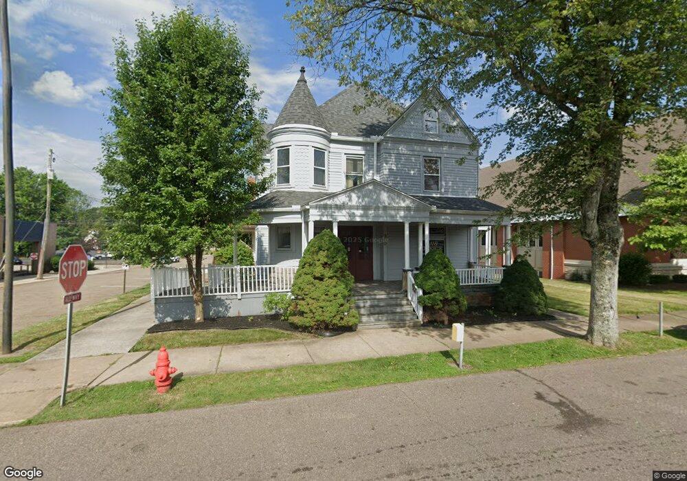
200 N Main St Minerva, OH 44657
Estimated Value: $162,000 - $265,219
3
Beds
2
Baths
2,016
Sq Ft
$101/Sq Ft
Est. Value
About This Home
This home is located at 200 N Main St, Minerva, OH 44657 and is currently estimated at $204,073, approximately $101 per square foot. 200 N Main St is a home located in Stark County with nearby schools including Minerva Elementary School, Minerva Middle School, and Minerva High School.
Ownership History
Date
Name
Owned For
Owner Type
Purchase Details
Closed on
Feb 13, 2010
Sold by
Willen Gary L and Willen Synthia A
Bought by
Roth Michael J and Roth Stacie L
Current Estimated Value
Home Financials for this Owner
Home Financials are based on the most recent Mortgage that was taken out on this home.
Original Mortgage
$100,000
Outstanding Balance
$66,744
Interest Rate
5.2%
Mortgage Type
Seller Take Back
Estimated Equity
$137,329
Purchase Details
Closed on
Apr 27, 2006
Sold by
Willen Gary L
Bought by
Willen Gary L and Willen Synthia A
Purchase Details
Closed on
Jan 10, 1989
Create a Home Valuation Report for This Property
The Home Valuation Report is an in-depth analysis detailing your home's value as well as a comparison with similar homes in the area
Home Values in the Area
Average Home Value in this Area
Purchase History
| Date | Buyer | Sale Price | Title Company |
|---|---|---|---|
| Roth Michael J | $100,000 | Attorney | |
| Willen Gary L | -- | None Available | |
| -- | $53,000 | -- |
Source: Public Records
Mortgage History
| Date | Status | Borrower | Loan Amount |
|---|---|---|---|
| Open | Roth Michael J | $100,000 |
Source: Public Records
Tax History
| Year | Tax Paid | Tax Assessment Tax Assessment Total Assessment is a certain percentage of the fair market value that is determined by local assessors to be the total taxable value of land and additions on the property. | Land | Improvement |
|---|---|---|---|---|
| 2025 | -- | $27,200 | $5,500 | $21,700 |
| 2024 | -- | $27,200 | $5,500 | $21,700 |
| 2023 | $2,847 | $24,750 | $5,010 | $19,740 |
| 2022 | $1,286 | $24,750 | $5,010 | $19,740 |
| 2021 | $1,310 | $24,750 | $5,010 | $19,740 |
| 2020 | $1,332 | $23,560 | $4,760 | $18,800 |
| 2019 | $1,174 | $23,560 | $4,760 | $18,800 |
| 2018 | $1,232 | $23,560 | $4,760 | $18,800 |
| 2017 | $1,134 | $20,240 | $3,540 | $16,700 |
| 2016 | $1,156 | $20,240 | $3,540 | $16,700 |
| 2015 | $1,232 | $20,240 | $3,540 | $16,700 |
| 2014 | $1,169 | $19,790 | $3,470 | $16,320 |
| 2013 | $590 | $19,790 | $3,470 | $16,320 |
Source: Public Records
Map
Nearby Homes
- 113 W 1st St
- 806 S Grant Blvd
- 208 Ridgewood Blvd
- 513 Queen St Unit 1A
- 701 E Lincolnway
- 720 Mcdaniel Ave
- 0 Lynnwood Dr
- 0 Surrey Dr SE
- 22141 Mcdaniel St
- 14000 Lincoln St SE Unit LOT A
- 14000 Lincoln St SE Unit 3
- 14000 Lincoln St SE Unit 16
- 0 Leopard Rd NW Unit 3
- 0 Leopard Rd NW Unit 5
- 0 Leopard Rd NW
- 0 Leopard Rd NW Unit 6
- 0 Leopard Rd NW Unit 4
- 8087 Magnet Rd NE Unit 13E
- 10294 Manor Rd NE
- 23894 Sandy Creek Rd
Your Personal Tour Guide
Ask me questions while you tour the home.