Estimated Value: $386,000 - $505,000
4
Beds
4
Baths
3,952
Sq Ft
$117/Sq Ft
Est. Value
About This Home
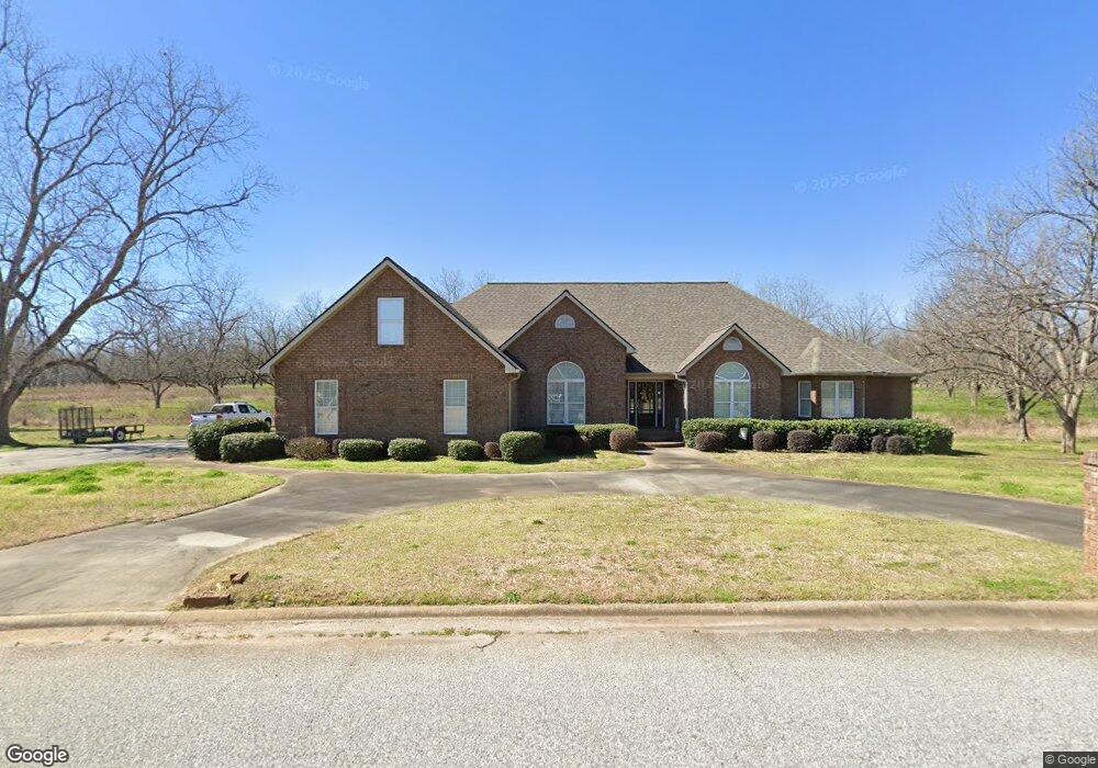
This home is located at 200 Noah Ln, Perry, GA 31069 and is currently estimated at $461,597, approximately $116 per square foot. 200 Noah Ln is a home located in Houston County with nearby schools including Kings Chapel Elementary School, Perry Middle School, and Perry High School.
Ownership History
Date
Name
Owned For
Owner Type
Purchase Details
Closed on
May 4, 2006
Sold by
Daviss Fred
Bought by
Daviss Fred P and Daviss Cynthia F
Current Estimated Value
Home Financials for this Owner
Home Financials are based on the most recent Mortgage that was taken out on this home.
Original Mortgage
$300,000
Outstanding Balance
$173,051
Interest Rate
6.33%
Mortgage Type
New Conventional
Estimated Equity
$288,546
Purchase Details
Closed on
Oct 5, 2004
Sold by
Orchard Developments Llp
Bought by
Daviss Fred
Create a Home Valuation Report for This Property
The Home Valuation Report is an in-depth analysis detailing your home's value as well as a comparison with similar homes in the area
Home Values in the Area
Average Home Value in this Area
Purchase History
| Date | Buyer | Sale Price | Title Company |
|---|---|---|---|
| Daviss Fred P | -- | None Available | |
| Daviss Fred | $15,000 | -- |
Source: Public Records
Mortgage History
| Date | Status | Borrower | Loan Amount |
|---|---|---|---|
| Open | Daviss Fred P | $300,000 |
Source: Public Records
Tax History
| Year | Tax Paid | Tax Assessment Tax Assessment Total Assessment is a certain percentage of the fair market value that is determined by local assessors to be the total taxable value of land and additions on the property. | Land | Improvement |
|---|---|---|---|---|
| 2024 | $3,979 | $168,320 | $13,680 | $154,640 |
| 2023 | $3,329 | $139,720 | $13,680 | $126,040 |
| 2022 | $3,043 | $127,920 | $13,680 | $114,240 |
| 2021 | $2,701 | $113,160 | $13,680 | $99,480 |
| 2020 | $2,657 | $110,840 | $12,520 | $98,320 |
| 2019 | $2,657 | $110,840 | $12,520 | $98,320 |
| 2018 | $2,657 | $110,840 | $12,520 | $98,320 |
| 2017 | $2,659 | $110,840 | $12,520 | $98,320 |
| 2016 | $2,663 | $110,840 | $12,520 | $98,320 |
| 2015 | $2,663 | $110,840 | $12,520 | $98,320 |
| 2014 | -- | $110,840 | $12,520 | $98,320 |
| 2013 | -- | $110,840 | $12,520 | $98,320 |
Source: Public Records
Map
Nearby Homes
- 2132 Kings Chapel Rd
- 116 Kanza Trail
- 110 Oconee Trail
- 123 Oconee Trail
- 115 Worchester Cir
- 133 Worchester Cir
- 400 Avington Chase
- 403 Avington Chase
- 420 Avington Chase
- 308 Haven Way
- 106 Ellington Ct
- 208 New Hope Dr
- 522 New Hope Dr
- 510 New Hope Dr
- 503 New Hope Dr
- 520 New Hope Dr
- 502 New Hope Dr
- 507 New Hope Dr
- 518 New Hope Dr
- 509 New Hope Dr
Your Personal Tour Guide
Ask me questions while you tour the home.