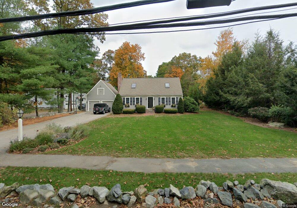
200 Old Lancaster Rd Sudbury, MA 01776
Estimated Value: $1,047,000 - $1,518,000
4
Beds
4
Baths
3,185
Sq Ft
$399/Sq Ft
Est. Value
About This Home
This home is located at 200 Old Lancaster Rd, Sudbury, MA 01776 and is currently estimated at $1,271,327, approximately $399 per square foot. 200 Old Lancaster Rd is a home located in Middlesex County with nearby schools including Peter Noyes Elementary School, Ephraim Curtis Middle School, and Lincoln-Sudbury Regional High School.
Ownership History
Date
Name
Owned For
Owner Type
Purchase Details
Closed on
Jul 25, 2002
Sold by
Neale Adam T and Neale Doreen F
Bought by
Deignan Robert E and Deignan Christina M
Current Estimated Value
Home Financials for this Owner
Home Financials are based on the most recent Mortgage that was taken out on this home.
Original Mortgage
$376,000
Outstanding Balance
$159,620
Interest Rate
6.73%
Mortgage Type
Purchase Money Mortgage
Estimated Equity
$1,111,707
Purchase Details
Closed on
Mar 27, 1998
Sold by
Cohen Mylan C and Cohen Myaya M
Bought by
Neale Adam T and Neale Doreen F
Purchase Details
Closed on
Jan 3, 1994
Sold by
Hayes Thomas F
Bought by
Cohen Mylan C and Cohen Maya M
Purchase Details
Closed on
Dec 17, 1992
Sold by
Dobbrow Christopher
Bought by
Hayes Thomas F
Create a Home Valuation Report for This Property
The Home Valuation Report is an in-depth analysis detailing your home's value as well as a comparison with similar homes in the area
Home Values in the Area
Average Home Value in this Area
Purchase History
| Date | Buyer | Sale Price | Title Company |
|---|---|---|---|
| Deignan Robert E | $470,000 | -- | |
| Neale Adam T | $316,000 | -- | |
| Cohen Mylan C | $280,000 | -- | |
| Hayes Thomas F | $263,000 | -- |
Source: Public Records
Mortgage History
| Date | Status | Borrower | Loan Amount |
|---|---|---|---|
| Open | Deignan Robert E | $376,000 | |
| Closed | Hayes Thomas F | $70,500 |
Source: Public Records
Tax History Compared to Growth
Tax History
| Year | Tax Paid | Tax Assessment Tax Assessment Total Assessment is a certain percentage of the fair market value that is determined by local assessors to be the total taxable value of land and additions on the property. | Land | Improvement |
|---|---|---|---|---|
| 2025 | $14,214 | $970,900 | $404,600 | $566,300 |
| 2024 | $13,714 | $938,700 | $392,800 | $545,900 |
| 2023 | $14,125 | $895,700 | $363,600 | $532,100 |
| 2022 | $13,373 | $740,900 | $333,800 | $407,100 |
| 2021 | $12,656 | $672,100 | $333,800 | $338,300 |
| 2020 | $12,400 | $672,100 | $333,800 | $338,300 |
| 2019 | $12,037 | $672,100 | $333,800 | $338,300 |
| 2018 | $12,054 | $672,300 | $355,900 | $316,400 |
| 2017 | $11,286 | $636,200 | $338,500 | $297,700 |
| 2016 | $10,093 | $567,000 | $325,600 | $241,400 |
| 2015 | $9,713 | $551,900 | $313,100 | $238,800 |
| 2014 | $9,691 | $537,500 | $303,900 | $233,600 |
Source: Public Records
Map
Nearby Homes
- 270 Old Lancaster Rd
- 36 Concord Rd
- 23 Massasoit Ave
- 89 Bridle Path
- 94 Goodmans Hill Rd
- 1011 Boston Post Rd
- 427 Concord Rd
- 24 Goodnow Rd
- 24 Woodland Rd
- 7 Saddle Ridge Rd
- 30 Rolling Ln
- 36 Old Forge Ln
- 0 Robbins Rd
- 12 Hickory Rd
- 6 Old County Rd Unit 16
- 216 Landham Rd
- 7 Adams Rd
- 54 Stone Rd
- 128 Nobscot Rd
- 63 Canterbury Dr
- 204 Old Lancaster Rd
- 179 Concord Rd
- 193 Concord Rd
- 205 Old Lancaster Rd
- 212 Old Lancaster Rd
- 201 Union Ave
- 213 Old Lancaster Rd
- 200 Concord Rd
- 199 Concord Rd
- 32 Pennymeadow Rd
- 216 Old Lancaster Rd
- 8 Pheasant Ave
- 18 Pheasant Ave
- 219 Old Lancaster Rd
- 24 Pheasant Ave
- 15 Pennymeadow Rd
- 4 Pheasant Ave
- 208 Concord Rd
- 7 Pennymeadow Rd
- 165 Concord Rd