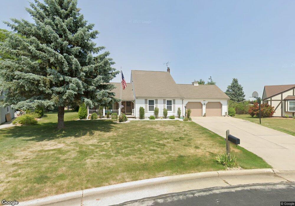
200 Pheasant Run Union Grove, WI 53182
Estimated Value: $440,000 - $471,833
4
Beds
3
Baths
1,828
Sq Ft
$250/Sq Ft
Est. Value
About This Home
This home is located at 200 Pheasant Run, Union Grove, WI 53182 and is currently estimated at $457,708, approximately $250 per square foot. 200 Pheasant Run is a home located in Racine County with nearby schools including Union Grove Elementary School, Union Grove High School, and Union Grove Christian School.
Ownership History
Date
Name
Owned For
Owner Type
Purchase Details
Closed on
Feb 18, 2025
Sold by
Lasken James A and Lasken Mary T
Bought by
Mcbryde Jason M and Mcbryde Clare C
Current Estimated Value
Home Financials for this Owner
Home Financials are based on the most recent Mortgage that was taken out on this home.
Original Mortgage
$400,000
Outstanding Balance
$397,623
Interest Rate
6.91%
Mortgage Type
New Conventional
Estimated Equity
$60,085
Create a Home Valuation Report for This Property
The Home Valuation Report is an in-depth analysis detailing your home's value as well as a comparison with similar homes in the area
Home Values in the Area
Average Home Value in this Area
Purchase History
| Date | Buyer | Sale Price | Title Company |
|---|---|---|---|
| Mcbryde Jason M | $450,000 | Landmark Title |
Source: Public Records
Mortgage History
| Date | Status | Borrower | Loan Amount |
|---|---|---|---|
| Open | Mcbryde Jason M | $400,000 |
Source: Public Records
Tax History Compared to Growth
Tax History
| Year | Tax Paid | Tax Assessment Tax Assessment Total Assessment is a certain percentage of the fair market value that is determined by local assessors to be the total taxable value of land and additions on the property. | Land | Improvement |
|---|---|---|---|---|
| 2024 | $4,724 | $292,900 | $51,600 | $241,300 |
| 2023 | $4,699 | $292,900 | $51,600 | $241,300 |
| 2022 | $4,931 | $292,900 | $51,600 | $241,300 |
| 2021 | $4,622 | $292,900 | $51,600 | $241,300 |
| 2020 | $4,716 | $237,800 | $44,600 | $193,200 |
| 2019 | $4,837 | $237,800 | $44,600 | $193,200 |
| 2018 | $4,615 | $236,600 | $44,600 | $192,000 |
| 2017 | $4,002 | $194,600 | $44,800 | $149,800 |
| 2016 | $4,001 | $194,600 | $44,800 | $149,800 |
| 2015 | $4,262 | $194,600 | $44,800 | $149,800 |
| 2014 | $4,192 | $194,600 | $44,800 | $149,800 |
| 2013 | $4,374 | $194,600 | $44,800 | $149,800 |
Source: Public Records
Map
Nearby Homes
- 1311 Highview Ave
- 1459 Groves Ln Unit 40
- 91 York St
- 334 Kiddle Ln
- 1020 Main St
- 1030 Main St
- 728 Vine St
- Lt0 Durand Ave
- 1072 5th Ave
- 1730 New St
- 1221 W Kiddle Ln
- 544 Kiddle Ln
- 528 Kiddle Ln
- 1350 15th Ave
- The Carrington Plan at Canopy Hill - The Estates of Canopy Hill
- The Delilah Plan at Canopy Hill - The Estates of Canopy Hill
- The Kendal Plan at Canopy Hill - The Estates of Canopy Hill
- The Wellington Plan at Canopy Hill - The Estates of Canopy Hill
- The Ava Plan at Canopy Hill - The Estates of Canopy Hill
- The Springwood Plan at Canopy Hill - The Estates of Canopy Hill
- 230 Pheasant Run
- 1021 Pheasant Run
- 260 Pheasant Run
- 201 Mill Ave
- 1070 Pheasant Run
- 1031 Pheasant Run
- 198 White Oak Ct
- 231 Mill Ave
- 191 Mill Ave
- 261 Mill Ave
- 231 Pheasant Run
- 187 Mill Ave
- 1075 Pheasant Run
- 195 White Oak Ct
- 184 White Oak Ct
- 291 Mill Ave
- 261 Pheasant Run
- 183 Mill Ave
- 1100 Pheasant Run
- 1133 Pheasant Run