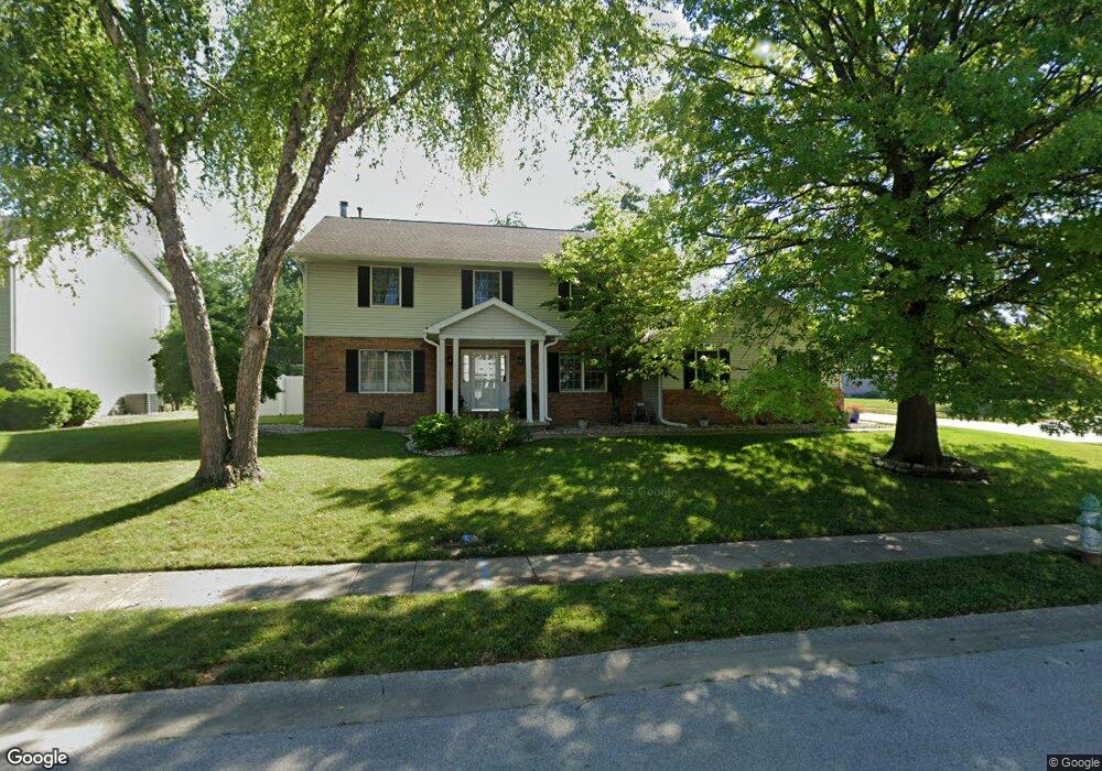
200 Prestwick Rd Springfield, IL 62702
Estimated Value: $328,000 - $400,000
4
Beds
3
Baths
3,400
Sq Ft
$104/Sq Ft
Est. Value
About This Home
This home is located at 200 Prestwick Rd, Springfield, IL 62702 and is currently estimated at $354,568, approximately $104 per square foot. 200 Prestwick Rd is a home located in Sangamon County with nearby schools including Dubois Elementary School, U.S. Grant Middle School, and Springfield High School.
Ownership History
Date
Name
Owned For
Owner Type
Purchase Details
Closed on
Aug 24, 2020
Sold by
Selinger Thomas M
Bought by
Selinger Thomas M and Selinger Kari M
Current Estimated Value
Home Financials for this Owner
Home Financials are based on the most recent Mortgage that was taken out on this home.
Original Mortgage
$227,000
Outstanding Balance
$200,610
Interest Rate
2.8%
Mortgage Type
New Conventional
Estimated Equity
$153,958
Purchase Details
Closed on
May 22, 2003
Create a Home Valuation Report for This Property
The Home Valuation Report is an in-depth analysis detailing your home's value as well as a comparison with similar homes in the area
Purchase History
| Date | Buyer | Sale Price | Title Company |
|---|---|---|---|
| Selinger Thomas M | -- | Mays Walden & Anastas Pc | |
| -- | -- | -- |
Source: Public Records
Mortgage History
| Date | Status | Borrower | Loan Amount |
|---|---|---|---|
| Open | Selinger Thomas M | $227,000 | |
| Closed | Selinger Thomas M | $38,500 |
Source: Public Records
Tax History
| Year | Tax Paid | Tax Assessment Tax Assessment Total Assessment is a certain percentage of the fair market value that is determined by local assessors to be the total taxable value of land and additions on the property. | Land | Improvement |
|---|---|---|---|---|
| 2024 | $7,239 | $92,180 | $12,206 | $79,974 |
| 2023 | $6,914 | $84,198 | $11,149 | $73,049 |
| 2022 | $6,571 | $79,328 | $10,578 | $68,750 |
| 2021 | $6,333 | $76,358 | $10,182 | $66,176 |
| 2020 | $6,208 | $76,472 | $10,197 | $66,275 |
| 2019 | $6,091 | $76,205 | $10,161 | $66,044 |
| 2018 | $5,870 | $75,470 | $10,112 | $65,358 |
| 2017 | $5,742 | $74,494 | $9,981 | $64,513 |
| 2016 | $5,621 | $73,407 | $9,835 | $63,572 |
| 2015 | $5,561 | $72,529 | $9,717 | $62,812 |
| 2014 | $5,538 | $72,060 | $9,654 | $62,406 |
| 2013 | $5,414 | $72,827 | $9,654 | $63,173 |
Source: Public Records
Map
Nearby Homes
- 6 Redwood Ln
- 36 Trailridge Ln Unit 152
- 3229 W Point Dr
- 160 S Durkin Dr Unit 4
- 3400 Briana Dr
- 243 S Durkin Dr Unit 24
- 804 Fairfax Ct
- 504 Brandywine Rd
- 2900 W Lawrence Ave
- 1038 N Koke Mill Rd
- 3424 Bluff Rd
- 3613 Briana Dr
- 3612 Melissa Dr
- 2651 W Lawrence Ave Unit 2
- 812 Roanoke Dr
- 107 Collier Dr
- 900 S Durkin Dr Unit 7
- 608 Rock River Rd
- 609 Rock River Rd
- 612 Rock River Rd
- 204 Prestwick Rd
- 213 Westbrook Dr
- 217 Westbrook Dr
- 201 Prestwick Rd
- 3004 Kensington Dr
- 221 Westbrook Dr
- 208 Prestwick Rd
- 205 Prestwick Rd
- 3100 Kensington Dr
- 209 Westbrook Dr
- 209 Prestwick Rd
- 225 Westbrook Dr
- 3104 Kensington Dr
- 212 Prestwick Rd
- 205 Westbrook Dr
- 213 Prestwick Rd
- 3105 Kensington Dr
- 229 Westbrook Dr
- 3009 Barrybrook Ct
- 220 Westbrook Dr
Your Personal Tour Guide
Ask me questions while you tour the home.