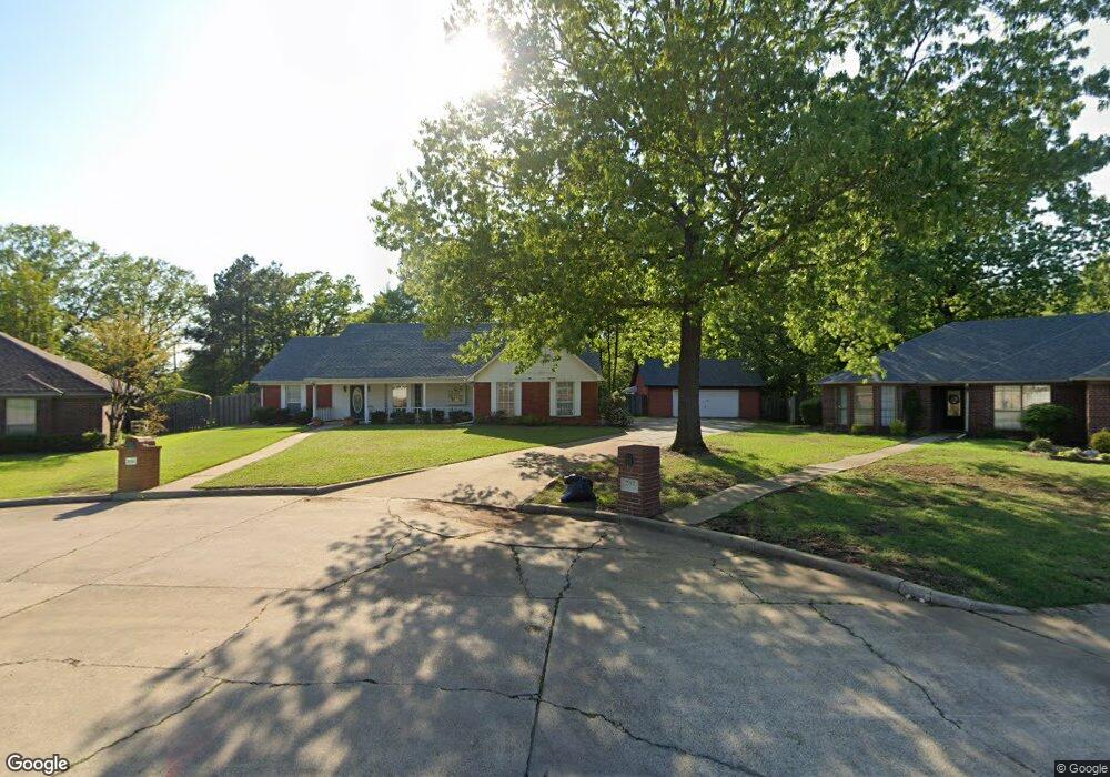
200 Rock Ridge Cir Texarkana, AR 71854
Estimated Value: $275,715 - $330,000
3
Beds
2
Baths
2,232
Sq Ft
$139/Sq Ft
Est. Value
About This Home
This home is located at 200 Rock Ridge Cir, Texarkana, AR 71854 and is currently estimated at $310,929, approximately $139 per square foot. 200 Rock Ridge Cir is a home located in Miller County with nearby schools including Arkansas High School, St. James Day School, and Trinity Christian School.
Ownership History
Date
Name
Owned For
Owner Type
Purchase Details
Closed on
Apr 4, 2003
Bought by
Knaupe Gary L and Knaupe Deborah A
Current Estimated Value
Purchase Details
Closed on
Aug 7, 2002
Bought by
Knaupe Deborah Annette
Purchase Details
Closed on
Jun 26, 2002
Bought by
Flowers Ronald and Flowers Knaupe, D
Purchase Details
Closed on
Feb 18, 2002
Bought by
Flowers Living Trust and Willaim R
Purchase Details
Closed on
Sep 25, 1996
Bought by
Flowers William R
Purchase Details
Closed on
Sep 1, 1995
Create a Home Valuation Report for This Property
The Home Valuation Report is an in-depth analysis detailing your home's value as well as a comparison with similar homes in the area
Home Values in the Area
Average Home Value in this Area
Purchase History
| Date | Buyer | Sale Price | Title Company |
|---|---|---|---|
| Knaupe Gary L | -- | -- | |
| Knaupe Deborah Annette | -- | -- | |
| Flowers Ronald | -- | -- | |
| Flowers Living Trust | -- | -- | |
| Flowers William R | $17,000 | -- | |
| -- | -- | -- |
Source: Public Records
Tax History Compared to Growth
Tax History
| Year | Tax Paid | Tax Assessment Tax Assessment Total Assessment is a certain percentage of the fair market value that is determined by local assessors to be the total taxable value of land and additions on the property. | Land | Improvement |
|---|---|---|---|---|
| 2024 | $1,124 | $38,560 | $4,300 | $34,260 |
| 2023 | $1,128 | $38,560 | $4,300 | $34,260 |
| 2022 | $1,178 | $38,560 | $4,300 | $34,260 |
| 2021 | $1,178 | $38,560 | $4,300 | $34,260 |
| 2020 | $1,178 | $38,560 | $4,300 | $34,260 |
| 2019 | $1,153 | $33,380 | $4,300 | $29,080 |
| 2018 | $1,203 | $33,380 | $4,300 | $29,080 |
| 2017 | $1,203 | $33,380 | $4,300 | $29,080 |
| 2016 | $1,203 | $28,292 | $3,960 | $24,332 |
| 2015 | $1,203 | $28,292 | $3,960 | $24,332 |
| 2014 | $1,203 | $28,292 | $3,960 | $24,332 |
Source: Public Records
Map
Nearby Homes
- 204 Boulder Ridge Cir
- 5409-5411 N State Line Ave
- 6428 Edgehill Cir
- 10 Sweetbrush Ave
- 301 Forest Lake Dr
- 0 Lakeridge Dr
- 6707 Lakeridge Dr
- 6712 N Hills Dr
- Lot 7 Blk 5 Treasure Hill
- 6506 Lakeview Dr
- Lot 15 Lakeview Dr
- 6727 N Hills Dr
- 6616 Lakeridge Dr
- 803 Lakeridge Place
- 6632 Lakeridge Dr
- 5411 N State Line Ave
- 4.94 Acres Mount Olive Dr
- 5906 Winchester Dr
- 6133 Timberwood Ln
- 6005 Timberwood Ln
- 205 Rock Ridge Cir
- 204 Rock Ridge Cir
- 207 Rock Ridge Cir
- 208 Rock Ridge Cir
- 305 Rock Ridge Cir
- 305 Rock Ridge Cir Unit 305 Rock Ridge Cir
- 208 Boulder Ridge Cir
- 200 Boulder Ridge Cir
- 306 Boulder Ridge Cir
- 308 Rock Ridge Cir
- 309 Rock Ridge Cir
- 209 Boulder Ridge Cir
- 6900 N State Line Ave
- 0 Rock Ridge Cir
- 313 Rock Ridge Cir
- 205 Boulder Ridge Cir
- 312 Rock Ridge Cir
- 308 Boulder Ridge Cir
- 312 Boulder Ridge Cir
- 305 Boulder Ridge Cir