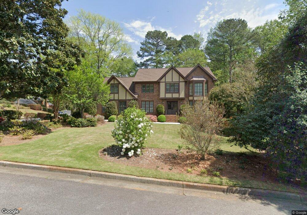
200 Rutland Ct Atlanta, GA 30350
Dunwoody Panhandle NeighborhoodEstimated Value: $865,000 - $915,000
4
Beds
5
Baths
3,406
Sq Ft
$260/Sq Ft
Est. Value
About This Home
This home is located at 200 Rutland Ct, Atlanta, GA 30350 and is currently estimated at $884,291, approximately $259 per square foot. 200 Rutland Ct is a home located in Fulton County with nearby schools including Dunwoody Springs Elementary School, Sandy Springs Middle School, and North Springs High School.
Ownership History
Date
Name
Owned For
Owner Type
Purchase Details
Closed on
Jul 13, 2024
Sold by
Tienken John H
Bought by
Tienken Family Living Trust and Tienken John Henry Jr Tr
Current Estimated Value
Purchase Details
Closed on
Nov 1, 2016
Sold by
Tienken Peggy J
Bought by
Tienken John H
Purchase Details
Closed on
Jun 14, 1999
Sold by
Tienken John H
Bought by
Tienken Peggy J
Create a Home Valuation Report for This Property
The Home Valuation Report is an in-depth analysis detailing your home's value as well as a comparison with similar homes in the area
Home Values in the Area
Average Home Value in this Area
Purchase History
| Date | Buyer | Sale Price | Title Company |
|---|---|---|---|
| Tienken Family Living Trust | -- | -- | |
| Tienken John H | -- | -- | |
| Tienken Peggy J | -- | -- |
Source: Public Records
Tax History Compared to Growth
Tax History
| Year | Tax Paid | Tax Assessment Tax Assessment Total Assessment is a certain percentage of the fair market value that is determined by local assessors to be the total taxable value of land and additions on the property. | Land | Improvement |
|---|---|---|---|---|
| 2025 | $3,574 | $234,400 | $56,960 | $177,440 |
| 2023 | $7,177 | $254,280 | $53,280 | $201,000 |
| 2022 | $3,553 | $255,720 | $75,280 | $180,440 |
| 2021 | $3,515 | $248,320 | $73,120 | $175,200 |
| 2020 | $3,512 | $237,880 | $48,680 | $189,200 |
| 2019 | $3,446 | $233,720 | $47,840 | $185,880 |
| 2018 | $3,439 | $203,240 | $34,040 | $169,200 |
| 2017 | $3,438 | $195,400 | $32,720 | $162,680 |
| 2016 | $5,928 | $195,400 | $32,720 | $162,680 |
| 2015 | $5,351 | $177,920 | $32,720 | $145,200 |
| 2014 | $5,534 | $177,920 | $32,720 | $145,200 |
Source: Public Records
Map
Nearby Homes
- 7695 Brigham Dr
- 355 Aldenshire Place
- 5352 Waterford Dr
- 130 Belvedere Ct
- 230 Westminster Place
- 7465 Stoneykirk Close
- 2381 Briarleigh Way
- 5264 Brooke Ridge Dr
- 4641 Brunning Ct
- 7700 Wickley Way
- 7640 Ryefield Dr
- 7790 Stables Dr
- 5284 Brookelake Dr
- 7750 Landowne Dr Unit 2
- 7770 N Spalding Lake Dr Unit 2
- 2820 Harwick Dr
- 7611 Regency Cir
- 210 Rutland Ct
- 1795 Redbourne Dr Unit 3
- 1770 Redbourne Dr Unit 3
- 1765 Redbourne Dr
- 220 Rutland Ct
- 1805 Redborne Dr
- 1805 Redbourne Dr Unit 117
- 1805 Redbourne Dr
- 1790 Redbourne Dr
- 1760 Redbourne Dr
- 1755 Redbourne Dr
- 215 Rutland Ct
- 1815 Redbourne Dr Unit 3
- 225 Rutland Ct
- 335 Cannady Ct
- 325 Cannady Ct
- 2360 Kimbrough Ct
- 2360 Kimbrough Ct Unit 137
- 2360 Kimbrough Ct Unit 1
- 2350 Kimbrough Ct