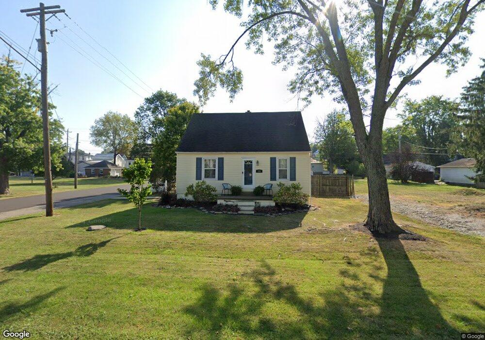
200 S Mill St Baltimore, OH 43105
Estimated Value: $190,000 - $215,517
3
Beds
1
Bath
728
Sq Ft
$286/Sq Ft
Est. Value
About This Home
This home is located at 200 S Mill St, Baltimore, OH 43105 and is currently estimated at $208,379, approximately $286 per square foot. 200 S Mill St is a home located in Fairfield County with nearby schools including Liberty Union Elementary School, Liberty Union Middle School, and Liberty Union High School.
Ownership History
Date
Name
Owned For
Owner Type
Purchase Details
Closed on
Aug 1, 1997
Sold by
Dean Douglas L
Bought by
Vannatta Gregory A and Vannatta Lisa K
Current Estimated Value
Home Financials for this Owner
Home Financials are based on the most recent Mortgage that was taken out on this home.
Original Mortgage
$78,119
Outstanding Balance
$9,448
Interest Rate
7.71%
Mortgage Type
FHA
Estimated Equity
$198,931
Purchase Details
Closed on
Jan 14, 1993
Sold by
Rowland Jack L
Bought by
Dean Douglas L
Create a Home Valuation Report for This Property
The Home Valuation Report is an in-depth analysis detailing your home's value as well as a comparison with similar homes in the area
Home Values in the Area
Average Home Value in this Area
Purchase History
| Date | Buyer | Sale Price | Title Company |
|---|---|---|---|
| Vannatta Gregory A | $79,900 | -- | |
| Dean Douglas L | $63,500 | -- |
Source: Public Records
Mortgage History
| Date | Status | Borrower | Loan Amount |
|---|---|---|---|
| Open | Vannatta Gregory A | $78,119 |
Source: Public Records
Tax History
| Year | Tax Paid | Tax Assessment Tax Assessment Total Assessment is a certain percentage of the fair market value that is determined by local assessors to be the total taxable value of land and additions on the property. | Land | Improvement |
|---|---|---|---|---|
| 2025 | $3,677 | $63,190 | $17,710 | $45,480 |
| 2024 | $3,677 | $48,980 | $12,860 | $36,120 |
| 2023 | $1,857 | $48,410 | $12,860 | $35,550 |
| 2022 | $1,842 | $48,410 | $12,860 | $35,550 |
| 2021 | $1,563 | $37,250 | $11,640 | $25,610 |
| 2020 | $1,599 | $37,250 | $11,640 | $25,610 |
| 2019 | $1,625 | $37,250 | $11,640 | $25,610 |
| 2018 | $1,390 | $29,350 | $11,640 | $17,710 |
| 2017 | $1,397 | $29,220 | $11,640 | $17,580 |
| 2016 | $1,378 | $29,220 | $11,640 | $17,580 |
| 2015 | $1,283 | $28,500 | $11,640 | $16,860 |
| 2014 | $1,231 | $28,500 | $11,640 | $16,860 |
| 2013 | $1,231 | $28,500 | $11,640 | $16,860 |
Source: Public Records
Map
Nearby Homes
- 407 S Main St
- 216 E Mulberry St
- 601 S Main St
- 201 E Dorchester Dr
- 727 W Washington St
- 118 N Oak St
- 220 N Wagner Ave
- 7836 Basil Rd NW
- 0 Basil Rd NW Unit 226003110
- 201 N Liberty St
- 243 N Liberty St
- 0 S Company St Unit Lot 2 225029545
- 0 S Company St Unit Lot 1 225029543
- 445 Baltimore Somerset Rd NE
- 570 Baltimore Somerset Rd NE Unit Lot 1
- 1455 Giesy Rd NW
- 0 Lancaster-Newark Rd NE Unit Lot A
- 0 Lancaster-Newark Rd NE
- 1813 Bickel Church Rd NW
- 9915 Lancaster-Newark Rd NE
- 206 S Mill St
- 120 S Mill St
- 203 S Walnut St
- 207 S Walnut St
- 210 W Johnson St
- 210 S Mill St
- 201 S Mill St
- 119 S Walnut St
- 203 S Mill St
- 213 S Walnut St
- 119 S Mill St
- 211 S Mill St
- 113 S Walnut St
- 299 S Walnut St
- 115 S Mill St
- 221 W Market St
- 217 W Market St
- 215 W Market St
- 207 W Market St
- 301 W Market St
Your Personal Tour Guide
Ask me questions while you tour the home.