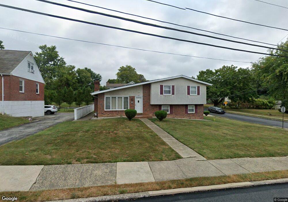
200 S Sproul Rd Broomall, PA 19008
Estimated Value: $541,000 - $583,000
3
Beds
2
Baths
2,009
Sq Ft
$282/Sq Ft
Est. Value
About This Home
This home is located at 200 S Sproul Rd, Broomall, PA 19008 and is currently estimated at $566,058, approximately $281 per square foot. 200 S Sproul Rd is a home located in Delaware County with nearby schools including Russell Elementary School, Paxon Hollow Middle School, and Marple Newtown Senior High School.
Ownership History
Date
Name
Owned For
Owner Type
Purchase Details
Closed on
Mar 16, 2005
Sold by
Ceritano Anne R
Bought by
Singh Balbir and Saini Kulwinder
Current Estimated Value
Home Financials for this Owner
Home Financials are based on the most recent Mortgage that was taken out on this home.
Original Mortgage
$198,000
Outstanding Balance
$98,781
Interest Rate
5.37%
Mortgage Type
Fannie Mae Freddie Mac
Estimated Equity
$467,277
Create a Home Valuation Report for This Property
The Home Valuation Report is an in-depth analysis detailing your home's value as well as a comparison with similar homes in the area
Home Values in the Area
Average Home Value in this Area
Purchase History
| Date | Buyer | Sale Price | Title Company |
|---|---|---|---|
| Singh Balbir | $298,000 | -- |
Source: Public Records
Mortgage History
| Date | Status | Borrower | Loan Amount |
|---|---|---|---|
| Open | Singh Balbir | $198,000 |
Source: Public Records
Tax History Compared to Growth
Tax History
| Year | Tax Paid | Tax Assessment Tax Assessment Total Assessment is a certain percentage of the fair market value that is determined by local assessors to be the total taxable value of land and additions on the property. | Land | Improvement |
|---|---|---|---|---|
| 2025 | $5,557 | $321,580 | $103,210 | $218,370 |
| 2024 | $5,557 | $321,580 | $103,210 | $218,370 |
| 2023 | $5,381 | $321,580 | $103,210 | $218,370 |
| 2022 | $5,279 | $321,580 | $103,210 | $218,370 |
| 2021 | $7,967 | $321,580 | $103,210 | $218,370 |
| 2020 | $5,263 | $182,880 | $50,940 | $131,940 |
| 2019 | $5,199 | $182,880 | $50,940 | $131,940 |
| 2018 | $5,145 | $182,880 | $0 | $0 |
| 2017 | $5,148 | $182,880 | $0 | $0 |
| 2016 | $1,004 | $182,880 | $0 | $0 |
| 2015 | $1,024 | $182,880 | $0 | $0 |
| 2014 | $1,024 | $182,880 | $0 | $0 |
Source: Public Records
Map
Nearby Homes
- 132 S Sproul Rd
- 2606 Springfield Rd
- 202 Rolling Rd
- 126 1st Ave
- 2025 S Sproul Rd
- 106 2nd Ave
- 310 Lewis Rd
- 88 4th Ave
- 50 Schoolhouse Ln
- 63 S Greenhill Rd
- 15 Oakland Rd
- 301 S New Ardmore Ave
- Lot1 Cynwyd
- Lot 2 Cynwyd
- 2604 Cynwyd Ave
- 2839 Springfield Rd
- 2119 Boxwood Dr
- 2611 Woodberry Rd
- 11 Linden Dr
- 2613 Caranel Rd
- 202 S Sproul Rd
- 2604 Radcliffe Rd
- 134 S Sproul Rd
- 210 S Sproul Rd
- 219 S Sproul Rd
- 217 S Sproul Rd
- 221 S Sproul Rd
- 213 S Sproul Rd
- 209 S Sproul Rd
- 223 S Sproul Rd
- 2606 Radcliffe Rd
- 2605 Radcliffe Rd
- 225 S Sproul Rd
- 2608 Radcliffe Rd
- 205 S Sproul Rd
- 214 S Sproul Rd
- 216 1st Ave
- 210 1st Ave
- 2607 Radcliffe Rd
- 208 1st Ave