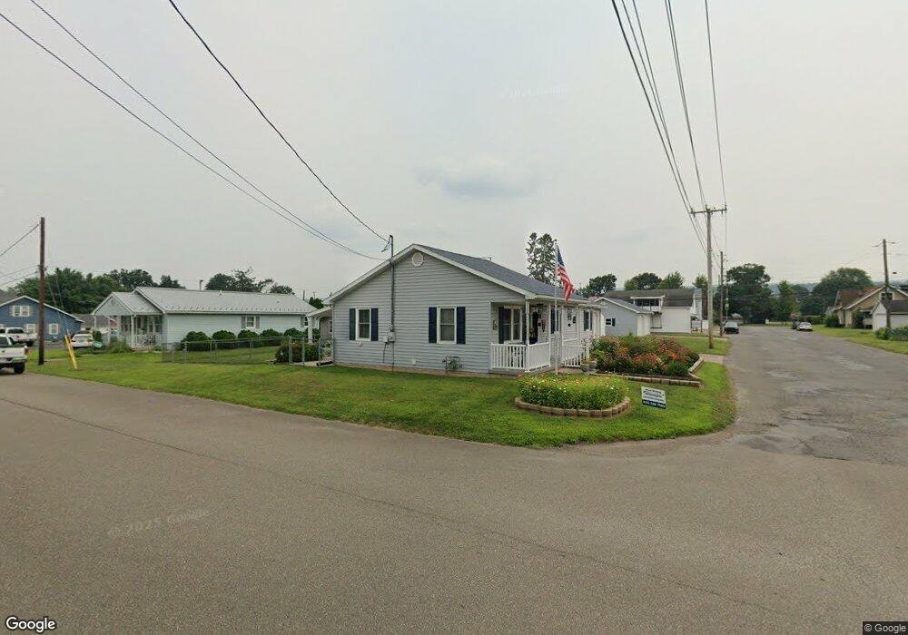
200 Scanlon St Berwick, PA 18603
Estimated Value: $165,000 - $239,000
--
Bed
--
Bath
1,170
Sq Ft
$171/Sq Ft
Est. Value
About This Home
This home is located at 200 Scanlon St, Berwick, PA 18603 and is currently estimated at $199,833, approximately $170 per square foot. 200 Scanlon St is a home located in Columbia County with nearby schools including Berwick Area High School, Holy Family Consolidated School, and New Story School.
Ownership History
Date
Name
Owned For
Owner Type
Purchase Details
Closed on
Jun 13, 2018
Sold by
Knorr Jennifer K
Bought by
Aurand Christopher P and Aurand Rebecca H
Current Estimated Value
Purchase Details
Closed on
Jul 18, 2014
Sold by
Gilbert Carl J and Gilbert Brenda K
Bought by
Knorr Jennifer K
Home Financials for this Owner
Home Financials are based on the most recent Mortgage that was taken out on this home.
Original Mortgage
$60,000
Interest Rate
4.18%
Mortgage Type
Closed End Mortgage
Purchase Details
Closed on
Jun 7, 1994
Bought by
Gilbert Carl J and Gilbert Brenda K
Create a Home Valuation Report for This Property
The Home Valuation Report is an in-depth analysis detailing your home's value as well as a comparison with similar homes in the area
Home Values in the Area
Average Home Value in this Area
Purchase History
| Date | Buyer | Sale Price | Title Company |
|---|---|---|---|
| Aurand Christopher P | -- | None Available | |
| Knorr Jennifer K | $165,000 | None Available | |
| Gilbert Carl J | $60,000 | -- |
Source: Public Records
Mortgage History
| Date | Status | Borrower | Loan Amount |
|---|---|---|---|
| Previous Owner | Knorr Jennifer K | $60,000 |
Source: Public Records
Tax History Compared to Growth
Tax History
| Year | Tax Paid | Tax Assessment Tax Assessment Total Assessment is a certain percentage of the fair market value that is determined by local assessors to be the total taxable value of land and additions on the property. | Land | Improvement |
|---|---|---|---|---|
| 2025 | $3,160 | $35,249 | $0 | $0 |
| 2024 | $3,125 | $35,249 | $6,120 | $29,129 |
| 2023 | $2,913 | $35,249 | $6,120 | $29,129 |
| 2022 | $2,817 | $35,249 | $6,120 | $29,129 |
| 2021 | $2,755 | $35,249 | $6,120 | $29,129 |
| 2020 | $2,693 | $35,249 | $6,120 | $29,129 |
| 2019 | $2,650 | $35,249 | $6,120 | $29,129 |
| 2018 | $2,546 | $35,249 | $6,120 | $29,129 |
| 2017 | $2,554 | $35,249 | $6,120 | $29,129 |
| 2016 | -- | $35,249 | $6,120 | $29,129 |
| 2015 | -- | $35,249 | $6,120 | $29,129 |
| 2014 | -- | $35,249 | $6,120 | $29,129 |
Source: Public Records
Map
Nearby Homes
- 1638 Brittain St
- 120 Briarcliff Rd
- 1651 Brittain St
- 0 Spring Garden Ave
- 1619 Brittain St
- 1510 Spring Garden Ave
- 1932 Spring Garden Ave
- 228 Maple Rd
- 1522 1st Ave
- 223 Maple Rd
- 405 N Mercer St
- 1239,1241 W Front St
- 1306 Orange St
- 601 Welliver Rd
- LOT #13 3rd Ave
- 825 N Mercer St
- 1185 Ferris Ave
- 108 110 Blair St
- 1180 1st Ave
- 1335 Freas Ave
- 1662 Spring Garden Ave
- 1700 Spring Garden Ave
- 1704 Spring Garden Ave
- 1667 W Front St
- 1665 W Front St
- 1701 Spring Garden Ave
- 1661 W Front St
- 1669 W Front St
- 1705 W Front St
- 1648 Spring Garden Ave
- 1709 W Front St
- 1716 Spring Garden Ave
- 1701W W Front St
- 1646 Spring Garden Ave
- 1651 W Front St
- 1649 Spring Garden Ave
- 1647 W Front St
- 1718 Spring Garden Ave
- 1642 Spring Garden Ave
- 1709 Spring Garden Ave