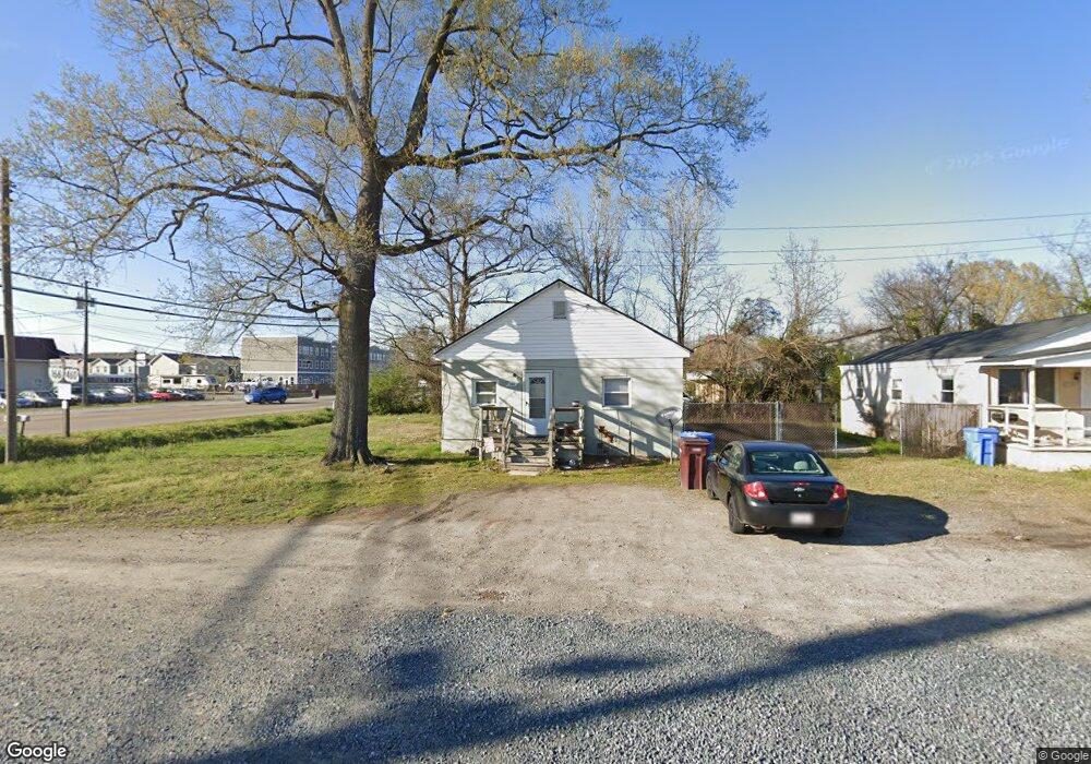
200 Scotties Ln Chesapeake, VA 23324
South Norfolk NeighborhoodEstimated Value: $573,549
--
Bed
1
Bath
858
Sq Ft
$668/Sq Ft
Est. Value
About This Home
This home is located at 200 Scotties Ln, Chesapeake, VA 23324 and is currently estimated at $573,549, approximately $668 per square foot. 200 Scotties Ln is a home located in Chesapeake City with nearby schools including Portlock Primary School, George W. Carver Intermediate School, and Oscar Smith Middle School.
Ownership History
Date
Name
Owned For
Owner Type
Purchase Details
Closed on
Jun 18, 2021
Sold by
Johnsons Rentals Llc
Bought by
United Rentals North America Inc
Current Estimated Value
Purchase Details
Closed on
Mar 2, 2021
Sold by
Johnson Jimmie Gilbert and Johnson Beth E
Bought by
Johnsons Rentals Llc
Purchase Details
Closed on
Aug 25, 2016
Sold by
The Jimmy G Johnson Revocable Trsut
Bought by
Johnson'S Rentals Llc A Virginia Limited
Create a Home Valuation Report for This Property
The Home Valuation Report is an in-depth analysis detailing your home's value as well as a comparison with similar homes in the area
Home Values in the Area
Average Home Value in this Area
Purchase History
| Date | Buyer | Sale Price | Title Company |
|---|---|---|---|
| United Rentals North America Inc | $450,000 | Attorney | |
| Johnsons Rentals Llc | -- | None Available | |
| Johnson'S Rentals Llc A Virginia Limited | -- | None Available |
Source: Public Records
Tax History Compared to Growth
Tax History
| Year | Tax Paid | Tax Assessment Tax Assessment Total Assessment is a certain percentage of the fair market value that is determined by local assessors to be the total taxable value of land and additions on the property. | Land | Improvement |
|---|---|---|---|---|
| 2025 | $1,463 | $169,100 | $169,100 | $0 |
| 2024 | $1,463 | $144,900 | $144,900 | $0 |
| 2023 | $1,612 | $144,900 | $144,900 | $0 |
| 2022 | $1,463 | $144,900 | $144,900 | $0 |
| 2021 | $2,058 | $196,000 | $144,900 | $51,100 |
| 2020 | $2,077 | $197,800 | $144,900 | $52,900 |
| 2019 | $2,074 | $197,500 | $144,900 | $52,600 |
| 2018 | $1,815 | $172,900 | $120,800 | $52,100 |
| 2017 | $1,815 | $172,900 | $120,800 | $52,100 |
| 2016 | $1,815 | $172,900 | $120,800 | $52,100 |
| 2015 | $1,714 | $163,200 | $111,100 | $52,100 |
| 2014 | $1,714 | $163,200 | $111,100 | $52,100 |
Source: Public Records
Map
Nearby Homes
- 4317 Alvah Martin Way
- 4348 Alvah Martin Way
- 4319 Salt Marsh Ln
- 602 Brickell Chase
- 1105 Maryview Ave
- 1114 Railroad Ave
- 4136 2nd St
- 0.21AC Freeman Ave
- 4138 3rd St
- 4130 3rd St
- 1616 Eugenia Ave
- 904 Mckinley Ave
- 1403 Freeman Ave
- 427 Freeman Ave
- 1212 Saul Dr
- 405 W Baylor Ct
- 436 Clemson Ave
- 4159 Williamson St
- 4130 Everett St
- 4121 Everett St
- 4323 Bainbridge Blvd
- 4321 Bainbridge Blvd
- 4320 Bainbridge Blvd
- 641 Ragged Island Unit 100 104 112 Rd
- 4333 Alvahmartin Way
- 641 Ragged Island (Units 100 104 112) Rd Unit 100
- 4329 Alvahmartin Way
- 4317 Bainbridge Blvd
- 4333 Bainbridge Blvd
- 4325 Alvahmartin Way
- 4321 Alvahmartin Way
- 4317 Alvahmartin Way Unit Way
- 4317 Alvahmartin Way
- 641 Ragged Island Rd Unit 120
- 641 Ragged Island Rd Unit 128
- 641 Ragged Island Rd Unit 124
- 641 Ragged Island Rd Unit 116
- 641 Ragged Island Rd Unit 112
- 641 Ragged Island Rd Unit 108
- 641 Ragged Island Rd Unit 104