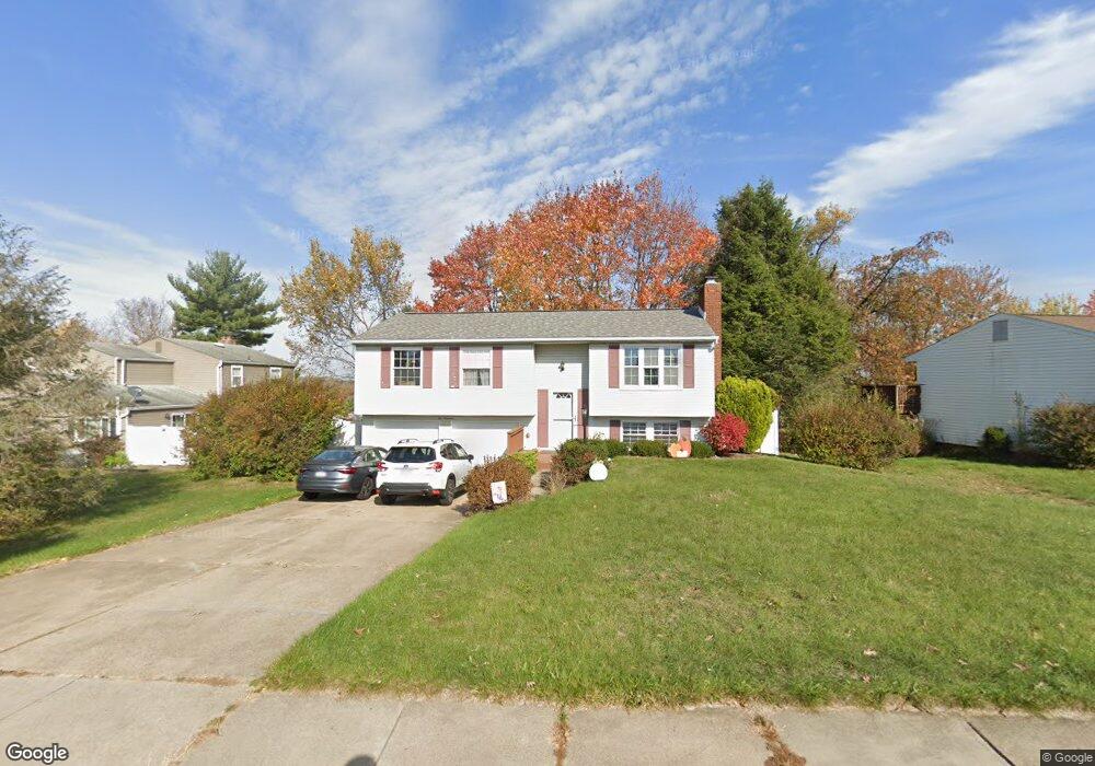
200 Scottsdale Dr Unit 4071 Coraopolis, PA 15108
Estimated Value: $257,000 - $287,559
3
Beds
2
Baths
1,502
Sq Ft
$178/Sq Ft
Est. Value
About This Home
This home is located at 200 Scottsdale Dr Unit 4071, Coraopolis, PA 15108 and is currently estimated at $267,890, approximately $178 per square foot. 200 Scottsdale Dr Unit 4071 is a home located in Allegheny County with nearby schools including Moon Area High School and Our Lady Of Fatima Elementary School.
Ownership History
Date
Name
Owned For
Owner Type
Purchase Details
Closed on
Apr 13, 2021
Sold by
Grese Cynthia L
Bought by
Castle Mallory
Current Estimated Value
Home Financials for this Owner
Home Financials are based on the most recent Mortgage that was taken out on this home.
Original Mortgage
$186,459
Outstanding Balance
$168,350
Interest Rate
3%
Mortgage Type
FHA
Estimated Equity
$99,540
Purchase Details
Closed on
Jul 12, 2001
Sold by
Miller Stephen R and Miller Carolyn J
Bought by
Grese Jeffrey E
Purchase Details
Closed on
May 10, 2001
Sold by
Grese Jeffrey E and Grese Cynthia L
Bought by
Grese Cynthia L
Create a Home Valuation Report for This Property
The Home Valuation Report is an in-depth analysis detailing your home's value as well as a comparison with similar homes in the area
Home Values in the Area
Average Home Value in this Area
Purchase History
| Date | Buyer | Sale Price | Title Company |
|---|---|---|---|
| Castle Mallory | $189,900 | -- | |
| Castle Mallory | $189,900 | Keystone Closing Services | |
| Grese Jeffrey E | $47,000 | -- | |
| Grese Cynthia L | -- | -- |
Source: Public Records
Mortgage History
| Date | Status | Borrower | Loan Amount |
|---|---|---|---|
| Open | Castle Mallory | $186,459 |
Source: Public Records
Tax History Compared to Growth
Tax History
| Year | Tax Paid | Tax Assessment Tax Assessment Total Assessment is a certain percentage of the fair market value that is determined by local assessors to be the total taxable value of land and additions on the property. | Land | Improvement |
|---|---|---|---|---|
| 2025 | $3,554 | $113,700 | $45,100 | $68,600 |
| 2024 | $3,554 | $113,700 | $45,100 | $68,600 |
| 2023 | $3,427 | $113,700 | $45,100 | $68,600 |
| 2022 | $3,970 | $113,700 | $45,100 | $68,600 |
| 2021 | $3,427 | $113,700 | $45,100 | $68,600 |
| 2020 | $3,342 | $113,700 | $45,100 | $68,600 |
| 2019 | $3,250 | $113,700 | $45,100 | $68,600 |
| 2018 | $538 | $113,700 | $45,100 | $68,600 |
| 2017 | $3,073 | $113,700 | $45,100 | $68,600 |
| 2016 | $538 | $113,700 | $45,100 | $68,600 |
| 2015 | $538 | $113,700 | $45,100 | $68,600 |
| 2014 | $2,993 | $113,700 | $45,100 | $68,600 |
Source: Public Records
Map
Nearby Homes
- 120 Scottsdale Dr
- 101 Darnley Dr
- 101 Glengarry Dr
- 174 Cimarron Dr
- 116 Mesa Dr
- 0 Spring Run Road Extension Unit 1684623
- 347 Ranchero Dr
- 141 Elmhurst Dr
- 603 Meade Dr
- 208 Lochinver Dr
- 001 Spring Run Road Extension
- 7011 Weeping Willow Dr
- 108 Sweetwater Dr
- 1490 Olde Stable Ln
- KENNEDY Plan at Rolling Hills
- Regent - Finished Basement Plan at Rolling Hills
- 1770 Brodhead Rd
- 185 Sweetwater Dr
- 177 Sweetwater Dr
- 165 Sweetwater Dr
- 216 Glengarry Dr
- 202 Scottsdale Dr
- 214 Glengarry Dr
- 204 Scottsdale Dr
- 201 Scottsdale Dr
- 203 Scottsdale Dr
- 206 Scottsdale Dr
- 199 Scottsdale Dr
- 205 Scottsdale Dr
- 211 Glengarry Dr
- 197 Scottsdale Dr
- 207 Scottsdale Dr
- 208 Scottsdale Dr
- 209 Scottsdale Dr
- 211 Scottsdale Dr
- 210 Glengarry Dr
- 195 Scottsdale Dr
- 136 Scottsdale Dr
- 123 Darnley Dr
- 125 Darnley Dr