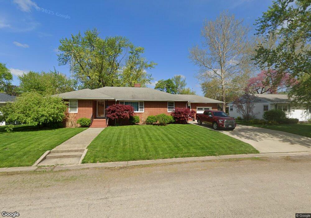
200 Southgate St Lincoln, IL 62656
Estimated Value: $174,000 - $198,000
3
Beds
--
Bath
1,668
Sq Ft
$112/Sq Ft
Est. Value
About This Home
This home is located at 200 Southgate St, Lincoln, IL 62656 and is currently estimated at $186,583, approximately $111 per square foot. 200 Southgate St is a home located in Logan County with nearby schools including Washington-Monroe Elementary School, Adams Elementary School, and Lincoln Junior High School.
Ownership History
Date
Name
Owned For
Owner Type
Purchase Details
Closed on
Dec 30, 2010
Sold by
Carter Sondra M and Carter John A
Bought by
Carter John A
Current Estimated Value
Home Financials for this Owner
Home Financials are based on the most recent Mortgage that was taken out on this home.
Original Mortgage
$104,000
Outstanding Balance
$37,442
Interest Rate
4.53%
Mortgage Type
Stand Alone First
Estimated Equity
$149,141
Create a Home Valuation Report for This Property
The Home Valuation Report is an in-depth analysis detailing your home's value as well as a comparison with similar homes in the area
Home Values in the Area
Average Home Value in this Area
Purchase History
| Date | Buyer | Sale Price | Title Company |
|---|---|---|---|
| Carter John A | -- | -- |
Source: Public Records
Mortgage History
| Date | Status | Borrower | Loan Amount |
|---|---|---|---|
| Open | Carter John A | $104,000 |
Source: Public Records
Tax History Compared to Growth
Tax History
| Year | Tax Paid | Tax Assessment Tax Assessment Total Assessment is a certain percentage of the fair market value that is determined by local assessors to be the total taxable value of land and additions on the property. | Land | Improvement |
|---|---|---|---|---|
| 2024 | $4,087 | $50,580 | $10,800 | $39,780 |
| 2023 | $3,861 | $46,830 | $10,000 | $36,830 |
| 2022 | $3,727 | $43,770 | $9,350 | $34,420 |
| 2021 | $3,567 | $42,030 | $8,980 | $33,050 |
| 2020 | $3,513 | $41,410 | $8,850 | $32,560 |
| 2019 | $3,427 | $40,600 | $8,680 | $31,920 |
| 2018 | $3,389 | $39,800 | $8,510 | $31,290 |
| 2017 | $3,369 | $39,800 | $8,510 | $31,290 |
| 2016 | $3,281 | $39,760 | $8,500 | $31,260 |
| 2015 | $2,756 | $34,410 | $8,400 | $26,010 |
| 2014 | $2,756 | $34,410 | $8,400 | $26,010 |
| 2013 | $2,756 | $32,660 | $7,970 | $24,690 |
| 2012 | $2,756 | $33,240 | $8,110 | $25,130 |
Source: Public Records
Map
Nearby Homes
- 180 Regent St
- 145 Half Moon St
- 102 Crestwood Dr
- 103 Crestwood Dr
- 1503 N Kankakee St
- 1019 N Mclean St
- 1431 N Ottawa St
- 1208 N Kankakee St
- 1204 N Ottawa St
- 1107 N Kankakee St
- 1354 Airport Rd
- 311 Davenport St
- 2294 Railsplitter Ave
- 2354 Railsplitter Ave
- 915 Peoria St
- 6 Meadow Ln
- 620 Tremont St
- 315 N Sherman St
- 1624 Delavan St
- 330 Water St
- 210 Southgate St
- 190 Southgate St
- 205 Southgate St
- 195 Southgate St
- 215 Southgate St
- 145 Regent St
- 225 Southgate St
- 165 Regent St
- 220 Southgate St
- 180 Southgate St
- 135 Regent St
- 175 Regent St
- 110 Bond St
- 170 Southgate St
- 185 Southgate St
- 160 Eaton Dr
- 230 Southgate St
- 175 Southgate St
- 115 Regent St
- 170 Eaton Dr