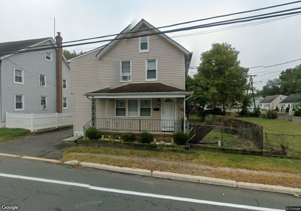
200 State Route 36 W Keansburg, NJ 07734
Estimated Value: $322,000 - $496,000
4
Beds
2
Baths
1,538
Sq Ft
$284/Sq Ft
Est. Value
About This Home
This home is located at 200 State Route 36 W, Keansburg, NJ 07734 and is currently estimated at $437,193, approximately $284 per square foot. 200 State Route 36 W is a home located in Monmouth County with nearby schools including Raritan High School, Baytul-Iman Academy, and St. Ann School.
Ownership History
Date
Name
Owned For
Owner Type
Purchase Details
Closed on
Aug 30, 2006
Sold by
Labarca Ted
Bought by
Labarca Ted and Labarca Tungchi
Current Estimated Value
Purchase Details
Closed on
Oct 19, 2001
Sold by
Mitterando Angelo
Bought by
Labarca Ted
Home Financials for this Owner
Home Financials are based on the most recent Mortgage that was taken out on this home.
Original Mortgage
$104,000
Interest Rate
6.82%
Purchase Details
Closed on
Apr 4, 1996
Sold by
Creel Carl
Bought by
Mitterando Angelo
Home Financials for this Owner
Home Financials are based on the most recent Mortgage that was taken out on this home.
Original Mortgage
$70,000
Interest Rate
7.31%
Create a Home Valuation Report for This Property
The Home Valuation Report is an in-depth analysis detailing your home's value as well as a comparison with similar homes in the area
Home Values in the Area
Average Home Value in this Area
Purchase History
| Date | Buyer | Sale Price | Title Company |
|---|---|---|---|
| Labarca Ted | -- | -- | |
| Labarca Ted | $130,000 | -- | |
| Mitterando Angelo | $66,895 | -- |
Source: Public Records
Mortgage History
| Date | Status | Borrower | Loan Amount |
|---|---|---|---|
| Previous Owner | Labarca Ted | $104,000 | |
| Previous Owner | Mitterando Angelo | $70,000 |
Source: Public Records
Tax History Compared to Growth
Tax History
| Year | Tax Paid | Tax Assessment Tax Assessment Total Assessment is a certain percentage of the fair market value that is determined by local assessors to be the total taxable value of land and additions on the property. | Land | Improvement |
|---|---|---|---|---|
| 2025 | $5,933 | $304,100 | $126,800 | $177,300 |
| 2024 | $5,913 | $282,100 | $105,600 | $176,500 |
| 2023 | $5,913 | $276,700 | $101,800 | $174,900 |
| 2022 | $5,217 | $225,100 | $79,200 | $145,900 |
| 2021 | $5,217 | $203,400 | $73,600 | $129,800 |
| 2020 | $5,125 | $198,500 | $71,700 | $126,800 |
| 2019 | $5,138 | $195,900 | $69,800 | $126,100 |
| 2018 | $4,925 | $186,200 | $66,000 | $120,200 |
| 2017 | $4,780 | $180,700 | $64,100 | $116,600 |
| 2016 | $4,659 | $176,800 | $63,200 | $113,600 |
| 2015 | $4,546 | $173,000 | $62,300 | $110,700 |
| 2014 | $4,545 | $162,200 | $56,600 | $105,600 |
Source: Public Records
Map
Nearby Homes
- 19 Woody Terrace
- 261 State Route 36
- 26 Gary Ave Unit 59
- 16 Gary Ave Unit 49
- 35 Randall Ave Unit 68
- 37 Randall Ave
- 21 13th St
- 34 Randall Ave Unit 67
- 32 Randall Ave Unit 65
- 30 Randall Ave Unit 63
- 46 Randall Ave
- 1 Robin Rd
- 17 Gary Ave
- 10 Robin
- 5 Justin Ct Unit 96
- 5 Justin Ct
- 0 Munro Ave
- 55 11th St
- 330 State Route 36
- 25 Hart St
- 194 State Route 36 W Unit 196
- 20 Liberty Place
- 15 Liberty Place
- 24 Liberty Place
- 15 Liberty Place
- 27 Franklin Ave
- 19 Liberty Place
- 19 Liberty Place
- 180 New Jersey 36
- 207 State Route 36 W
- 23 Liberty Place
- 6 Franklin Ave
- 26 Liberty Place
- 16 Franklin Ave
- 35 Franklin Ave
- 27 Liberty Place
- 82 13th St
- 92 13th St
- 175 State Route 36 W
- 31 Liberty Place