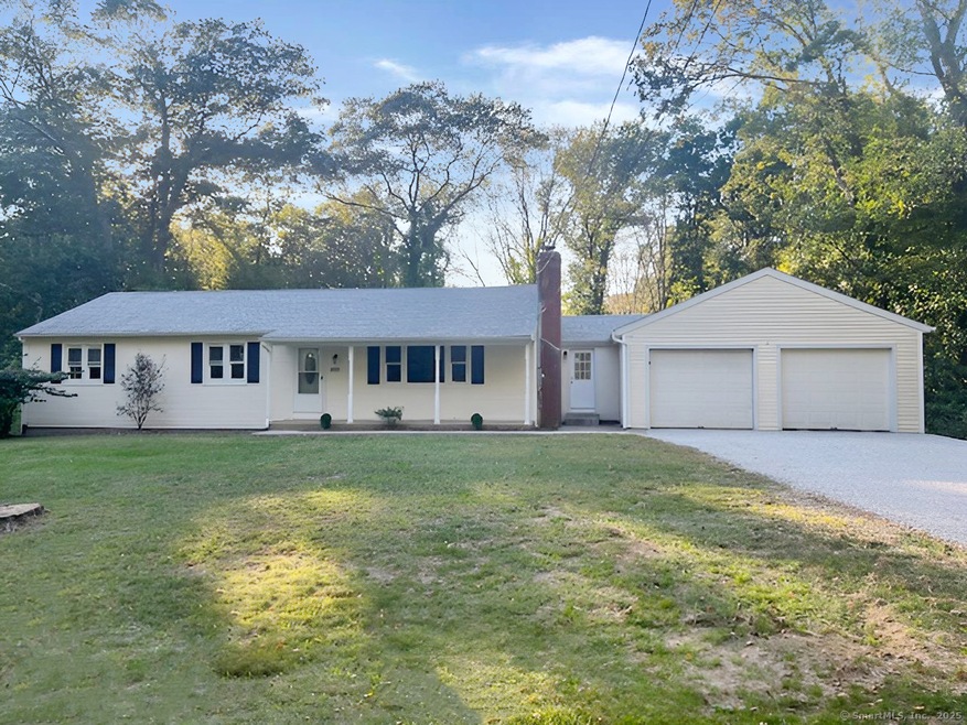
200 Westbrook Rd Deep River, CT 06417
Estimated payment $2,609/month
Highlights
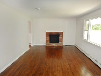
- Ranch Style House
- 1 Fireplace
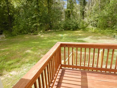
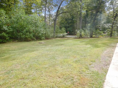
- Garden
- Valley Regional High School Rated A-
- Porch
- Hot Water Circulator
About This Home
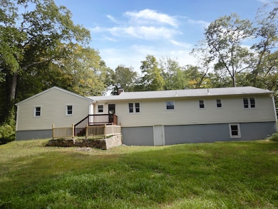
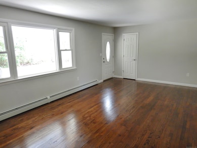
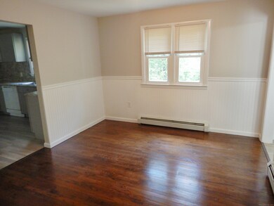
Ranch style home located on a corner lot with a generous sized backyard. The home features a living room with fireplace, dining room, 3 bedrooms and 1 1/2 baths. Freshly painted. Hardwood flooring thru out. Newer furnace. Major updates have been completed. New septic system, new well tank, well pump and well head, new stone driveway. Oversized two car garage. Easy access to Interstate 95 and Route 9. Easy to show.
Listing Agent
DB Associates of CT, LLC Brokerage Phone: (860) 227-0849 License #RES.0752058 Listed on: 09/25/2025
Home Details
Home Type
- Single Family
Est. Annual Taxes
- $5,122
Year Built
- Built in 1969
Lot Details
- 1.02 Acre Lot
- Garden
- Property is zoned R60
Home Design
- Ranch Style House
- Concrete Foundation
- Frame Construction
- Asphalt Shingled Roof
- Vinyl Siding
Interior Spaces
- 1,432 Sq Ft Home
- 1 Fireplace
- Concrete Flooring
Kitchen
- Oven or Range
- Range Hood
- Microwave
Bedrooms and Bathrooms
- 3 Bedrooms
Unfinished Basement
- Walk-Out Basement
- Basement Fills Entire Space Under The House
- Interior Basement Entry
Parking
- 2 Car Garage
- Driveway
Outdoor Features
- Rain Gutters
- Porch
Schools
- Deep River Elementary School
Utilities
- Hot Water Heating System
- Heating System Uses Oil
- Private Company Owned Well
- Hot Water Circulator
- Fuel Tank Located in Basement
- Cable TV Available
Listing and Financial Details
- Assessor Parcel Number 961131
Map
Home Values in the Area
Average Home Value in this Area
Tax History
| Year | Tax Paid | Tax Assessment Tax Assessment Total Assessment is a certain percentage of the fair market value that is determined by local assessors to be the total taxable value of land and additions on the property. | Land | Improvement |
|---|---|---|---|---|
| 2025 | $5,122 | $160,160 | $48,440 | $111,720 |
| 2024 | $5,026 | $160,160 | $48,440 | $111,720 |
| 2023 | $4,786 | $160,160 | $48,440 | $111,720 |
| 2022 | $4,641 | $160,160 | $48,440 | $111,720 |
| 2021 | $4,738 | $160,160 | $48,440 | $111,720 |
| 2020 | $4,581 | $152,740 | $48,440 | $104,300 |
| 2019 | $4,129 | $140,350 | $48,440 | $91,910 |
| 2018 | $4,094 | $139,160 | $48,440 | $90,720 |
| 2017 | $4,025 | $139,160 | $48,440 | $90,720 |
| 2016 | $3,831 | $139,160 | $48,440 | $90,720 |
| 2015 | $4,100 | $156,030 | $49,140 | $106,890 |
| 2014 | $4,038 | $156,030 | $49,140 | $106,890 |
Property History
| Date | Event | Price | List to Sale | Price per Sq Ft |
|---|---|---|---|---|
| 09/25/2025 09/25/25 | For Sale | $414,900 | -- | $290 / Sq Ft |
Purchase History
| Date | Type | Sale Price | Title Company |
|---|---|---|---|
| Foreclosure Deed | -- | -- | |
| Foreclosure Deed | -- | -- | |
| Warranty Deed | $100,000 | -- |
Mortgage History
| Date | Status | Loan Amount | Loan Type |
|---|---|---|---|
| Previous Owner | $167,500 | No Value Available | |
| Previous Owner | $117,600 | No Value Available | |
| Previous Owner | $112,000 | No Value Available | |
| Previous Owner | $20,000 | No Value Available |
Source: SmartMLS
MLS Number: 24129427
APN: DEEP-000022-000000-B000000-000007
Disclaimer: Certain information contained herein is derived from information provided by parties other than Homes.com. All information provided is deemed reliable, but is not guaranteed to be accurate and should be independently verified.
![]() IDX information is provided exclusively for personal, non-commercial use, and may not be used for any purpose other than to identify prospective properties consumers may be interested in purchasing. Information is deemed reliable but not guaranteed.
IDX information is provided exclusively for personal, non-commercial use, and may not be used for any purpose other than to identify prospective properties consumers may be interested in purchasing. Information is deemed reliable but not guaranteed.
- 0 Glen Grove Rd
- 32 Pinewood Trail
- 538 Winthrop Rd
- 538 Winthrop Rd Unit 5
- 180 Malabar Dr
- 112 Cedar Swamp Rd
- 86 Bushy Hill Rd
- 41 Bushy Hill Rd
- 19 Bushy Hill Rd
- 47 Plains Rd
- 20 Comstock Ave Unit 3D
- 20 Comstock Ave Unit 4C
- 88 Winthrop Rd
- 100 N Tower Hill Rd
- 129 Falls Landing Rd
- 31 Whittlesey Brook Rd
- 0 Kelseytown Bridge Rd
- 13 Cross Rd
- 25 Kelseytown Bridge Rd
- 130 Mares Hill Rd
- 70 Pond Meadow Rd
- 70 Pond Meadow Rd
- 25 Park Rd
- 119 Kelseytown Rd
- 42 Bokum Rd Unit 2nd Floor Apartment
- 159 W Main St Unit E
- 92 Main St Unit 222
- 15 Laurel St
- 27 Spring St
- 55 Liberty St
- 26 Sunset Terrace Unit C16
- 26 Sunset Terrace Unit B6
- 15 Liberty St
- 20 Grove St
- 101 Cow Hill Rd
- 5 Beaver Dam Trail
- 27 S Main St Unit 9
- 33 Prospect St
- 29 New City St
- 9 Essex Rd
