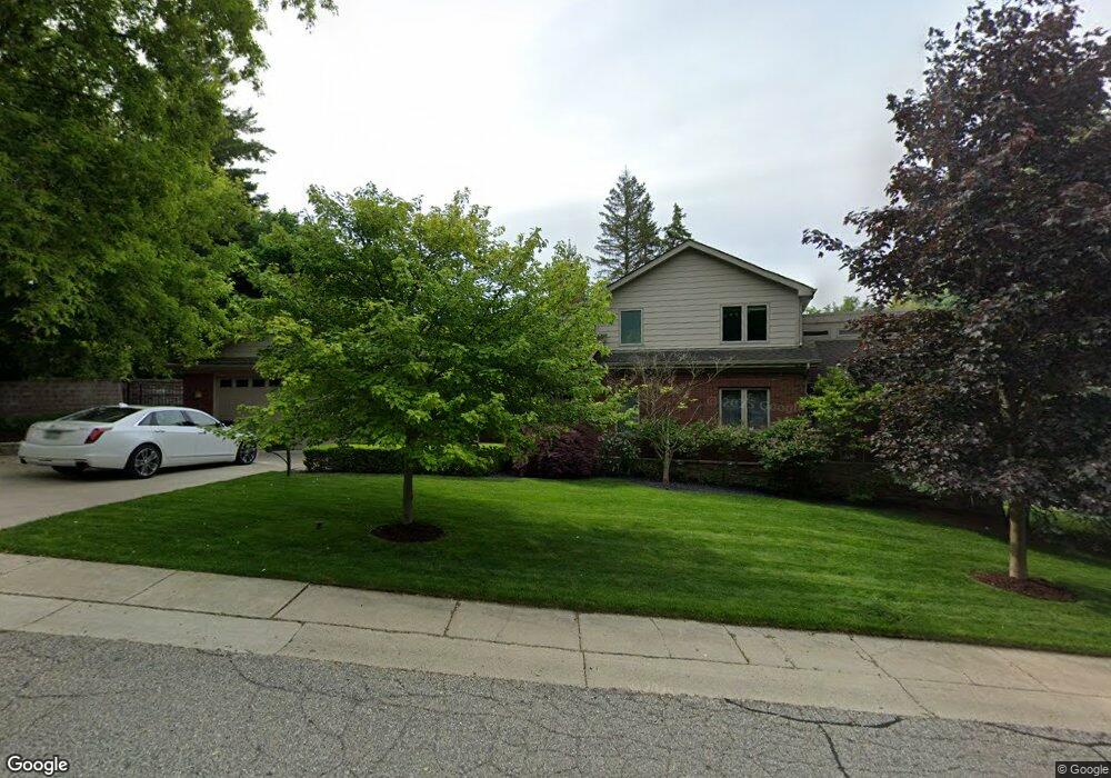
200 William Rd Rochester, MI 48307
Estimated Value: $778,000 - $1,114,000
5
Beds
5
Baths
2,554
Sq Ft
$350/Sq Ft
Est. Value
About This Home
This home is located at 200 William Rd, Rochester, MI 48307 and is currently estimated at $894,524, approximately $350 per square foot. 200 William Rd is a home located in Oakland County with nearby schools including North Hill Elementary School, Hart Middle School, and Stoney Creek High School.
Ownership History
Date
Name
Owned For
Owner Type
Purchase Details
Closed on
Nov 13, 2020
Sold by
Ruddy Sara E
Bought by
Ruddy Daniel E
Current Estimated Value
Purchase Details
Closed on
Nov 2, 2012
Sold by
Colasanti Anthony D and The Anthony D Colasanti Revoca
Bought by
Ruddy Daniel E
Purchase Details
Closed on
Jan 5, 2007
Sold by
Colasanti Anthony D
Bought by
Colasanti Anthony D and Anthony D Colasanti Revocable Living Tr
Home Financials for this Owner
Home Financials are based on the most recent Mortgage that was taken out on this home.
Original Mortgage
$390,000
Interest Rate
6.27%
Mortgage Type
New Conventional
Purchase Details
Closed on
Apr 16, 2003
Sold by
Colasanti Anthony D
Bought by
Colasanti Anthony D and Anthony D Colasanti Revocable Living Tr
Purchase Details
Closed on
Nov 15, 2002
Sold by
King Margaret E and Garen Margaret E
Bought by
Colasanti Anthony D
Create a Home Valuation Report for This Property
The Home Valuation Report is an in-depth analysis detailing your home's value as well as a comparison with similar homes in the area
Home Values in the Area
Average Home Value in this Area
Purchase History
| Date | Buyer | Sale Price | Title Company |
|---|---|---|---|
| Ruddy Daniel E | -- | None Available | |
| Ruddy Daniel E | $370,000 | Capital Title Ins Agency | |
| Colasanti Anthony D | -- | Stewart Title | |
| Colasanti Anthony D | -- | Stewart Title | |
| Colasanti Anthony D | -- | -- | |
| Colasanti Anthony D | $184,777 | -- |
Source: Public Records
Mortgage History
| Date | Status | Borrower | Loan Amount |
|---|---|---|---|
| Previous Owner | Colasanti Anthony D | $390,000 |
Source: Public Records
Tax History
| Year | Tax Paid | Tax Assessment Tax Assessment Total Assessment is a certain percentage of the fair market value that is determined by local assessors to be the total taxable value of land and additions on the property. | Land | Improvement |
|---|---|---|---|---|
| 2025 | $8,468 | $352,740 | $0 | $0 |
| 2024 | $7,536 | $336,360 | $0 | $0 |
| 2023 | $7,216 | $310,360 | $0 | $0 |
| 2022 | $7,676 | $291,650 | $0 | $0 |
| 2021 | $7,211 | $291,840 | $0 | $0 |
| 2020 | $6,771 | $271,700 | $0 | $0 |
| 2019 | $7,444 | $261,220 | $0 | $0 |
| 2018 | $7,434 | $261,350 | $0 | $0 |
| 2017 | $7,289 | $260,690 | $0 | $0 |
| 2016 | $7,057 | $252,980 | $0 | $0 |
| 2015 | -- | $228,740 | $0 | $0 |
| 2014 | -- | $213,050 | $0 | $0 |
| 2011 | -- | $191,940 | $0 | $0 |
Source: Public Records
Map
Nearby Homes
- 804 N Main St Unit 2A
- 804 N Main St Unit 2C
- 334 Romeo Rd
- 312 Terry Ave
- 417 Parkdale Ave Unit 13
- 417 Parkdale Ave Unit 20
- 761 Lounsbury Ave
- 164 Albertson St
- 428 East St
- 805 Plate St Unit 207
- 141 Ferndale Ave
- 500 Romeo Rd Unit 122
- 1223 N Main St
- 1219 N Main St
- 445 Miller Ave
- 451 Miller Ave Unit 211
- 495 Miller Ave Unit . 212
- 1156 Sycamore Dr
- 1117 N Oak St
- 1238 Pine Knoll Ln
- 209 Charles Rd
- 210 William Rd
- 205 William Rd
- 191 Charles Rd
- 204 Charles Rd
- 213 Charles Rd
- 206 Charles Rd
- 300 William Rd
- 207 William Rd
- 200 Charles Rd
- 208 Charles Rd
- 124 Charles Rd
- 316 William Rd
- 210 Charles Rd
- 215 William Rd
- 301 Charles Rd Unit Bldg-Unit
- 301 Charles Rd
- 316 Charles Rd
- 301 William Rd
- 320 William Rd
Your Personal Tour Guide
Ask me questions while you tour the home.