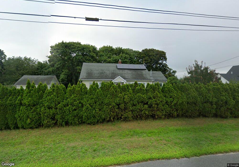
2000 Alvahs Ln Cutchogue, NY 11935
Nassau Point NeighborhoodEstimated Value: $695,000 - $1,025,000
--
Bed
--
Bath
--
Sq Ft
0.92
Acres
About This Home
This home is located at 2000 Alvahs Ln, Cutchogue, NY 11935 and is currently estimated at $893,817. 2000 Alvahs Ln is a home with nearby schools including Mattituck-Cutchogue Elementary School and Mattituck Junior/Senior High School.
Ownership History
Date
Name
Owned For
Owner Type
Purchase Details
Closed on
Jun 25, 2018
Sold by
Hargrave Ft
Bought by
Cusack Heather
Current Estimated Value
Purchase Details
Closed on
Mar 14, 2018
Sold by
Hamann Linda
Bought by
Hargrave Ft
Purchase Details
Closed on
May 24, 2017
Sold by
Simon Lorraine and Kaloski Family 2012 Irrevocabl
Bought by
Hamann Linda
Purchase Details
Closed on
Jun 5, 2012
Sold by
Kaloski Michael and Kaloski Michael
Bought by
Kaloski Family 2012 Irrevocable Trust
Purchase Details
Closed on
May 19, 2008
Sold by
Simon Howard
Bought by
Kaloski Michael
Create a Home Valuation Report for This Property
The Home Valuation Report is an in-depth analysis detailing your home's value as well as a comparison with similar homes in the area
Home Values in the Area
Average Home Value in this Area
Purchase History
| Date | Buyer | Sale Price | Title Company |
|---|---|---|---|
| Cusack Heather | $365,000 | -- | |
| Cusack Heather | $365,000 | -- | |
| Hargrave Ft | -- | -- | |
| Hargrave Ft | -- | -- | |
| Hamann Linda | -- | None Available | |
| Hamann Linda | -- | None Available | |
| Kaloski Family 2012 Irrevocable Trust | -- | -- | |
| Kaloski Family 2012 Irrevocable Trust | -- | -- | |
| Kaloski Michael | -- | Abigail A Wickham |
Source: Public Records
Tax History Compared to Growth
Tax History
| Year | Tax Paid | Tax Assessment Tax Assessment Total Assessment is a certain percentage of the fair market value that is determined by local assessors to be the total taxable value of land and additions on the property. | Land | Improvement |
|---|---|---|---|---|
| 2024 | $6,468 | $4,200 | $1,600 | $2,600 |
| 2023 | $6,468 | $4,200 | $1,600 | $2,600 |
| 2022 | $6,319 | $4,200 | $1,600 | $2,600 |
| 2021 | $6,120 | $4,200 | $1,600 | $2,600 |
| 2020 | $6,034 | $4,200 | $1,600 | $2,600 |
| 2019 | $6,034 | $0 | $0 | $0 |
| 2018 | $4,121 | $5,600 | $1,600 | $4,000 |
| 2017 | $3,149 | $5,600 | $1,600 | $4,000 |
| 2016 | $3,127 | $5,600 | $1,600 | $4,000 |
| 2015 | -- | $5,600 | $1,600 | $4,000 |
| 2014 | -- | $5,600 | $1,600 | $4,000 |
Source: Public Records
Map
Nearby Homes
- 32 Millstone Ln
- 26705 Main Rd
- 1070 Depot Ln
- 15690 County Road 48
- 630 New Suffolk Rd
- 18250 County Road 48
- 2870 Fairway Dr
- 29500 Main Rd
- 30170 Main Rd
- 0 County Road 48
- 34100 New York State Route 25
- 1030 Horseshoe Dr
- 31 Sweet Meadow Ct Unit 62
- 18955 Main Rd
- 1555 Cox Ln
- 3120 Grathwohl Rd
- 240 Wicks Rd
- 6580 Oregon Rd
- 155 Pinewood Rd
- 770 Meadow Ln
- 1735 Alvahs Ln
- 1600 Alvahs Ln
- 1700 Alvahs Ln
- 1500 Alvahs Ln
- 3290 Alvahs Ln
- 854 Bridle Ln
- 840 Bridle Ln
- 2465 Crown Land Ln
- 1350 Alvahs Ln
- 1020 Bridle Ln
- 95 Bridle Ct
- 2390 Crown Land Ln
- 2605 Crown Land Ln
- 1785 Crown Land Ln
- 2120 Crown Land Ln
- 215 Bridle Ct
- 1725 Alvahs Ln
- 1725 Alvahs Ln
- 1100 Alvahs Ln
- 1940 Crown Land Ln