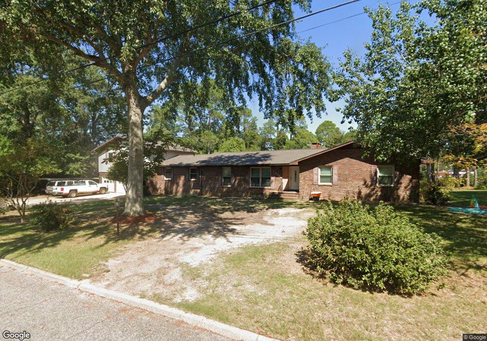
2000 Baker Trace Dothan, AL 36303
Estimated Value: $280,000 - $410,654
6
Beds
6
Baths
3,325
Sq Ft
$101/Sq Ft
Est. Value
About This Home
This home is located at 2000 Baker Trace, Dothan, AL 36303 and is currently estimated at $336,664, approximately $101 per square foot. 2000 Baker Trace is a home located in Houston County with nearby schools including Dothan City Early Education Center, Dothan 6th Grade Center, and Girard Elementary School.
Ownership History
Date
Name
Owned For
Owner Type
Purchase Details
Closed on
Feb 14, 2014
Sold by
Howard J Howard J
Bought by
Smith Shoanette
Current Estimated Value
Purchase Details
Closed on
May 10, 2010
Sold by
Cook Russellw
Bought by
Smith Howard J and Smith Shoanette
Home Financials for this Owner
Home Financials are based on the most recent Mortgage that was taken out on this home.
Original Mortgage
$184,515
Interest Rate
5.15%
Create a Home Valuation Report for This Property
The Home Valuation Report is an in-depth analysis detailing your home's value as well as a comparison with similar homes in the area
Purchase History
| Date | Buyer | Sale Price | Title Company |
|---|---|---|---|
| Smith Shoanette | $254,400 | -- | |
| Smith Howard J | -- | -- |
Source: Public Records
Mortgage History
| Date | Status | Borrower | Loan Amount |
|---|---|---|---|
| Previous Owner | Smith Howard J | $184,515 |
Source: Public Records
Tax History
| Year | Tax Paid | Tax Assessment Tax Assessment Total Assessment is a certain percentage of the fair market value that is determined by local assessors to be the total taxable value of land and additions on the property. | Land | Improvement |
|---|---|---|---|---|
| 2025 | $2,261 | $62,800 | $0 | $0 |
| 2024 | $2,261 | $61,660 | $0 | $0 |
| 2023 | $2,220 | $28,720 | $0 | $0 |
| 2022 | $839 | $25,820 | $0 | $0 |
| 2021 | $747 | $26,460 | $0 | $0 |
| 2020 | $747 | $23,160 | $0 | $0 |
| 2019 | $747 | $23,160 | $0 | $0 |
| 2018 | $747 | $23,160 | $0 | $0 |
| 2017 | $824 | $25,400 | $0 | $0 |
| 2016 | $824 | $0 | $0 | $0 |
| 2015 | $1,763 | $0 | $0 | $0 |
| 2014 | $826 | $0 | $0 | $0 |
Source: Public Records
Map
Nearby Homes
- 1922 Sullivan Dr
- 1301 N Cherokee Ave
- 1514 Plaza Dr
- 1404 Hiawatha Dr
- 1515 Plaza Dr
- 1510 Oak Dr
- 1504 Sioux St
- 601 Sequoyah Dr
- 1616 Randall Rd
- 207 Seeba Dr
- 409 Sequoyah Dr
- 407 Sequoyah Dr
- 107 Shawnee Ct
- 1309 Sioux St
- 1804 Azure Dr
- 1935 Denton Rd
- 2102 Centenial Dr
- 1507 Catalina Dr
- 1638 Denton Rd
- 1500 Denton Rd
- 803 Girard Ave
- 700 Wildwood Ave
- 805 Girard Ave
- 2001 Baker Trace
- 702 Wildwood Ave
- 704 Wildwood Ave
- 2005 Baker Trace
- 706 Wildwood Ave
- 2007 Baker Trace
- 611 Girard Ave
- 701 Wildwood Ave
- 708 Wildwood Ave
- 807 Girard Ave
- 2101 Baker Trace
- 703 Wildwood Ave
- 2643 Montgomery Hwy
- 1408 N Pontiac Ave
- 2102 Baker Trace
- 705 Wildwood Ave
- 607 Girard Ave
Your Personal Tour Guide
Ask me questions while you tour the home.