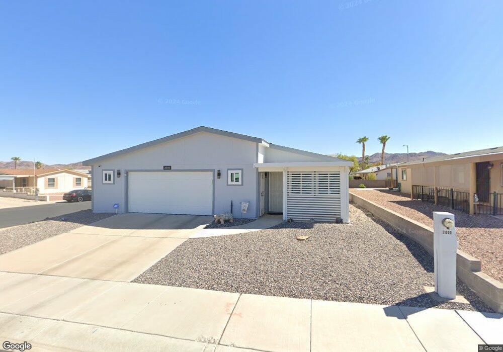
2000 Darla St Henderson, NV 89002
River Mountain NeighborhoodEstimated Value: $278,000 - $363,914
3
Beds
2
Baths
1,260
Sq Ft
$250/Sq Ft
Est. Value
About This Home
This home is located at 2000 Darla St, Henderson, NV 89002 and is currently estimated at $315,479, approximately $250 per square foot. 2000 Darla St is a home located in Clark County with nearby schools including John Dooley Elementary School, B Mahlon Brown Academy of International Studies, and Basic Academy of International Studies.
Ownership History
Date
Name
Owned For
Owner Type
Purchase Details
Closed on
Jun 28, 2011
Sold by
Burger Family Trust
Bought by
Ditty Robert W and Ditty Deborah A
Current Estimated Value
Purchase Details
Closed on
Jan 27, 2004
Sold by
Burger Mary L
Bought by
Burger Family Trust
Purchase Details
Closed on
Oct 3, 1997
Sold by
Burger Edward O and Burger Mary Louise
Bought by
Burger Edward O and Burger Mary Louise
Home Financials for this Owner
Home Financials are based on the most recent Mortgage that was taken out on this home.
Original Mortgage
$53,500
Interest Rate
7.49%
Purchase Details
Closed on
Apr 8, 1997
Sold by
Burger Edward O and Burger Mary Louise
Bought by
Burger Edward O and Burger Mary Louise
Purchase Details
Closed on
Sep 8, 1994
Sold by
Roberts Mary E
Bought by
Burger Edward O and Burger Mary L
Create a Home Valuation Report for This Property
The Home Valuation Report is an in-depth analysis detailing your home's value as well as a comparison with similar homes in the area
Home Values in the Area
Average Home Value in this Area
Purchase History
| Date | Buyer | Sale Price | Title Company |
|---|---|---|---|
| Ditty Robert W | $100,000 | Ticor Title Las Vegas | |
| Burger Family Trust | -- | -- | |
| Burger Edward O | -- | Fidelity National Title | |
| Burger Edward O | -- | -- | |
| Burger Edward O | $37,000 | Land Title |
Source: Public Records
Mortgage History
| Date | Status | Borrower | Loan Amount |
|---|---|---|---|
| Previous Owner | Burger Edward O | $53,500 |
Source: Public Records
Tax History
| Year | Tax Paid | Tax Assessment Tax Assessment Total Assessment is a certain percentage of the fair market value that is determined by local assessors to be the total taxable value of land and additions on the property. | Land | Improvement |
|---|---|---|---|---|
| 2026 | $943 | $57,392 | $23,450 | $33,942 |
| 2025 | $915 | $52,861 | $18,200 | $34,661 |
| 2024 | $889 | $52,861 | $18,200 | $34,661 |
| 2023 | $889 | $54,488 | $21,700 | $32,788 |
| 2022 | $863 | $48,045 | $18,200 | $29,845 |
| 2021 | $838 | $45,969 | $17,500 | $28,469 |
| 2020 | $811 | $42,498 | $14,000 | $28,498 |
| 2019 | $787 | $41,042 | $12,950 | $28,092 |
| 2018 | $764 | $38,043 | $10,850 | $27,193 |
| 2017 | $1,017 | $34,304 | $7,350 | $26,954 |
| 2016 | $725 | $25,020 | $6,300 | $18,720 |
| 2015 | $722 | $24,675 | $6,300 | $18,375 |
| 2014 | -- | $22,644 | $5,250 | $17,394 |
Source: Public Records
Map
Nearby Homes
- 2002 Darla St
- 2011 Darla St
- 1309 Luna Del Oro Ln
- 2050 S Magic Way Unit 201
- 2050 S Magic Way Unit 191
- 2050 S Magic Way Unit 203
- 2050 S Magic Way Unit 210
- 2050 S Magic Way Unit 291
- 2050 S Magic Way Unit 8
- 2031 Buckeye Reef St
- 607 Sylvan St
- 1294 Paseo Del Oso Ln
- 1305 Paseo Del Oso Ln
- 2169 Rio Rancho Pointe Place
- 2073 Hocus Pocus Place
- 2199 Maple Shade St
- 2001 Appaloosa Rd
- 1337 Passiflora Dr
- 700 Sea Coast Dr
- 723 Gorringe Ridge Ct
- 2001 Cullen St
- 2003 Cullen St
- 2004 Darla St
- 2001 Darla St
- 1288 Dalene Ave
- 2005 Cullen St
- 2003 Darla St
- 1294 Dalene Ave
- 2005 Darla St
- 1286 Dalene Ave
- 2007 Cullen St
- 1296 Dalene Ave
- 2007 Darla St
- 2008 Darla St
- 1284 Dalene Ave
- 2000 Roberts Rd
- 2002 Cullen St
- 2002 Roberts Rd
- 2009 Cullen St
- 2000 Cullen St
Your Personal Tour Guide
Ask me questions while you tour the home.