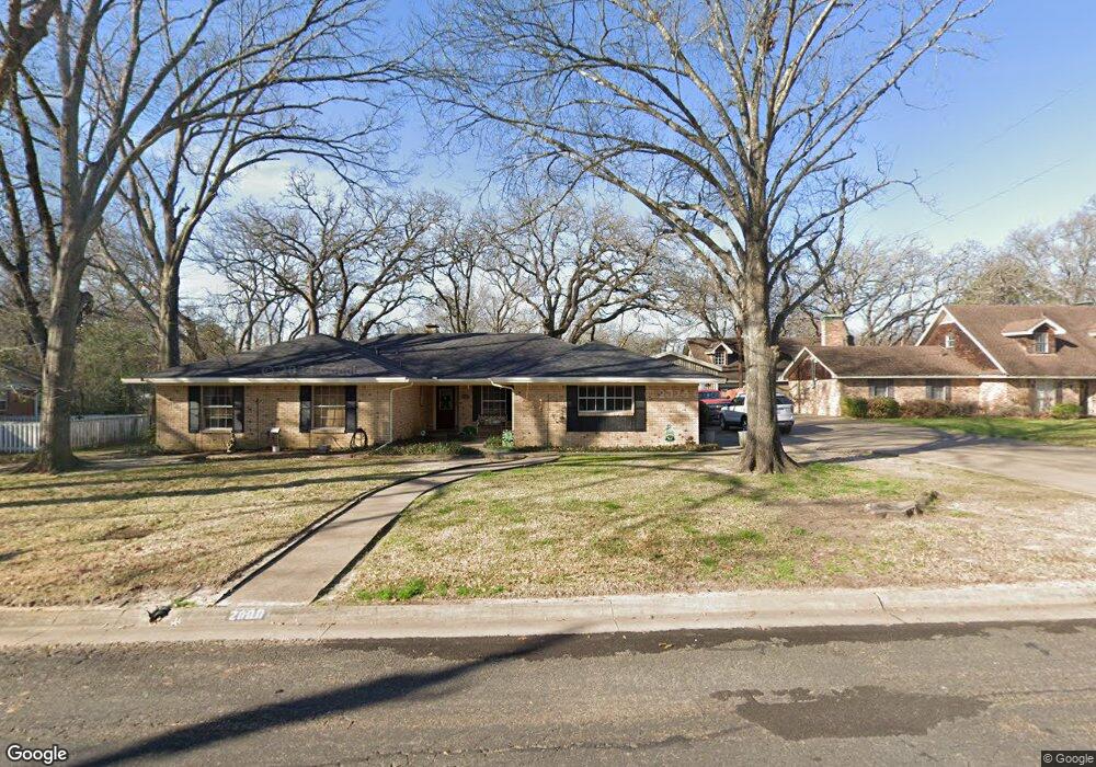
2000 Dartmouth Ln Corsicana, TX 75110
Estimated Value: $329,000 - $373,000
4
Beds
2
Baths
2,548
Sq Ft
$137/Sq Ft
Est. Value
About This Home
This home is located at 2000 Dartmouth Ln, Corsicana, TX 75110 and is currently estimated at $348,109, approximately $136 per square foot. 2000 Dartmouth Ln is a home located in Navarro County with nearby schools including Corsicana High School and William Tyndale Christian Academy.
Ownership History
Date
Name
Owned For
Owner Type
Purchase Details
Closed on
Jun 6, 2025
Sold by
Palos Taitum Elise
Bought by
Palos Jacob Ross
Current Estimated Value
Purchase Details
Closed on
Apr 21, 2020
Sold by
Hayes Robert S and Hayes Kimberly G
Bought by
Palos Jacob and Palos Taitum
Home Financials for this Owner
Home Financials are based on the most recent Mortgage that was taken out on this home.
Original Mortgage
$215,500
Interest Rate
3.3%
Mortgage Type
VA
Purchase Details
Closed on
Jun 27, 2008
Sold by
Sharpley Laurie D Mccoy
Bought by
Hayes Robert S and Hayes Kimberly G
Home Financials for this Owner
Home Financials are based on the most recent Mortgage that was taken out on this home.
Original Mortgage
$462,400
Interest Rate
6.05%
Mortgage Type
FHA
Create a Home Valuation Report for This Property
The Home Valuation Report is an in-depth analysis detailing your home's value as well as a comparison with similar homes in the area
Home Values in the Area
Average Home Value in this Area
Purchase History
| Date | Buyer | Sale Price | Title Company |
|---|---|---|---|
| Palos Jacob Ross | -- | None Listed On Document | |
| Palos Jacob | -- | Micro Title Navarro Cnty Llc | |
| Hayes Robert S | -- | None Available |
Source: Public Records
Mortgage History
| Date | Status | Borrower | Loan Amount |
|---|---|---|---|
| Previous Owner | Palos Jacob | $215,500 | |
| Previous Owner | Hayes Robert S | $462,400 |
Source: Public Records
Tax History Compared to Growth
Tax History
| Year | Tax Paid | Tax Assessment Tax Assessment Total Assessment is a certain percentage of the fair market value that is determined by local assessors to be the total taxable value of land and additions on the property. | Land | Improvement |
|---|---|---|---|---|
| 2025 | $5,465 | $288,614 | $58,740 | $308,550 |
| 2024 | $4,968 | $262,376 | $54,230 | $327,380 |
| 2023 | $3,835 | $238,524 | $54,230 | $327,020 |
| 2022 | $5,021 | $216,840 | $22,590 | $194,250 |
| 2021 | $5,562 | $213,970 | $22,590 | $191,380 |
| 2020 | $5,678 | $213,970 | $22,590 | $191,380 |
| 2019 | $5,750 | $209,360 | $22,590 | $186,770 |
| 2018 | $5,444 | $204,850 | $18,080 | $186,770 |
| 2017 | $4,943 | $191,010 | $18,080 | $172,930 |
| 2016 | $4,494 | $163,830 | $18,080 | $145,750 |
| 2015 | -- | $163,830 | $18,080 | $145,750 |
| 2014 | -- | $160,340 | $18,080 | $142,260 |
Source: Public Records
Map
Nearby Homes
- 2110 Dartmouth Ln
- 1906 Mimosa Dr
- 800 Imperial Ln
- 1000 Bryn Mawr St
- 1004 Bryn Mawr St
- 1235 Lexington Square
- 2604 Forest Lane Cir
- 542 Forrest Ln
- 2629 Fish Tank Rd
- 2631 Fish Tank Rd
- 1305 Tammy Ave
- 405 Fairmont Ave
- 421 Forrest Ln
- 1424 Bowie Dr
- 408 Fairmont Ave
- 1500 Bowie Cir
- 400 Fairmont Ave
- 2809 Lafayette St
- 2200 N Beaton St
- 3400 Dobbins Row
- 2002 Dartmouth Ln
- 1912 Dartmouth Ln
- 2005 Mimosa Dr
- 912 Cedar Crest Ln
- 2004 Dartmouth Ln
- 2009 Mimosa Dr
- 1908 Dartmouth Ln
- 2101 Dartmouth Ln
- 2013 Mimosa Dr
- 2003 Mimosa Dr
- 915 Cedar Crest Ln
- 908 Cedar Crest Ln
- 2006 Dartmouth Ln
- 907 Cedar Crest Ln
- 2015 Mimosa Dr
- 2105 Dartmouth Ln
- 2008 Dartmouth Ln
- 1900 Dartmouth Ln
- 1919 Mimosa Dr
- 2002 Mimosa Dr