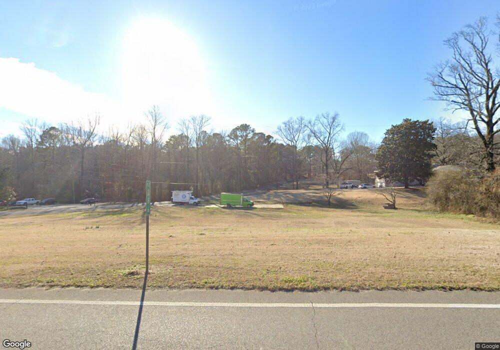
2000 Decatur Hwy Gardendale, AL 35071
Estimated Value: $64,000
3
Beds
3
Baths
2,258
Sq Ft
$28/Sq Ft
Est. Value
About This Home
This home is located at 2000 Decatur Hwy, Gardendale, AL 35071 and is currently estimated at $64,000, approximately $28 per square foot. 2000 Decatur Hwy is a home located in Jefferson County with nearby schools including Snow Rogers Elementary School, Bragg Middle School, and Gardendale High School.
Ownership History
Date
Name
Owned For
Owner Type
Purchase Details
Closed on
Jan 5, 2022
Sold by
Hometown Bank Of Alabama
Bought by
Tsunami Mobile Detail & Pressure Wa
Current Estimated Value
Home Financials for this Owner
Home Financials are based on the most recent Mortgage that was taken out on this home.
Original Mortgage
$33,750
Outstanding Balance
$31,109
Interest Rate
3.12%
Estimated Equity
$32,891
Purchase Details
Closed on
May 23, 2017
Sold by
Hughes Brian R
Bought by
Hometown Bank Of Alabama
Purchase Details
Closed on
Mar 6, 2008
Sold by
Neely Floyd Earl and Neely Doris Jean
Bought by
Neely Floyd Earl and Neely Doris Jean
Purchase Details
Closed on
Jan 29, 2001
Sold by
Earl Neely Floyd and Jean Doris
Bought by
Neely Floyd Earl and Neely Doris Jean
Create a Home Valuation Report for This Property
The Home Valuation Report is an in-depth analysis detailing your home's value as well as a comparison with similar homes in the area
Home Values in the Area
Average Home Value in this Area
Purchase History
| Date | Buyer | Sale Price | Title Company |
|---|---|---|---|
| Tsunami Mobile Detail & Pressure Wa | $45,000 | -- | |
| Hometown Bank Of Alabama | $127,611 | -- | |
| Neely Floyd Earl | -- | None Available | |
| Neely Floyd Earl | -- | -- |
Source: Public Records
Mortgage History
| Date | Status | Borrower | Loan Amount |
|---|---|---|---|
| Open | Tsunami Mobile Detail & Pressure Wa | $33,750 |
Source: Public Records
Tax History Compared to Growth
Tax History
| Year | Tax Paid | Tax Assessment Tax Assessment Total Assessment is a certain percentage of the fair market value that is determined by local assessors to be the total taxable value of land and additions on the property. | Land | Improvement |
|---|---|---|---|---|
| 2024 | $757 | $12,600 | $12,600 | -- |
| 2022 | $2,473 | $41,140 | $11,980 | $29,160 |
| 2021 | $2,130 | $35,440 | $11,980 | $23,460 |
| 2020 | $1,946 | $32,380 | $11,980 | $20,400 |
| 2019 | $1,946 | $32,380 | $0 | $0 |
| 2018 | $1,768 | $29,420 | $0 | $0 |
| 2017 | $1,821 | $30,300 | $0 | $0 |
| 2016 | $1,737 | $28,900 | $0 | $0 |
| 2015 | $1,768 | $29,420 | $0 | $0 |
| 2014 | $1,703 | $33,700 | $0 | $0 |
| 2013 | $1,703 | $33,700 | $0 | $0 |
Source: Public Records
Map
Nearby Homes
- 5634 Hunter Brook Ct
- 1767 Mount Olive Rd
- 1825 Harrison Dr
- 313 Belcher Hill Rd Unit 1
- 216 Howard Dr
- 1515 Clover Ave
- 1641 Jaye Dr
- 420 Redmayne Rd
- 904 Gardenview Cir
- 2256 Pinehurst Dr
- 1220 W Forest Dr
- 304 Mozelle Cir
- 1704 Magnolia St
- 1704 Gardenridge Rd
- 1747 Magnolia St
- 309 Catherine Ct
- 0 Odum Rd
- 1715 Magnolia St
- 1308 Colonial Ave
- 203 Gardenbrook Cir
- 2012 Decatur Hwy
- 2016 Decatur Hwy
- 2710 Decatur Hwy Unit 7-00-35-1-002-004.0
- 2001 Albritton Rd
- 2001 Albritton Rd
- 2005 Albritton Rd
- 2029 Albritton Rd
- 2028 Decatur Hwy
- 200 Harden Rd
- 1827 Poplar Dr
- 2016 Albritton Rd
- 31101 Decatur Hwy
- 2025 Albritton Rd
- 2020 Albritton Rd
- 1823 Poplar Dr
- 2036 Decatur Hwy
- 2003 Harden Cir
- 2007 Harden Cir
- 2024 Albritton Rd
- 1819 Poplar Dr
