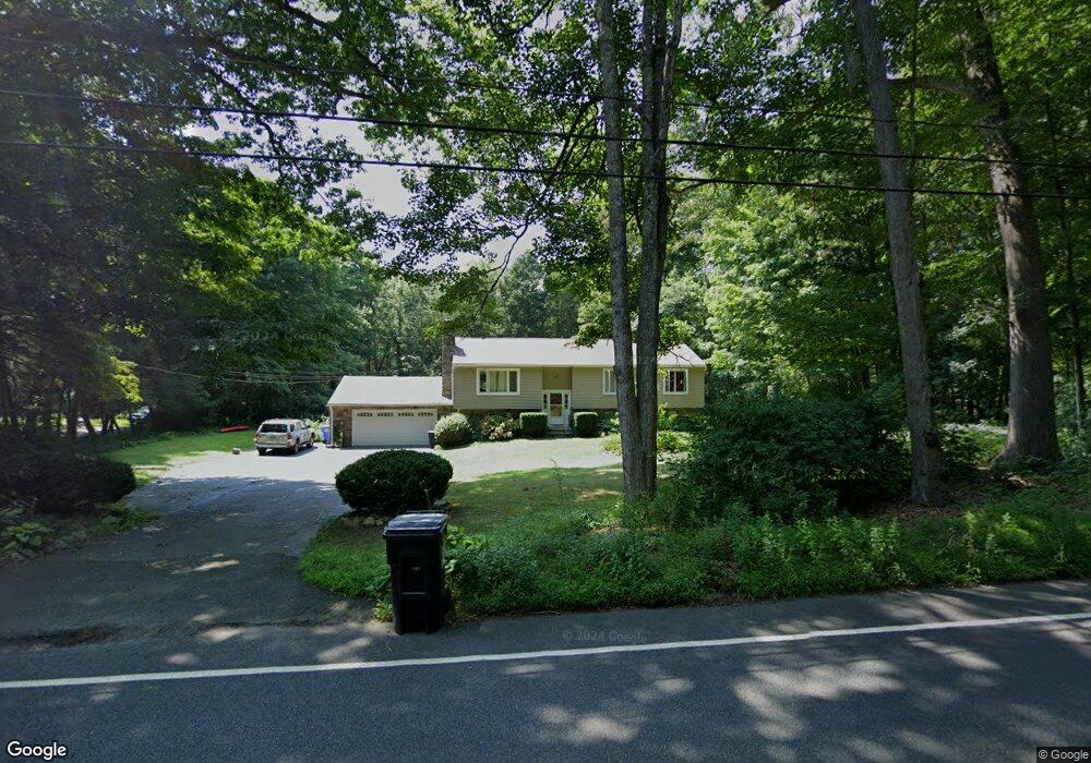
2000 Durham Rd Guilford, CT 06437
Estimated Value: $545,000 - $638,000
4
Beds
3
Baths
1,444
Sq Ft
$417/Sq Ft
Est. Value
About This Home
This home is located at 2000 Durham Rd, Guilford, CT 06437 and is currently estimated at $602,532, approximately $417 per square foot. 2000 Durham Rd is a home located in New Haven County with nearby schools including A. Baldwin Middle School, E.C. Adams Middle School, and Guilford High School.
Ownership History
Date
Name
Owned For
Owner Type
Purchase Details
Closed on
Dec 29, 2006
Sold by
Swan Verlinda A and Korzon Nancy L
Bought by
Gard Allan R and Gard Vivien E
Current Estimated Value
Home Financials for this Owner
Home Financials are based on the most recent Mortgage that was taken out on this home.
Original Mortgage
$269,000
Interest Rate
6.29%
Purchase Details
Closed on
Apr 28, 1995
Sold by
Kessler Harold W and Kessler Helen C
Bought by
Calvert William E
Create a Home Valuation Report for This Property
The Home Valuation Report is an in-depth analysis detailing your home's value as well as a comparison with similar homes in the area
Home Values in the Area
Average Home Value in this Area
Purchase History
| Date | Buyer | Sale Price | Title Company |
|---|---|---|---|
| Gard Allan R | $369,000 | -- | |
| Calvert William E | $185,000 | -- |
Source: Public Records
Mortgage History
| Date | Status | Borrower | Loan Amount |
|---|---|---|---|
| Open | Calvert William E | $292,000 | |
| Closed | Calvert William E | $269,000 |
Source: Public Records
Tax History
| Year | Tax Paid | Tax Assessment Tax Assessment Total Assessment is a certain percentage of the fair market value that is determined by local assessors to be the total taxable value of land and additions on the property. | Land | Improvement |
|---|---|---|---|---|
| 2025 | $9,122 | $329,910 | $148,890 | $181,020 |
| 2024 | $8,769 | $329,910 | $148,890 | $181,020 |
| 2023 | $8,538 | $329,910 | $148,890 | $181,020 |
| 2022 | $7,658 | $230,330 | $129,910 | $100,420 |
| 2021 | $7,513 | $230,330 | $129,910 | $100,420 |
| 2020 | $7,442 | $230,330 | $129,910 | $100,420 |
| 2019 | $7,377 | $230,330 | $129,910 | $100,420 |
| 2018 | $7,205 | $230,330 | $129,910 | $100,420 |
| 2017 | $7,039 | $239,760 | $135,450 | $104,310 |
| 2016 | $6,874 | $239,760 | $135,450 | $104,310 |
| 2015 | $6,771 | $239,760 | $135,450 | $104,310 |
| 2014 | $6,574 | $239,760 | $135,450 | $104,310 |
Source: Public Records
Map
Nearby Homes
- 0 Tamarack Ln Unit Lot 19 24071360
- 2125 Long Hill Rd
- 286 Weatherly Trail
- 154 Wilburs Ln
- 77 Pinebrook Cir
- 1092 Durham Rd
- 71 Glenwood Rd
- 375 Sea Hill Rd
- 24 Echo Point Rd
- 87 White Birch Dr
- 296 Valley Shore Dr
- 173 Highwoods Dr
- 876 Nut Plains Rd
- 874 Nut Plains Rd Unit Lot 2 - Style A
- 46 Mcmahon Ln
- 20 Long Hill Farm
- 83 Long Hill Farm Unit 83
- 1789 Foxon Rd Unit 5D
- 72 Notch Hill Rd
- LOT 28B Bruce Ln Unit MAP 83
- 1980 Durham Rd
- 2030 Durham Rd
- 1972 Durham Rd
- 1958 Durham Rd
- 2001 Durham Rd
- 2023 Durham Rd
- 1944 Durham Rd
- 1949 Durham Rd
- 1930 Durham Rd
- 3 Greenbrier Dr
- 2069 Durham Rd
- 83 Greenbrier Dr
- 1904 Durham Rd
- 2104 Durham Rd
- 420 Andrew Ln
- 2099 Durham Rd
- 51 Greenbrier Dr
- 2109 Durham Rd
- 85 Greenbrier Dr
- 430 Andrew Ln
Your Personal Tour Guide
Ask me questions while you tour the home.