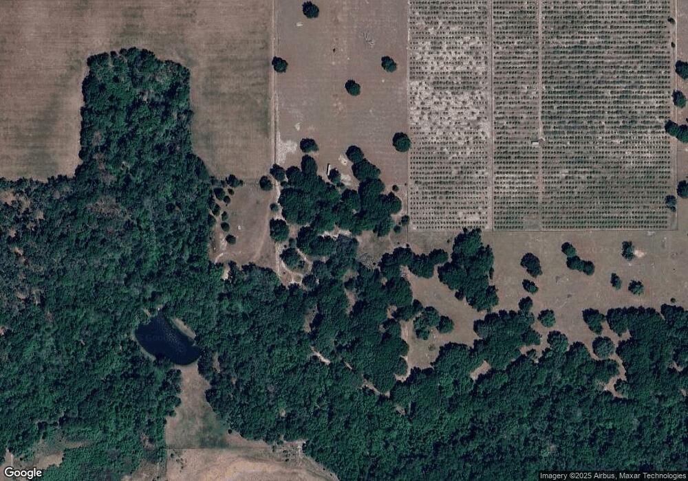
2000 G R S Ln Brooksville, FL 34602
Estimated Value: $635,827 - $707,000
3
Beds
2
Baths
2,113
Sq Ft
$317/Sq Ft
Est. Value
About This Home
This home is located at 2000 G R S Ln, Brooksville, FL 34602 and is currently estimated at $668,942, approximately $316 per square foot. 2000 G R S Ln is a home located in Hernando County with nearby schools including Eastside Elementary School, Hernando High School, and D. S. Parrott Middle School.
Ownership History
Date
Name
Owned For
Owner Type
Purchase Details
Closed on
Jan 6, 1998
Sold by
Scheibe George R and Scheibe Kayna L
Bought by
Scheibe George R and Scheibe Kayna L
Current Estimated Value
Home Financials for this Owner
Home Financials are based on the most recent Mortgage that was taken out on this home.
Original Mortgage
$147,000
Interest Rate
7.2%
Purchase Details
Closed on
Dec 15, 1995
Sold by
Scheibe George R and Scheibe Kayna L
Bought by
Scheibe George R and Scheibe Kayna L
Create a Home Valuation Report for This Property
The Home Valuation Report is an in-depth analysis detailing your home's value as well as a comparison with similar homes in the area
Home Values in the Area
Average Home Value in this Area
Purchase History
| Date | Buyer | Sale Price | Title Company |
|---|---|---|---|
| Scheibe George R | -- | -- | |
| Scheibe George R | -- | -- |
Source: Public Records
Mortgage History
| Date | Status | Borrower | Loan Amount |
|---|---|---|---|
| Open | Scheibe George R | $255,000 | |
| Closed | Scheibe George R | $147,000 |
Source: Public Records
Tax History Compared to Growth
Tax History
| Year | Tax Paid | Tax Assessment Tax Assessment Total Assessment is a certain percentage of the fair market value that is determined by local assessors to be the total taxable value of land and additions on the property. | Land | Improvement |
|---|---|---|---|---|
| 2024 | $1,782 | $133,176 | -- | -- |
| 2023 | $1,782 | $129,564 | $0 | $0 |
| 2022 | $1,695 | $126,052 | $0 | $0 |
| 2021 | $1,690 | $121,998 | $0 | $0 |
| 2020 | $1,570 | $120,179 | $0 | $0 |
| 2019 | $1,571 | $117,667 | $0 | $0 |
| 2018 | $1,134 | $113,464 | $0 | $0 |
| 2017 | $1,399 | $111,277 | $0 | $0 |
| 2016 | $1,338 | $108,129 | $0 | $0 |
| 2015 | $1,346 | $107,405 | $0 | $0 |
| 2014 | $1,304 | $106,583 | $0 | $0 |
Source: Public Records
Map
Nearby Homes
- 0 Church Rd Unit MFRTB8407445
- 1353 Spring Lake Hwy
- 0 Pumpkin Path
- 26290 Hayman Rd
- 3283 Neff Lake Rd
- 3060 Spring Lake Hwy
- 3519 Goldsmith Rd
- 0 Spring Lake Hwy Unit 23440408
- 0 Spring Lake Hwy Unit 2253282
- 0 Mountainview Blvd Unit 2255968
- 00 Batten Rd
- 0 Townsend House Rd Unit MFRTB8363130
- 18331 Townsend House Rd
- 25927 Old Spring Lake Rd
- 18253 Townsend House Rd
- 22448 Chenoak Rd
- 22396 Bull Run Rd
- 22460 Chenoak Rd
- 4148 Batten Rd
- 4063 Baseball Pond Rd
- 25299 Hayman Rd
- 25343 Hayman Rd
- 25351 Hayman Rd
- 1418 Fenway Dr
- 1406 Fenway Dr
- 1410 Fenway Dr
- 1444 Fenway Dr
- 2260 Rose Terrace Path
- 25483 Hayman Rd
- 0 Hayman (Parcel 1)
- 1400 Fenway Dr
- 0 Fenway Dr
- 0 Church Rd Unit MFRTB8339039
- 0 Church Rd Unit T3357873
- 0 Church Rd
- TBD Rose Terrace Path
- 00000 Rose Terrace Path
- 0 Rose Terrace Path Unit 2045706
- 0 Rose Terrace Path Unit 2024024
