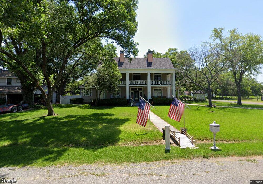
2000 Liberty St Bonham, TX 75418
Estimated Value: $426,000 - $735,000
4
Beds
4
Baths
4,213
Sq Ft
$129/Sq Ft
Est. Value
About This Home
This home is located at 2000 Liberty St, Bonham, TX 75418 and is currently estimated at $542,538, approximately $128 per square foot. 2000 Liberty St is a home located in Fannin County with nearby schools including Finley-Oates Elementary School, Evans Elementary School, and LH Rather Jr High School.
Ownership History
Date
Name
Owned For
Owner Type
Purchase Details
Closed on
Dec 18, 2018
Sold by
Stiff James Price and Stiff Barbara Dianne
Bought by
Lea James Patrick and Lea Lori Jeanette
Current Estimated Value
Home Financials for this Owner
Home Financials are based on the most recent Mortgage that was taken out on this home.
Original Mortgage
$313,500
Outstanding Balance
$275,682
Interest Rate
4.9%
Mortgage Type
New Conventional
Estimated Equity
$266,856
Create a Home Valuation Report for This Property
The Home Valuation Report is an in-depth analysis detailing your home's value as well as a comparison with similar homes in the area
Purchase History
| Date | Buyer | Sale Price | Title Company |
|---|---|---|---|
| Lea James Patrick | -- | Republic Title Of Texas Inc |
Source: Public Records
Mortgage History
| Date | Status | Borrower | Loan Amount |
|---|---|---|---|
| Open | Lea James Patrick | $313,500 |
Source: Public Records
Tax History
| Year | Tax Paid | Tax Assessment Tax Assessment Total Assessment is a certain percentage of the fair market value that is determined by local assessors to be the total taxable value of land and additions on the property. | Land | Improvement |
|---|---|---|---|---|
| 2025 | $8,787 | $453,020 | $58,690 | $394,330 |
| 2024 | $8,343 | $482,150 | $63,490 | $418,660 |
| 2023 | $8,788 | $472,240 | $57,540 | $414,700 |
| 2022 | $8,911 | $446,940 | $42,960 | $403,980 |
| 2021 | $9,309 | $368,320 | $20,910 | $347,410 |
| 2020 | $9,603 | $375,670 | $20,710 | $354,960 |
| 2019 | $9,536 | $358,850 | $9,970 | $348,880 |
| 2018 | $7,339 | $331,740 | $9,970 | $321,770 |
| 2017 | $6,425 | $251,400 | $9,780 | $241,620 |
| 2016 | $5,979 | $233,940 | $9,780 | $224,160 |
| 2015 | -- | $232,000 | $9,400 | $222,600 |
| 2014 | -- | $213,970 | $8,820 | $205,150 |
Source: Public Records
Map
Nearby Homes
- 108 Leslie St
- TBD Albert Broadfoot St
- 1913 N Main St
- 1500-1510 Albert Broadfoot St
- 1700 Agnew St
- 1709 Franklin Ave
- 000 S State Highway 78
- 110 E Cunningham St
- 408 Rainey St
- TBD Saint Andrews Ct
- 2204 Albert Broadfoot St
- 2 Broadmoor Ct
- 1616 Cedar St
- 2109 Island Bayou
- 1525 Franklin St
- 253 Graham Ave
- 257 Graham Ave
- 106 Westwood Ct
- 2220 N Village Dr
- 509 Allen Ave
- 2002 Liberty St
- 1924 Liberty St
- 2001 Franklin Ave
- 1920 Liberty St
- 2005 Franklin Ave
- 2001 Liberty St
- 2004 Liberty St
- 1925 Franklin Ave
- 1937 Liberty St
- 2005 Liberty St
- 1916 Liberty St
- 2007 Franklin Ave
- 1933 Liberty St
- 1921 Franklin Ave
- 2006 Liberty St
- 1912 Liberty St
- 1929 Liberty St
- 2009 Liberty St
- 1917 Franklin Ave
- 2000 Agnew St
Your Personal Tour Guide
Ask me questions while you tour the home.