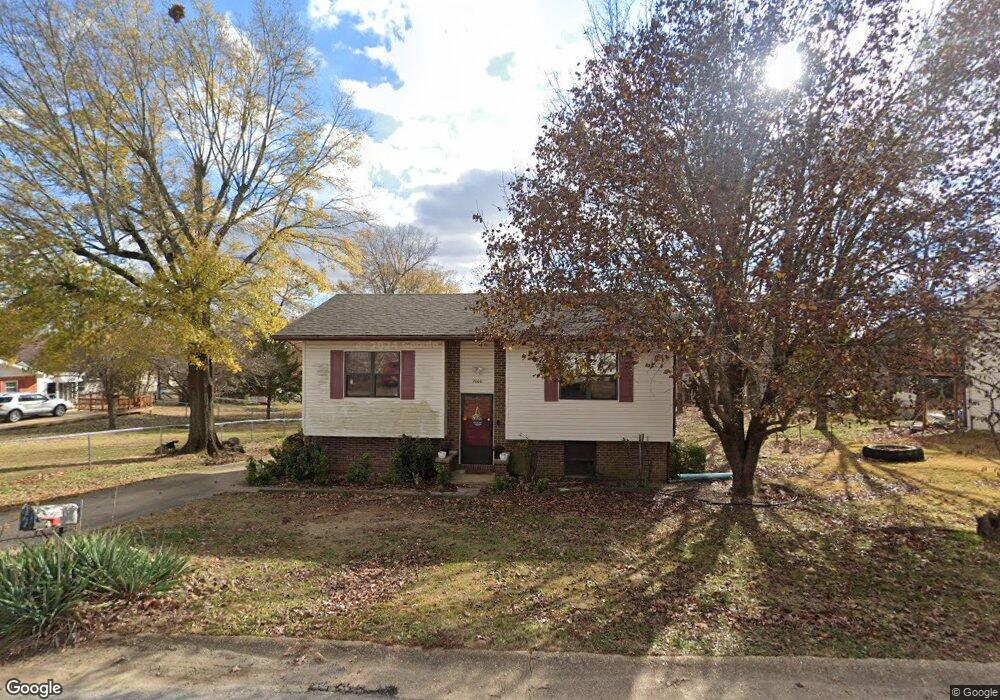
2000 Linn St Poplar Bluff, MO 63901
Estimated Value: $129,000 - $153,000
About This Home
This home is located at 2000 Linn St, Poplar Bluff, MO 63901 and is currently estimated at $143,047, approximately $103 per square foot. 2000 Linn St is a home with nearby schools including Eugene Field Elementary School, Poplar Bluff Fifth & Sixth Grade Center, and Poplar Bluff Junior High School.
Ownership History
We collect this data history from publicly available records. To have your information removed, we recommend requesting removal directly through your county’s website.
Purchase Details
Home Financials for this Owner
Home Financials are based on the most recent Mortgage that was taken out on this home.Home Values in the Area
Average Home Value in this Area
Purchase History
We collect this data history from publicly available records. To have your information removed, we recommend requesting removal directly through your county’s website.
| Date | Buyer | Sale Price | Title Company |
|---|---|---|---|
| -- | None Available |
Mortgage History
We collect this data history from publicly available records. To have your information removed, we recommend requesting removal directly through your county’s website.
| Date | Status | Borrower | Loan Amount |
|---|---|---|---|
| Closed | $9,768 | ||
| Closed | $6,813 | ||
| Closed | $85,353 | ||
| Closed | $85,353 | ||
| Closed | $33,371 |
Tax History
We collect this data history from publicly available records. To have your information removed, we recommend requesting removal directly through your county’s website.
| Year | Tax Paid | Tax Assessment Tax Assessment Total Assessment is a certain percentage of the fair market value that is determined by local assessors to be the total taxable value of land and additions on the property. | Land | Improvement |
|---|---|---|---|---|
| 2025 | $729 | $15,460 | $0 | $0 |
| 2024 | $7 | $14,370 | $0 | $0 |
| 2023 | $694 | $14,370 | $0 | $0 |
| 2022 | $672 | $13,930 | $0 | $0 |
| 2021 | $672 | $13,930 | $0 | $0 |
| 2020 | $643 | $13,150 | $0 | $0 |
| 2019 | $643 | $13,150 | $0 | $0 |
| 2018 | $643 | $13,150 | $0 | $0 |
| 2017 | -- | $13,150 | $0 | $0 |
| 2016 | -- | $13,150 | $0 | $0 |
| 2015 | -- | $13,150 | $0 | $0 |
| 2014 | -- | $12,320 | $0 | $0 |
| 2012 | $524 | $12,320 | $0 | $0 |
Map
- 1931 Brentwood Rd
- 2801 Bedoll Ave
- 2057 Cravens Ln
- 2915 Cravens Rd
- Lots 10,11 S Side International
- 2325 Mangold St
- 2202 Mangold St
- 1210 S 14th St
- 1031 Delano St
- 1033 Franklin St
- 1214 S 14th St
- 1009 Nickey St
- 2227 Audubon Rd
- 2335 Cheshire Blvd
- 00 Palm Tree Dr
- 623 Arthur St
- 112 Kaylee Cir
- 518 W Victor St
- 605 Don St
- 792 County Road 466
- 2002 Linn St
- 2012 Linn St
- 2007 Brentwood Rd
- 2013 Brentwood Rd
- 2024 Linn St
- 1943 Brentwood Rd
- 1937 Brentwood Rd
- 2025 Brentwood Rd
- 2006 Brentwood Rd
- 1938 Linn St
- 2000 Brentwood Rd
- 2012 Brentwood Rd
- 1942 Brentwood Rd
- 1936 Brentwood Rd
- 2042 Linn St
- 1930 Brentwood Rd
- 1924 Brentwood Rd
- 1919 Brentwood Rd
- 2036 Brentwood Rd
- 2007 Glendale Rd
Ask me questions while you tour the home.