Estimated Value: $874,000 - $1,238,000
About This Home
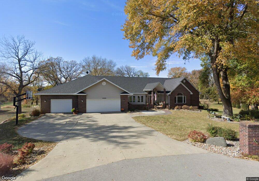
This home is located at 2000 Michael Ln, Ames, IA 50010 and is currently estimated at $1,049,445, approximately $343 per square foot. 2000 Michael Ln is a home located in Story County with nearby schools including Gilbert Elementary School, Gilbert Intermediate School, and Gilbert Middle School.
Ownership History
We collect this data history from publicly available records. To have your information removed, we recommend requesting removal directly through your county’s website.
Purchase Details
Purchase Details
Home Financials for this Owner
Home Financials are based on the most recent Mortgage that was taken out on this home.Purchase Details
Home Financials for this Owner
Home Financials are based on the most recent Mortgage that was taken out on this home.Purchase History
We collect this data history from publicly available records. To have your information removed, we recommend requesting removal directly through your county’s website.
| Date | Buyer | Sale Price | Title Company |
|---|---|---|---|
| -- | Gartin Timothy L | ||
| -- | None Available | ||
| $685,000 | -- |
Mortgage History
We collect this data history from publicly available records. To have your information removed, we recommend requesting removal directly through your county’s website.
| Date | Status | Borrower | Loan Amount |
|---|---|---|---|
| Previous Owner | $471,000 | ||
| Previous Owner | $567,000 | ||
| Previous Owner | $574,400 | ||
| Previous Owner | $402,000 | ||
| Previous Owner | $408,500 | ||
| Previous Owner | $199,500 | ||
| Previous Owner | $225,000 |
Tax History
We collect this data history from publicly available records. To have your information removed, we recommend requesting removal directly through your county’s website.
| Year | Tax Paid | Tax Assessment Tax Assessment Total Assessment is a certain percentage of the fair market value that is determined by local assessors to be the total taxable value of land and additions on the property. | Land | Improvement |
|---|---|---|---|---|
| 2025 | $11,714 | $943,800 | $292,100 | $651,700 |
| 2024 | $11,140 | $900,100 | $262,800 | $637,300 |
| 2023 | $11,328 | $900,100 | $262,800 | $637,300 |
| 2022 | $11,262 | $774,700 | $214,200 | $560,500 |
| 2021 | $11,538 | $774,700 | $214,200 | $560,500 |
| 2020 | $11,696 | $740,600 | $214,200 | $526,400 |
| 2019 | $11,696 | $740,600 | $214,200 | $526,400 |
| 2018 | $11,530 | $702,500 | $214,200 | $488,300 |
| 2017 | $11,530 | $702,500 | $214,200 | $488,300 |
| 2016 | $11,506 | $703,900 | $214,200 | $489,700 |
| 2015 | $11,506 | $703,900 | $214,200 | $489,700 |
| 2014 | $11,316 | $703,900 | $214,200 | $489,700 |
Map
- 2349 Lake View Dr
- 2218 Ada Hayden Rd
- 5667 Arrasmith Trail
- 5167 Skycrest Dr
- 265 W Riverside Rd
- 6235 US Highway 69
- 4882 Copperstone Dr
- 2010 Aikman Dr
- 2005 Ada Hayden Rd
- 2117 Lacey Dr
- 2242 Ketelsen Dr
- 2106 Ketelsen Dr
- 4002 Edgewater Dr
- 623 River Oak Dr
- 2236 Ketelsen Dr
- 2122 Leopold Dr
- 3201 Polaris Dr
- 1956 Wyngate Dr
- 202 Cedar Dr
- 4255 Eisenhower Ln Unit 17
- 2020 Michael Ln
- 2027 Michael Ln
- 2085 Michael Ln
- 2078 Michael Ln
- 2100 Katie Ln
- 2103 Quail Ridge Rd
- 2054 Katie Ln
- 2112 Quail Ridge Rd
- 2131 Quail Ridge Rd
- 2104 Quail Ridge Rd
- 2129 Quail Ridge Rd
- 2096 Quail Ridge Rd
- 2063 Katie Ln
- 2105 Katie Ln
- 2128 Quail Ridge Rd
- 2134 Quail Ridge Rd
- 2134 Quail Ridge Rd
- 2088 Quail Ridge Rd
- 2176 Pintail Ridge Ln
- 2124 Pintail Ridge Ln
Ask me questions while you tour the home.