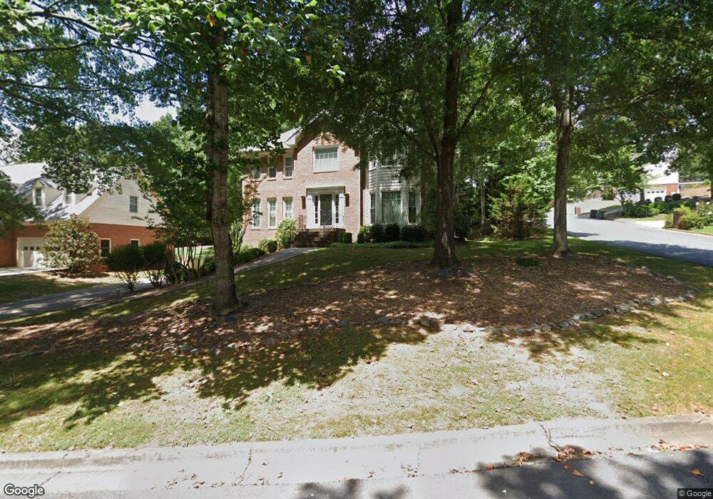
2000 Pearwood Path Roswell, GA 30076
Estimated Value: $604,683 - $772,000
4
Beds
4
Baths
2,534
Sq Ft
$273/Sq Ft
Est. Value
About This Home
This home is located at 2000 Pearwood Path, Roswell, GA 30076 and is currently estimated at $692,421, approximately $273 per square foot. 2000 Pearwood Path is a home located in Fulton County with nearby schools including Hillside Elementary School, Haynes Bridge Middle School, and Centennial High School.
Ownership History
Date
Name
Owned For
Owner Type
Purchase Details
Closed on
Sep 25, 2009
Sold by
Ducker Scott W and Ducker Jami E
Bought by
Woodrow Willard
Current Estimated Value
Home Financials for this Owner
Home Financials are based on the most recent Mortgage that was taken out on this home.
Original Mortgage
$315,676
Outstanding Balance
$206,447
Interest Rate
5.11%
Mortgage Type
FHA
Estimated Equity
$485,974
Purchase Details
Closed on
Jan 24, 2002
Sold by
Robb Stephen P and Robb Katherine C
Bought by
Ducker Scott W and Ducker Jami E
Home Financials for this Owner
Home Financials are based on the most recent Mortgage that was taken out on this home.
Original Mortgage
$222,800
Interest Rate
7.16%
Mortgage Type
New Conventional
Purchase Details
Closed on
Sep 11, 1996
Sold by
Riddell Chris F Cheryl
Bought by
Robb Stephen P Katherin
Create a Home Valuation Report for This Property
The Home Valuation Report is an in-depth analysis detailing your home's value as well as a comparison with similar homes in the area
Home Values in the Area
Average Home Value in this Area
Purchase History
| Date | Buyer | Sale Price | Title Company |
|---|---|---|---|
| Woodrow Willard | $321,500 | -- | |
| Ducker Scott W | $278,500 | -- | |
| Robb Stephen P Katherin | $216,000 | -- |
Source: Public Records
Mortgage History
| Date | Status | Borrower | Loan Amount |
|---|---|---|---|
| Open | Woodrow Willard | $315,676 | |
| Previous Owner | Ducker Scott W | $222,800 | |
| Closed | Robb Stephen P Katherin | $0 |
Source: Public Records
Tax History
| Year | Tax Paid | Tax Assessment Tax Assessment Total Assessment is a certain percentage of the fair market value that is determined by local assessors to be the total taxable value of land and additions on the property. | Land | Improvement |
|---|---|---|---|---|
| 2025 | $719 | $194,120 | $44,240 | $149,880 |
| 2023 | $719 | $203,360 | $44,960 | $158,400 |
| 2022 | $3,018 | $174,760 | $30,520 | $144,240 |
| 2021 | $3,571 | $150,040 | $27,040 | $123,000 |
| 2020 | $3,626 | $151,000 | $23,880 | $127,120 |
| 2019 | $583 | $151,600 | $32,720 | $118,880 |
| 2018 | $3,388 | $138,520 | $22,440 | $116,080 |
| 2017 | $2,894 | $111,120 | $17,160 | $93,960 |
| 2016 | $2,892 | $111,120 | $17,160 | $93,960 |
| 2015 | $3,510 | $111,120 | $17,160 | $93,960 |
| 2014 | $3,016 | $111,120 | $17,160 | $93,960 |
Source: Public Records
Map
Nearby Homes
- 350 S Satinwood Place
- 650 Wood Work Way
- 2618 Long Pointe
- 2745 Shadow Pine Dr
- 260 Spring Ridge Dr
- 1120 Northpoint Trace
- 1150 Northpoint Trace
- 130 Spring Ridge Ct
- 535 Water Shadow Ln
- 10120 Kinross Rd
- 970 Laurel Mill Dr
- 2660 Coachmans Cir
- 705 Springview Ct
- 920 Waters Reach Ct
- 590 Ridgemont Dr
- 115 Forest Breeze Cove
- 585 Saint Regis Ln
- 3095 Ivey Oaks Ln
- 2415 Roxburgh Dr
- 2910 Leeds Garden Ln
- 305 S Satinwood Place Unit 1
- 315 S Satinwood Place
- 2020 Pearwood Path Unit II
- 1075 Pine Bloom Dr
- 2005 Pearwood Path Unit 2
- 440 Spring Ridge Trace
- 1071 Pine Bloom Dr
- 1085 Pine Bloom Dr
- 1050 Pine Bloom Dr
- 325 S Satinwood Place
- 500 New Cherry Ln
- 2030 Pearwood Path
- 515 N Satinwood Place Unit 1
- 1060 Pine Bloom Dr
- N N Satinwood Place
- 2040 Pearwood Path
- 505 New Cherry Ln
- 510 New Cherry Ln Unit II
- 310 S Satinwood Place Unit 1
- 320 S Satinwood Place
Your Personal Tour Guide
Ask me questions while you tour the home.