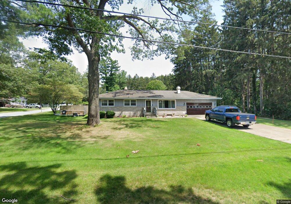
2000 Roberts Rd Muskegon, MI 49445
Estimated Value: $264,000 - $325,000
2
Beds
1
Bath
1,280
Sq Ft
$225/Sq Ft
Est. Value
About This Home
This home is located at 2000 Roberts Rd, Muskegon, MI 49445 and is currently estimated at $288,120, approximately $225 per square foot. 2000 Roberts Rd is a home located in Muskegon County with nearby schools including Reeths-Puffer High School.
Ownership History
Date
Name
Owned For
Owner Type
Purchase Details
Closed on
Aug 15, 2023
Sold by
Cvengros Dora L
Bought by
Ames David L and Ames Ronda
Current Estimated Value
Home Financials for this Owner
Home Financials are based on the most recent Mortgage that was taken out on this home.
Original Mortgage
$73,000
Outstanding Balance
$71,337
Interest Rate
6.81%
Mortgage Type
New Conventional
Estimated Equity
$216,783
Purchase Details
Closed on
May 21, 2020
Sold by
Cvengros Dora L and Cvengros Raymond L
Bought by
Cvengros Dora L and Cvengros Raymond B
Create a Home Valuation Report for This Property
The Home Valuation Report is an in-depth analysis detailing your home's value as well as a comparison with similar homes in the area
Home Values in the Area
Average Home Value in this Area
Purchase History
| Date | Buyer | Sale Price | Title Company |
|---|---|---|---|
| Ames David L | $236,900 | None Listed On Document | |
| Cvengros Dora L | -- | None Available |
Source: Public Records
Mortgage History
| Date | Status | Borrower | Loan Amount |
|---|---|---|---|
| Open | Ames David L | $73,000 |
Source: Public Records
Tax History Compared to Growth
Tax History
| Year | Tax Paid | Tax Assessment Tax Assessment Total Assessment is a certain percentage of the fair market value that is determined by local assessors to be the total taxable value of land and additions on the property. | Land | Improvement |
|---|---|---|---|---|
| 2025 | $4,714 | $130,800 | $0 | $0 |
| 2024 | $1,411 | $120,800 | $0 | $0 |
| 2023 | $579 | $89,100 | $0 | $0 |
| 2022 | $1,848 | $77,800 | $0 | $0 |
| 2021 | $1,806 | $71,100 | $0 | $0 |
| 2020 | $1,783 | $67,500 | $0 | $0 |
| 2019 | $1,756 | $60,200 | $0 | $0 |
| 2018 | $1,807 | $58,800 | $0 | $0 |
| 2017 | $1,799 | $57,900 | $0 | $0 |
| 2016 | $517 | $53,400 | $0 | $0 |
| 2015 | -- | $48,300 | $0 | $0 |
| 2014 | -- | $49,400 | $0 | $0 |
| 2013 | -- | $42,900 | $0 | $0 |
Source: Public Records
Map
Nearby Homes
- 2060 N Roberts Rd
- 2021 Queens Ct
- 0 N Getty St
- 1925 Shady Oak Dr
- 764 E Giles Rd
- 787 E Giles Rd
- 0 Holton Vl Rd Unit 20027438
- 2026 N Port Blvd
- 1960 Nielwood Dr
- V/L Holton Rd
- 1353 Holton Rd
- 1850 Mildred St
- V/L Reed Ave
- 2624 Holton Rd
- 129 Maple Ct
- 1699 Sycamore Dr
- 2051 Russell Rd
- 2400 Russell Rd
- 2551 Hiawatha Trail
- 0 E Mcmillan Rd
- 1950 Roberts Rd
- 2000 N Roberts Rd
- 0 N Roberts Rd
- 1235 Robin Rd
- 1967 Roberts Rd
- 1245 Robin Rd
- 1947 N Roberts Rd
- 1947 Roberts Rd
- 1236 Robin Rd
- 1930 Roberts Rd
- 1999 Roberts Rd
- 1212 Robin Rd
- 1230 Robin Rd
- 1948 N Roberts Rd
- 1927 N Roberts Rd
- 1275 Robin Rd
- 1900 N Roberts Rd
- 2034 Roberts Rd
- 1900 Roberts Rd
- 2034 N Roberts Rd